
Pause Trail

Key facts
- Distance
- 4.1 km
- Ascent
- +198 m
- Descent
- −179 m
- Estimated time
- 1 hr 20
- hiking
- Difficulty
- Very easy
- official rating
- Route
- Loop
- back to the start
Profile and gradient
- under 10%
- 10 to 20%
- over 20%
Gradient along the route: 2.5 km under 10%, 1.6 km at 10 to 20% and 0.1 km over 20%. Elevation from 598 m to 774 m over 4.1 km.
Description
An easy loop at the start of this typical hilltop village, between old stones, lavender fields, and view of the Ventoux. "From the old houses of the village to the cairns and "clapiers" of the Champe rasé ridge, stone is present in many forms on this route. This walk begins with the descent along a ridge allowing to enjoy the landscape, before climbing towards the village on a pathmore shaded on its 2nd part. The passage on the edge of a field of lavender is a true invitation to take the walk one morning in July! ". Vincent Aubert - Technician at the Pnr des Baronnies Provençales. From the village square, take the lane in front of the departure sign and go down towards Arpavon towards the west. Follow the path for 350m then, at the big oak, turn left. 1 - Shortly after this crossroad the trail descends slightly and runs in front of the Mont Ventoux. After 500m the trail leads to an old field: the path becomes a trail. 2 - Continue straight for 1km to descend the ridge on themarked trail of small cairns. At the end of the ridge, turn right in the direction of the rightmost telephone pole. 3 - Join the path and follow it on the left for 200m. On arriving in front of the house, turn left and follow the road on the climb towards Poët-Sigillat (2km). The road arrives under the village along a wall: take the small asphalt road which goes to the right then join the houses of the village in the covered alley passing under the bell of the Chapel Saint Bernard. Join the village square down the lane on the eastern side of Poët-Sigillat.
Difficulty
Official rating: very easy, by Parcs naturels régionaux de Provence-Alpes-Côte d'Azur.
Getting there
Start: Parking de l'église, Le Poët-Sigillat, Le Poët-Sigillat (26).
Sources
- Track: Parcs naturels régionaux de Provence-Alpes-Côte d'Azur (Chemins des Parcs), Licence Ouverte 2.0, Licence Ouverte 2.0 (Etalab) (www.cheminsdesparcs.fr/trek/55784-POET-SIGILLAT---Sentier-de-la-Pause). Time estimated by GPX Path with the Mac app rule, breaks not included.
- Official elevation gain: 198 m, Parcs naturels régionaux de Provence-Alpes-Côte d'Azur
Nearby tracks

 © OpenStreetMap, SRTM · OpenTopoMap (CC-BY-SA)
Montreal-les-Sources - Sur les traces des sources
Auvergne-Rhône-Alpes, Montréal-les-Sources (26) · LoopOfficial rating by Parcs naturels régionaux de Provence-Alpes-Côte d'Azur © OpenStreetMap, SRTM · OpenTopoMap (CC-BY-SA)
Remuzat - Le rocher du Caire
Auvergne-Rhône-Alpes, Rémuzat (26) · LoopOfficial rating by Parcs naturels régionaux de Provence-Alpes-Côte d'Azur © OpenStreetMap, SRTM · OpenTopoMap (CC-BY-SA)
Le plateau de Saint-Laurent
Auvergne-Rhône-Alpes, Saint-May (26) · Out and backOfficial rating by Parcs naturels régionaux de Provence-Alpes-Côte d'Azur © OpenStreetMap, SRTM · OpenTopoMap (CC-BY-SA)
Sahune - Marcel et Devès
Auvergne-Rhône-Alpes, Sahune (26) · LoopOfficial rating by Parcs naturels régionaux de Provence-Alpes-Côte d'Azur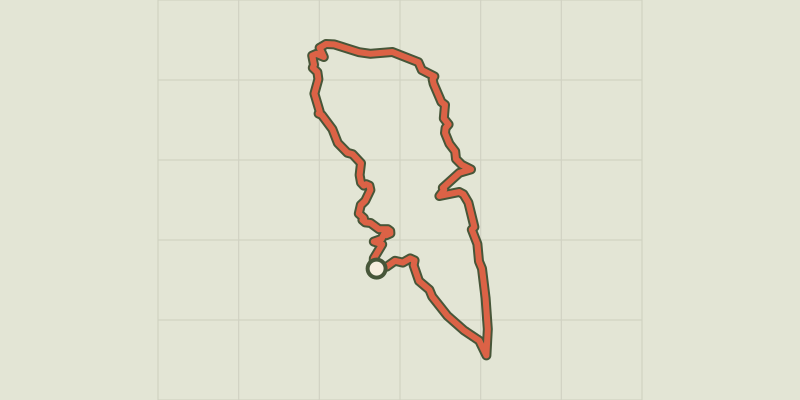 © OpenStreetMap, SRTM · OpenTopoMap (CC-BY-SA)
Tour of the Montagne du Buègue
Auvergne-Rhône-Alpes, Saint-May (26) · LoopOfficial rating by Parcs naturels régionaux de Provence-Alpes-Côte d'Azur © OpenStreetMap, SRTM · OpenTopoMap (CC-BY-SA)
Saint-Sauveur-Gouvernet - Tour de la vallée de l'Ennuyé
Auvergne-Rhône-Alpes, Saint-Sauveur-Gouvernet (26) · Point to pointOfficial rating by Parcs naturels régionaux de Provence-Alpes-Côte d'Azur