
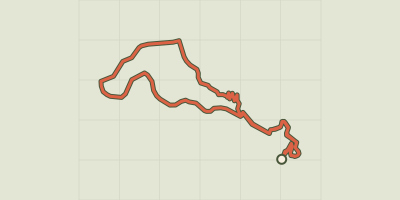
Le puy d'Eraigne

Key facts
- Distance
- 7.4 km
- Ascent
- +260 m
- Descent
- −248 m
- Estimated time
- 2 hr 10
- hiking
- Difficulty
- Not rated
- Route
- Loop
- back to the start
Profile and gradient
- under 10%
- 10 to 20%
- over 20%
Gradient along the route: 6.0 km under 10% and 1.5 km at 10 to 20%. Elevation from 684 m to 817 m over 7.4 km.
Difficulty
No official rating for this track: we do not make one up.
Getting there
Start: Saint-Nectaire, Saint-Nectaire (63).
Sources
- Track: Conseil départemental du Puy-de-Dôme, PDIPR, Licence Ouverte 2.0, Licence Ouverte 2.0 (Etalab) (opendata.clermontmetropole.eu/explore/dataset/les_circuits_des_itineraires_de_promenade_conseil-dep-63-kml-vcf/). Time estimated by GPX Path with the Mac app rule, breaks not included.
- Official elevation gain: 260 m, Conseil départemental du Puy-de-Dôme (publication Clermont Auvergne Métropole)
Nearby tracks
 © OpenStreetMap, SRTM · OpenTopoMap (CC-BY-SA)
Les grottes de Châteauneuf
Auvergne, Saint-Nectaire (63) · Loop © OpenStreetMap, SRTM · OpenTopoMap (CC-BY-SA)
Le Puy des Plattes et le Bourgeassou
Auvergne, Verrières (63) · Loop © OpenStreetMap, SRTM · OpenTopoMap (CC-BY-SA)
Le puy d'Alou
Auvergne, Le Vernet-Sainte-Marguerite (63) · Loop © OpenStreetMap, SRTM · OpenTopoMap (CC-BY-SA)
Roche Romaine
Auvergne, Murol (63) · Loop © OpenStreetMap, SRTM · OpenTopoMap (CC-BY-SA)
Le Ravin de Quinsat
Auvergne, Grandeyrolles (63) · Loop © OpenStreetMap, SRTM · OpenTopoMap (CC-BY-SA)
Le Cheix
Auvergne, Saint-Diéry (63) · Loop