
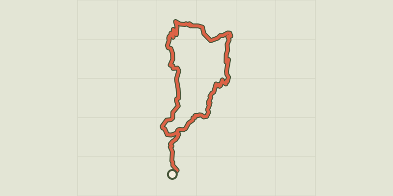
From Le Vigan to Mont Aigoual, 5 days

Key facts
- Distance
- 57.7 km
- Ascent
- +2,387 m
- Descent
- −2,021 m
- Estimated time
- 17 hr 10
- hiking
- Difficulty
- Difficult
- official rating
- Route
- Point to point
- ends elsewhere
Profile and gradient
- under 10%
- 10 to 20%
- over 20%
Gradient along the route: 41.7 km under 10%, 15.5 km at 10 to 20% and 0.5 km over 20%. Elevation from 226 m to 1,559 m over 57.7 km.
Description
Throughout your hike, explore and admire the varied landscape with its panoramic views onto the valleys of the Cévennes. Your trip will take you to the very top of Mont Aigoual through a state forest with abundant flora and fauna. A fairly athletic hike from pass to pass, with magnificent panoramic views onto a very varied landscape and the Aigoual massif. A five-day trip exploring, among other things, a mixed state forest and a natural pinewood, both wonderfully refreshing in summer. You walk on drailles, ancient livestock tracks linking the Languedoc plain to summer pastures in the uplands. 5 days exploring the Aigoual massif : 58.5 km, 2400 m of climbs : Day 1, From Le Vigan to Cap de Côte (GR®60a),10km, 980 m of climbs and 38 m of descents. From Cap de Côte you can make a there-and-back detour to the monument to André Chamson (GR®60) on the draille (1 ½ hrs). Day 2, From Cap de Côte to L’Espérou (GR®60 and GR®7),12 km, 340 m of climbs and 297 m of descents. Day 3, From L’Espérou to Mont Aigoual, 10 km, 582 m of climbs and 238 m of descents. Day 4, From Mont Aigoual to Peychagut (Maison des Cévennes), (GR®7), 17.5 km, 400 m of climbs and 959 of descents. Day 5, From Peychagut to Le Vigan, (GR®7), 9 km, 86 m of climbs and 853 m of descents.
Difficulty
Official rating: difficult, by Parc national des Cévennes.
Before you go
- NB : Steep climb at the start of the hike.
- Make sure your equipment is appropriate for the day’s weather conditions. Remember that the weather changes quickly in the mountains. Take enough water, wear sturdy shoes and bring warm clothing.
Getting there
Start: Le Vigan, Le Vigan (30).
Sources
- Track: Parc national des Cévennes, Licence Ouverte 1.0, Licence Ouverte 1.0 (Etalab) (destination.cevennes-parcnational.fr/trek/98652-Du-Vigan-au-Mont-Aigoual-(5-jours)). Time estimated by GPX Path with the Mac app rule, breaks not included.
- Official elevation gain: 2,387 m, Parc national des Cévennes
Nearby tracks
 © OpenStreetMap, SRTM · OpenTopoMap (CC-BY-SA)
Sur les pas d'André Chamson - 2 jours
Cévennes, Le Vigan (30) · Point to pointOfficial rating by Parc national des Cévennes © OpenStreetMap, SRTM · OpenTopoMap (CC-BY-SA)
By the River Arre
Cévennes, Le Vigan (30) · LoopOfficial rating by Parc national des Cévennes © OpenStreetMap, SRTM · OpenTopoMap (CC-BY-SA)
Towards the Col des Mourèzes pass
Cévennes, Le Vigan (30) · LoopOfficial rating by Parc national des Cévennes © OpenStreetMap, SRTM · OpenTopoMap (CC-BY-SA)
Around Aulas
Cévennes, Aulas (30) · LoopOfficial rating by Parc national des Cévennes © OpenStreetMap, SRTM · OpenTopoMap (CC-BY-SA)
Pont de Mousse
Cévennes, Avèze (30) · LoopOfficial rating by Parc national des Cévennes © OpenStreetMap, SRTM · OpenTopoMap (CC-BY-SA)
Col de la Cravate pass
Cévennes, Bréau-Mars (30) · LoopOfficial rating by Parc national des Cévennes