
Intercommunal open-air street-art museum

Key facts
- Distance
- 4.9 km
- Ascent
- +52 m
- Descent
- −30 m
- Estimated time
- 1 hr 10
- hiking
- Difficulty
- Very easy
- official rating
- Route
- Loop
- back to the start
Profile and gradient
- under 10%
- 10 to 20%
- over 20%
Gradient along the route: 4.9 km under 10%. Elevation from 162 m to 183 m over 4.9 km.
Description
An open-air urban art circuit that is accessible year-round. The old mining town of Bessèges brings colour to its working-class past. Its walls inherited from the days of mining and industry are now a promising canvas for street artists with very diverse styles. A large loop or several smaller loops are possible for your a-la-carte visit in the streets of Bessèges.
Difficulty
Official rating: very easy, by Parc national des Cévennes.
Before you go
- For your own security and to preserve the site, you must stay on the laid-out path.
Getting there
Start: place de la Révolution, Bessèges (30).
Sources
- Track: Parc national des Cévennes, Licence Ouverte 1.0, Licence Ouverte 1.0 (Etalab) (destination.cevennes-parcnational.fr/trek/94959-Musee-intercommunal-d-art-ouvert-et-urbain). Time estimated by GPX Path with the Mac app rule, breaks not included.
- Official elevation gain: 52 m, Parc national des Cévennes
Nearby tracks

 © OpenStreetMap, SRTM · OpenTopoMap (CC-BY-SA)
Le Ronc rouge
Cévennes, Bessèges (30) · LoopOfficial rating by Parc national des Cévennes © OpenStreetMap, SRTM · OpenTopoMap (CC-BY-SA)
Lachamp chapel
Cévennes, Robiac-Rochessadoule (30) · LoopOfficial rating by Parc national des Cévennes © OpenStreetMap, SRTM · OpenTopoMap (CC-BY-SA)
Once upon a mine
Cévennes, Robiac-Rochessadoule (30) · LoopOfficial rating by Parc national des Cévennes © OpenStreetMap, SRTM · OpenTopoMap (CC-BY-SA)
Col des 4 chemins
Cévennes, Peyremale (30) · LoopOfficial rating by Parc national des Cévennes © OpenStreetMap, SRTM · OpenTopoMap (CC-BY-SA)
Le Chambonnet
Cévennes, Bordezac (30) · LoopOfficial rating by Parc national des Cévennes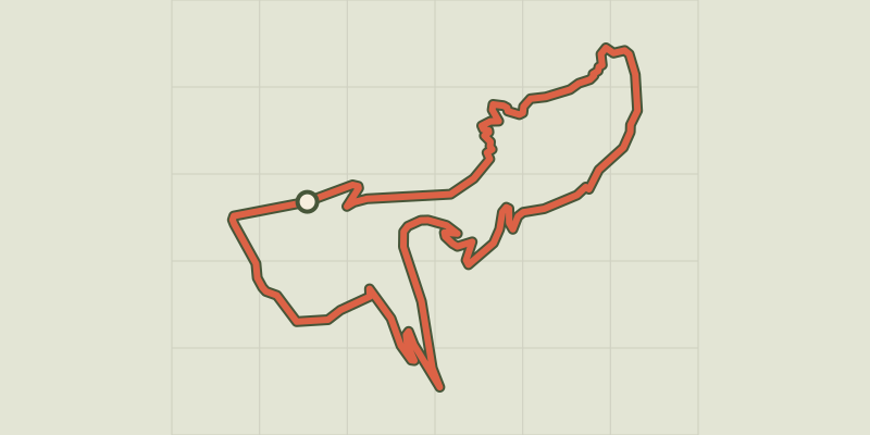 © OpenStreetMap, SRTM · OpenTopoMap (CC-BY-SA)
Castillon tower
Cévennes, Bessèges (30) · LoopOfficial rating by Parc national des Cévennes