
Lozeret Wood, MTB circuit #15 (red)
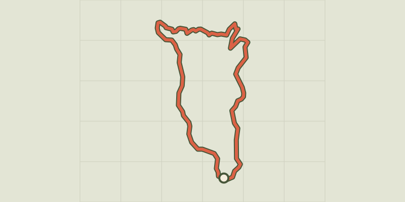
Key facts
- Distance
- 18.0 km
- Ascent
- +632 m
- Descent
- −591 m
- Estimated time
- 2 hr 30
- mtb
- Difficulty
- Difficult
- official rating
- Route
- Loop
- back to the start
Profile and gradient
- under 10%
- 10 to 20%
- over 20%
Gradient along the route: 14.8 km under 10% and 3.1 km at 10 to 20%. Elevation from 975 m to 1,558 m over 18.0 km.
Description
This rather athletic circuit crosses the state forests of Mont Lozère and Le Goulet, the two emblematic massifs of the department. Follow the MTB n°15 waymarks Signposts will guide you all along this route, as well as yellow painted waymarks. In the description below, the signposted place names and/or directions are given in bold italics between quotation marks : Starting-point at Col de Finiels, but departure from La station du Mont Lozère (D2) or Cubières (D3) also possible. Starting from “Col de Finiels”, bike downhill to “Station du Mont Lozère”, D2, via : - “Sous le col de Finiels”, - “Plan des Gours”, - “La chapelle du Mont-Lozère”. - At “Station du Mont-Lozère”, continue to “Cubières” via : - “La Massola”, - “Col Santel”, - “Le Réservoir”. - At “Cubières”, D3, bike through the village following : - “Village” and continue to : - “Pelloufet” and turn right to : - “Bois du Mathieu”. At “Bois du Mathieu”, climb to “Col de Finiels” via : - “Louzero de Broussoux”, - “Ancienne Voie Romaine”. This MTB circuit is taken from the guidebook Mont Lozère, Pays des sources, de la montagne du Goulet aux gorges du Bramont, published by the Pôle de pleine nature du Mont Lozère.
Difficulty
Official rating: difficult, by Parc national des Cévennes.
Before you go
- No off-roading. You are strongly encouraged to wear a helmet. Do not forget your repair kit and a small tool kit. Slow down in hamlets.
Getting there
Start: Col de Finiels, Mont Lozère et Goulet (48).
Sources
- Track: Parc national des Cévennes, Licence Ouverte 1.0, Licence Ouverte 1.0 (Etalab) (destination.cevennes-parcnational.fr/trek/95003-Bois-de-Lozeret---VTT-n15). Time estimated by GPX Path with the Mac app rule, breaks not included.
- Official elevation gain: 632 m, Parc national des Cévennes
Nearby tracks

 © OpenStreetMap, SRTM · OpenTopoMap (CC-BY-SA)
Col de Finiels - VTT n°12
Cévennes, Mont Lozère et Goulet (48) · LoopOfficial rating by Parc national des Cévennes © OpenStreetMap, SRTM · OpenTopoMap (CC-BY-SA)
Tour du Finiels, MTB circuit #14 (blue)
Cévennes, Cubières (48) · LoopOfficial rating by Parc national des Cévennes © OpenStreetMap, SRTM · OpenTopoMap (CC-BY-SA)
Du Finiels à l'étang de Barrandon - VTT N°16
Cévennes, Cubières (48) · LoopOfficial rating by Parc national des Cévennes © OpenStreetMap, SRTM · OpenTopoMap (CC-BY-SA)
Le Mont Lozère - VTT N°13
Cévennes, Mont Lozère et Goulet (48) · LoopOfficial rating by Parc national des Cévennes © OpenStreetMap, SRTM · OpenTopoMap (CC-BY-SA)
Montagne du Goulet - VTT n°20
Cévennes, Mont Lozère et Goulet (48) · LoopOfficial rating by Parc national des Cévennes © OpenStreetMap, SRTM · OpenTopoMap (CC-BY-SA)
Serviès - VTT n°19
Cévennes, Mont Lozère et Goulet (48) · LoopOfficial rating by Parc national des Cévennes