
Pont du Tarn, Trail #23

Key facts
- Distance
- 18.4 km
- Ascent
- +697 m
- Descent
- −615 m
- Estimated time
- 2 hr 25
- trail running
- Difficulty
- Moderate
- official rating
- Route
- Loop
- back to the start
Profile and gradient
- under 10%
- 10 to 20%
- over 20%
Gradient along the route: 12.9 km under 10%, 5.1 km at 10 to 20% and 0.5 km over 20%. Elevation from 899 m to 1,372 m over 18.4 km.
Description
Magnificent panoramic views over the Cévennes, typical Mont Lozère hamlets and, as a bonus, perfect bathing spots make for a trail to enjoy without moderation. The trail starts in the village, with a steep climb for a few hundred metres, then continues on a narrow path. Once you reach the hamlet of Villeneuve, most of the climb is done! Then you follow a small lane to the hamlet of L’Hôpital, before taking a sandy track that leads you to the Pont du Tarn. The last part of the trail is on the GR® long-distance hiking path, a pleasant route that runs alongside the Tarn. The first section of the descent is a little technical but also magnificent. The last two kilometres are identical to the first two. Follow waymarks for #23. Signposts will guide you all along this route, as well as yellow painted waymarks. In the description below, the signposted place names and/or directions are given in bold italics between quotation marks: From "Pont de Montvert", go towards "L'Hôpital" via : - "Quartier de la Barte", - "La Barte", - "Prat del Lach", - "L'Avès", - "Villeneuve > 2km", - "Pont de Planche", - "Gasbiel", - "L'Hôpital - Commanderie". Then head for "Pont du Tarn" via - "Prat Redoun". - From "Pont du Tarn", return to "Pont de Montvert" via - "Gap Francès", - "La plaine du Tarn", - "Bois de la Mouline" (2x), - "Le Merlet", - "Lou Mouly", - "L'Avès", then return to "Pont de Monvert" via "Prat del Lach", "La Barte", "Quartier de la Barte". This trail is taken from the guidebook Mont Lozère - Pays des sources, published by the Pôle de pleine nature du mont Lozère.
Difficulty
Official rating: moderate, by Parc national des Cévennes.
Before you go
- In high season, parking is difficult in the village: prioritise the suggested car park at the edge of the village. Before committing yourself to a circuit, ensure that it is suitable for your activity level and ability. Remember that the weather changes quickly in the mountains. Please close all gates and barriers behind you. Stay on the marked path.
Getting there
Start: Pont-de-Montvert - Sud-Mont-Lozère, Pont de Montvert - Sud Mont Lozère (48).
Sources
- Track: Parc national des Cévennes, Licence Ouverte 1.0, Licence Ouverte 1.0 (Etalab) (destination.cevennes-parcnational.fr/trek/74855-Pont-du-Tarn---Trail-n23). Time estimated by GPX Path with the Mac app rule, breaks not included.
- Official elevation gain: 697 m, Parc national des Cévennes
Nearby tracks

 © OpenStreetMap, SRTM · OpenTopoMap (CC-BY-SA)
Le Viala, Trail #22
Cévennes, Pont de Montvert - Sud Mont Lozère (48) · LoopOfficial rating by Parc national des Cévennes © OpenStreetMap, SRTM · OpenTopoMap (CC-BY-SA)
The Bougès foothills, Trail #24
Cévennes, Pont de Montvert - Sud Mont Lozère (48) · LoopOfficial rating by Parc national des Cévennes © OpenStreetMap, SRTM · OpenTopoMap (CC-BY-SA)
Finiels and Pont du Tarn, Trail #25
Cévennes, Pont de Montvert - Sud Mont Lozère (48) · LoopOfficial rating by Parc national des Cévennes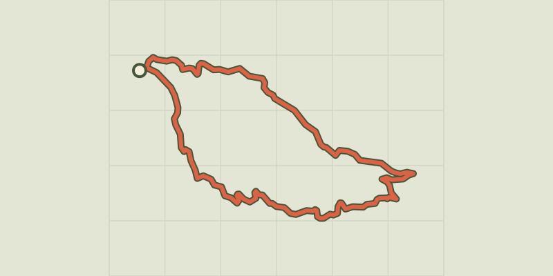 © OpenStreetMap, SRTM · OpenTopoMap (CC-BY-SA)
The ridges of Mont Lozère, Trail #18.
Cévennes, Pont de Montvert - Sud Mont Lozère (48) · LoopOfficial rating by Parc national des Cévennes © OpenStreetMap, SRTM · OpenTopoMap (CC-BY-SA)
Summit of Finiels and Pelouse, variant Trail #17v
Cévennes, Mont Lozère et Goulet (48) · LoopOfficial rating by Parc national des Cévennes © OpenStreetMap, SRTM · OpenTopoMap (CC-BY-SA)
Summet of Finiels and Pelouse, Trail #17
Cévennes, Cubières (48) · LoopOfficial rating by Parc national des Cévennes