
The Clochers de Tourmente (Blizzard belltowers)

Key facts
- Distance
- 22.7 km
- Ascent
- +937 m
- Descent
- −781 m
- Estimated time
- 6 hr 45
- hiking
- Difficulty
- Difficult
- official rating
- Route
- Loop
- back to the start
Profile and gradient
- under 10%
- 10 to 20%
- over 20%
Gradient along the route: 18.5 km under 10% and 4.2 km at 10 to 20%. Elevation from 921 m to 1,370 m over 22.7 km.
Description
Blizzard belltowers keep you company throughout this trail over the large Mont Lozère peatbogs, the meadows of Les Espradels plateau and the “1,000 rivers” with their steep banks. As you leave the hamlet of f Oultet, head towards Lozerette. Fork left onto the path to join up with the track to Lozerette. Take it to the right (do not go through Lozerette). As you cross Les Espadrels plateau, at the crossroads, continue straight ahead. Join up with the track to Serviès (do go to the hamlet of Serviès to see its blizzard belltower, then retrace your steps) and turn right towards les Sagnes. Keep going straight, across the plateau, and in Les Sagnes walk to the lower hamlet to see its blizzard belltower before doubling back. As you enter the hamlet, take the track on the left towards Croix de Peyrou. 150 m after the cross, continue straight ahead, then take the second path on the right, towards Auriac. Go through Auriac and then around the summit of Peyrou to the fork below La Felgère, at the menhir (standing stone). Take the right-hand path to go back downhill to Oultet.
Difficulty
Official rating: difficult, by Parc national des Cévennes.
Before you go
- Make sure your equipment is appropriate for the day's weather conditions. Remember that the weather changes quickly in the mountains. Take enough water, wear solid shoes and put on a hat. Please close all gates and barriers after yourself.
Getting there
Start: Saint-Julien-du-Tournel, Mont Lozère et Goulet (48).
Sources
- Track: Parc national des Cévennes, Licence Ouverte 1.0, Licence Ouverte 1.0 (Etalab) (destination.cevennes-parcnational.fr/trek/39681-Auriac---Oultet). Time estimated by GPX Path with the Mac app rule, breaks not included.
- Official elevation gain: 937 m, Parc national des Cévennes
Nearby tracks

 © OpenStreetMap, SRTM · OpenTopoMap (CC-BY-SA)
Château du Tournel
Cévennes, Mont Lozère et Goulet (48) · LoopOfficial rating by Parc national des Cévennes © OpenStreetMap, SRTM · OpenTopoMap (CC-BY-SA)
Combelle ravine
Cévennes, Mont Lozère et Goulet (48) · LoopOfficial rating by Parc national des Cévennes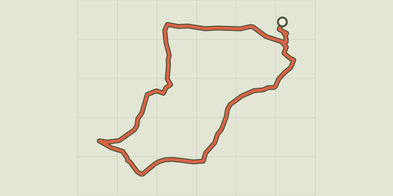 © OpenStreetMap, SRTM · OpenTopoMap (CC-BY-SA)
L'Oustal Crémat
Cévennes, Mont Lozère et Goulet (48) · LoopOfficial rating by Parc national des Cévennes © OpenStreetMap, SRTM · OpenTopoMap (CC-BY-SA)
Château du Tournel
Cévennes, Mont Lozère et Goulet (48) · LoopOfficial rating by Parc national des Cévennes © OpenStreetMap, SRTM · OpenTopoMap (CC-BY-SA)
Lozerette
Cévennes, Mont Lozère et Goulet (48) · LoopOfficial rating by Parc national des Cévennes © OpenStreetMap, SRTM · OpenTopoMap (CC-BY-SA)
The old mill
Cévennes, Chadenet (48) · LoopOfficial rating by Parc national des Cévennes