
The panoramic Cévennes via Mont Aigoual

Key facts
- Distance
- 72.5 km
- Ascent
- +2,412 m
- Descent
- −2,264 m
- Estimated time
- 9 hr 10
- trail running
- Difficulty
- Difficult
- official rating
- Route
- Point to point
- ends elsewhere
Profile and gradient
- under 10%
- 10 to 20%
- over 20%
Gradient along the route: 58.0 km under 10%, 13.5 km at 10 to 20% and 1.0 km over 20%. Elevation from 226 m to 1,559 m over 72.5 km.
Description
This three-stage itinerary leads you to the summit of Mont Aigoual, the emblematic peak of the Cévennes, in an upland atmosphere from beginning to end. The route crosses the massif on ridge paths, alternating between forest tracks and technically demanding singletracks. The highpoints are the panoramic views over the surrounding massifs and the technical sections. A route reserved for experienced runners, used to technical terrain and long distances. Day 1: Florac, Barre-des-Cévennes, 16 km, 780 m of climbs, 390 m of descents. GR®43, GR®7. From Florac, go to Barre-des-Cévennes on the GR®43 to the Col des Faïsses pass via Le Pont de Barre, La Rouvière, Tardonenche, Col du Rey. At Col de Faïsses, leave the GR®43 to take the GR®7 to Barre-des-Cévennes via the Can Noire plateau. Day 2 : Barre-des-Cévennes, summit of Mont Aigoual, 30 km, 680 m of climbs, 1280 m of descents, GR®7. From Barre-des-Cévennes, take the GR®7 back to Col des Faïsses. At the pass, continue on the GR®7 uphill to the summit of Mont Aigoual via L'Hospitalet, Col de Salidès, Aire de Côte, Cap Brion, Mont Aigoual. Day 3 : Summit of Mont Aigoual, Le Vigan, 26 km, 440 m of climbs, 1770 m of descents, GR®7 From the summit of Mont Aigoual, go downhill to Prat Peyrot, Col de la Serreyrède, L'Espérou, Col de Montals, Col de la Broue, Aulas, Le Vigan.
Difficulty
Official rating: difficult, by Parc national des Cévennes.
Before you go
- Before committing yourself to a circuit, ensure that it is suitable for your activity level and ability. Remember that the weather changes quickly in the mountains. Take enough water.
Getting there
Start: Florac-Trois-Rivières, Florac Trois Rivières (48).
Sources
- Track: Parc national des Cévennes, Licence Ouverte 1.0, Licence Ouverte 1.0 (Etalab) (destination.cevennes-parcnational.fr/trek/73798-Les-Cevennes-panoramiques-par-le-mont-Aigoual---Trail). Time estimated by GPX Path with the Mac app rule, breaks not included.
- Official elevation gain: 2,412 m, Parc national des Cévennes
Nearby tracks

 © OpenStreetMap, SRTM · OpenTopoMap (CC-BY-SA)
Couronnes Trail- Intégrale- Trail n°3
Cévennes, Florac Trois Rivières (48) · LoopOfficial rating by Parc national des Cévennes © OpenStreetMap, SRTM · OpenTopoMap (CC-BY-SA)
Couronnes version courte - Trail n°1
Cévennes, Florac Trois Rivières (48) · LoopOfficial rating by Parc national des Cévennes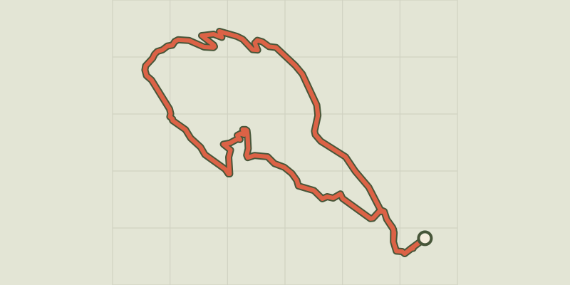 © OpenStreetMap, SRTM · OpenTopoMap (CC-BY-SA)
Gralhon- Trail n°2
Cévennes, Florac Trois Rivières (48) · LoopOfficial rating by Parc national des Cévennes © OpenStreetMap, SRTM · OpenTopoMap (CC-BY-SA)
Rocher des Fées - Trail n°43
Cévennes, Ispagnac (48) · LoopOfficial rating by Parc national des Cévennes © OpenStreetMap, SRTM · OpenTopoMap (CC-BY-SA)
Le tour d'Ispagnac - Trail n°41
Cévennes, Ispagnac (48) · LoopOfficial rating by Parc national des Cévennes © OpenStreetMap, SRTM · OpenTopoMap (CC-BY-SA)
Les deux ponts- Trail n°42
Cévennes, Ispagnac (48) · LoopOfficial rating by Parc national des Cévennes