
A stroll around the Observatory

Key facts
- Distance
- 11.3 km
- Ascent
- +291 m
- Descent
- −227 m
- Estimated time
- 3 hr
- hiking
- Difficulty
- Easy
- official rating
- Route
- Loop
- back to the start
Profile and gradient
- under 10%
- 10 to 20%
- over 20%
Gradient along the route: 11.0 km under 10% and 0.3 km at 10 to 20%. Elevation from 473 m to 632 m over 11.3 km.
Description
From the Earth to our star! Between harmonious landscapes and a rural heritage, to be paired with the astronomy centre of Haute-Provence. Reasonable trails, paths and tracks succeed each other around the Saint-Michel Observatory to offer to the hiker chapels, a Romanesque tower, dovecotes but also beautiful views of the Craux, Mount Lure, the Valensole plateau... Lastly, it is highly recommended to to take advantage of the immediate vicinity of the observation site for astronomy, the environment and the study of the atmosphere of Haute-Provence, to go make a unique discovery of the sun, our star. Turn left at the back of the car park, pass the town hall and follow the street to the right for 300m. 1 - Take the little road that goes to the right below the D305 and then take a quick right and go past the cemetery. Go left at the first intersection. After a steep hill, turn right on the small road which turns into a path 200m further. Behind a well marked shift to the right, climb the narrow path to the left. At the top, take the track to the right, then 70m further, continue straight. Turn right again and then left. At the crossroads'Tour de Porchères'', turn left, walk along the tower, go past a house then turn right. Then, from the right, go around the old quarries of Porchères (private property). Take a right at the next Y-shaped fork. 2 - At the crossroads ‘"Petit Sauvan", turn left towards Saint-Jean. Turn left after 150m, then continue straight through a path that narrows down and enters the woods. Reach a track and continue straight along a beautiful house and continue the track. When you come out on the track, turn left on the small road. Go down the road and reach the D305. Continue on the left for 200m. 3 - Turn right, pass between a farm and a shed, then rise slowly. At the first apparent crossroads (transformer) turn left. Go along an old wall, take a slight descend and go up the opposite side of the valley. After a marked turn on the left, turn right and come out on the plateau. Continue straight for 500m. 4 - At the crossroads (point 632), take the path going down to the left and thus reach the D5, a kilometre below. When you come out on the road, take a quick left and take the small road. Continue straight at the next intersection and go down to the village. After the wash-house, turn right and return to the starting point through the streets used to go.
Difficulty
Official rating: easy, by Parcs naturels régionaux de Provence-Alpes-Côte d'Azur.
Before you go
- Caution with your ankles on the rocky passages after point 3.
Getting there
Start: parking Bardouin, au sud de la mairie, Saint-Michel l'Observatoire, Saint-Michel-l'Observatoire (04).
Sources
- Track: Parcs naturels régionaux de Provence-Alpes-Côte d'Azur (Chemins des Parcs), Licence Ouverte 2.0, Licence Ouverte 2.0 (Etalab) (www.cheminsdesparcs.fr/trek/34096-SAINT-MICHEL-L-OBSERVATOIRE---Balade-de-l-Observatoire). Time estimated by GPX Path with the Mac app rule, breaks not included.
- Official elevation gain: 291 m, Parcs naturels régionaux de Provence-Alpes-Côte d'Azur
Nearby tracks

 © OpenStreetMap, SRTM · OpenTopoMap (CC-BY-SA)
Saint-Martin-les-Eaux - Le Castellas
Luberon, Saint-Martin-les-Eaux (04) · LoopOfficial rating by Parcs naturels régionaux de Provence-Alpes-Côte d'Azur © OpenStreetMap, SRTM · OpenTopoMap (CC-BY-SA)
Manosque - Pélicier en poussette !
Luberon, Manosque (04) · LoopOfficial rating by Parcs naturels régionaux de Provence-Alpes-Côte d'Azur © OpenStreetMap, SRTM · OpenTopoMap (CC-BY-SA)
Manosque - En forêt Domaniale de Pélicier
Luberon, Manosque (04) · LoopOfficial rating by Parcs naturels régionaux de Provence-Alpes-Côte d'Azur © OpenStreetMap, SRTM · OpenTopoMap (CC-BY-SA)
Manosque - Les chemins de Pélicier
Luberon, Manosque (04) · LoopOfficial rating by Parcs naturels régionaux de Provence-Alpes-Côte d'Azur © OpenStreetMap, SRTM · OpenTopoMap (CC-BY-SA)
Manosque - Chemins de Bellevue
Luberon, Manosque (04) · LoopOfficial rating by Parcs naturels régionaux de Provence-Alpes-Côte d'Azur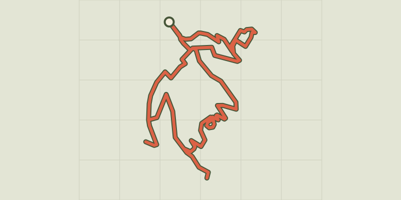 © OpenStreetMap, SRTM · OpenTopoMap (CC-BY-SA)
Forcalquier and its fortress
Luberon, Forcalquier (04) · LoopOfficial rating by Parcs naturels régionaux de Provence-Alpes-Côte d'Azur