
Cliff of the Madeleine

Key facts
- Distance
- 7.2 km
- Ascent
- +306 m
- Descent
- −271 m
- Estimated time
- 2 hr 10
- hiking
- Difficulty
- Moderate
- official rating
- Route
- Loop
- back to the start
Profile and gradient
- under 10%
- 10 to 20%
- over 20%
Gradient along the route: 6.0 km under 10%, 1.1 km at 10 to 20% and 0.2 km over 20%. Elevation from 279 m to 538 m over 7.2 km.
Description
fullness and wonder at the wild beauty of a long cliff ridge ... "I love these landscapes steeped in massive limestone, the tormented forms of valleys and ravines, the mixture of gray, honey and moss, the parade of the cliff overlooking the small village of Lioux, the panoramic views at sunset. .. A pure happiness ! Anne-Camille Vinson, Master 2 intern at the PACA Parks network. Take a left at the exit of the parking and join the road junction. Take the D60 on the left towards Lioux and its cliff. 1-At the exit of the first right turn (tank), turn left onto a dirt road (PR). Get out higher on the D60 and take it to the left. At the entrance of the bend, turn right on a footpath at the foot of the cliff (PR). At the height of the first houses of Lioux, join again the D60 on the left (not marked), then reach the nearby church and the wash house opposite. Continue the road, exit the village of Lioux and continue to the right on a stony path (PR). Walk along the foot of the cliff and climb a steep ramp. Unblock between two houses, turn left and immediately right then continue the path between vineyards, truffle and lavender (PR). 2- - At the mas of La Verrerie, turn right and climb the ancestral path to the crests. Take a bend, turn right and continue 20 m further on the right path (PR). Start to descend along the ridges, then 150 m lower, to sneak right on a path that approaches the edge of the cliff of La Madeleine (local PR, green mark up dots). Get out on the path more marked then repeat twice this escapade right on the edge of cliff. Follow the rocky trail in the scrubland, descend and climb a rock jump (walk) to reach the top of a shoulder (cairn). 3- Continue the path along the ridges. Further on, continue on the path on the right to follow the cliff edge (green dots). Join again the main rocky path (PR and green dots) and go straight up to the top of a bump. Sneak behind on the trail that skirts left over the grove of trees (green dots), then 30 m lower, dive on the right path (PR and green dots). 4- Unclog on an esplanade near the old mill. Go down the paved path and walk along the foot of the cliff. Pass the cemetery and reach the D60. Turn left and go down the road to the hamlet of La Combe.
Difficulty
Official rating: moderate, by Parcs naturels régionaux de Provence-Alpes-Côte d'Azur.
Before you go
- Extreme vigilance along the path that runs along the cliff (between points 2 and 4).
- Watch out for the ankles in the many rugged rocky passages (lapiaz).
- Stay attentive to follow the mark-up (many diverticula).
Getting there
Start: Parking hameau de la Combe, Lioux, Lioux (84).
Sources
- Track: Parcs naturels régionaux de Provence-Alpes-Côte d'Azur (Chemins des Parcs), Licence Ouverte 2.0, Licence Ouverte 2.0 (Etalab) (www.cheminsdesparcs.fr/trek/49878-LIOUX---Falaise-de-la-Madeleine). Time estimated by GPX Path with the Mac app rule, breaks not included.
- Official elevation gain: 306 m, Parcs naturels régionaux de Provence-Alpes-Côte d'Azur
Nearby tracks

 © OpenStreetMap, SRTM · OpenTopoMap (CC-BY-SA)
Saint-Saturnin-lès-Apt - Marnes grises de La Tuilière
Luberon, Saint-Saturnin-lès-Apt (84) · Out and backOfficial rating by Parcs naturels régionaux de Provence-Alpes-Côte d'Azur © OpenStreetMap, SRTM · OpenTopoMap (CC-BY-SA)
Roussillon - Rando insolite
Luberon, Roussillon (84) · LoopOfficial rating by Parcs naturels régionaux de Provence-Alpes-Côte d'Azur © OpenStreetMap, SRTM · OpenTopoMap (CC-BY-SA)
The upstream sections of the gorges of Véroncle
Luberon, Murs (84) · LoopOfficial rating by Parcs naturels régionaux de Provence-Alpes-Côte d'Azur © OpenStreetMap, SRTM · OpenTopoMap (CC-BY-SA)
Roussillon - Balade du Bois Saint Jean
Luberon, Roussillon (84) · LoopOfficial rating by Parcs naturels régionaux de Provence-Alpes-Côte d'Azur © OpenStreetMap, SRTM · OpenTopoMap (CC-BY-SA)
Roussillon - Ecomusée, village coloré et sentier des ocres
Luberon, Roussillon (84) · LoopOfficial rating by Parcs naturels régionaux de Provence-Alpes-Côte d'Azur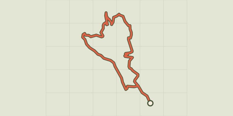 © OpenStreetMap, SRTM · OpenTopoMap (CC-BY-SA)
Gordes - Sentier du Maquis de Gordes par Véroncle
Luberon, Gordes (84) · LoopOfficial rating by Parcs naturels régionaux de Provence-Alpes-Côte d'Azur