
The Provençal Colorado
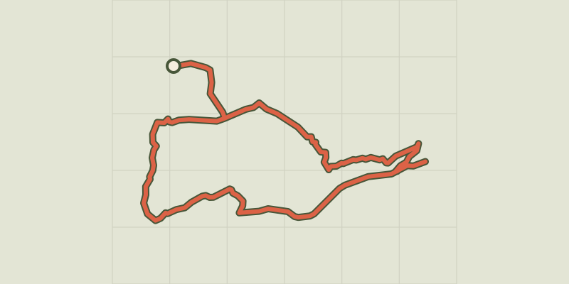
Key facts
- Distance
- 15.5 km
- Ascent
- +423 m
- Descent
- −351 m
- Estimated time
- 4 hr 10
- hiking
- Difficulty
- Moderate
- official rating
- Route
- Loop
- back to the start
Profile and gradient
- under 10%
- 10 to 20%
- over 20%
Gradient along the route: 14.0 km under 10% and 1.6 km at 10 to 20%. Elevation from 325 m to 581 m over 15.5 km.
Description
A break in the vast ocher gathering, both intimate and panoramic. "The ocher massif of Luberon is a geological and landscape curiosity not to be missed! Circling around the heart of the classified site of the Colorado of Rustrel, highly visited, is choosing to enjoy the site differently. Between colored views, sandy passages, mining operation remains and natural wealth, this stroll is a treat! ". says Anne-Camille Vinson - 2nd year of Master's intern at Réseau des Parcs de PACA. Facing the Restreou Hostel, take the Route de Saint-Christol (D30) to the right. 100m further, turn right and go down the Boulevard du Colorado (D30a). 430m further, take the Chemin de Saint-Joseph to the right and follow it. At the stop sign, cross the D22 (be careful!) and continue across. At the crossroads "Cornet", turn left. Then follow the old car park of Colorado. In a curve (refreshment area), immerse to the right on the DFCI track. Cross the Dôa (ford) and go up the long track of Barriès (GR® markings). 1- At the sign-post ''Barriès'' turn left onto the pretty trail (slab). Reach an area of ruts and continue straight (GR®). Then take the paved road "Chemin de l'Ubac". At the junction, go right onto Route de Gignac. 2- At the mountain pass, take the left track for 500m and reach the imprinted slabs. Turn around and go back to point 2. Back again on the pass, follow the road to the left. At the crossroads "Pradenques" and "Ubac de Pradenques" continue straight. On top of the hill, turn onto the right track. 1km away, take a right back into the woods. After a break, continue left onto the lower trail (PR). Go along a large field and reach the crossroads ''Croix de Christol '' (sign-post). 3- Pass the gate and hurtle down the trail (PR). The stones give way to ocher; take the time to make a landscape stop. Down, spin slightly to the left along the clearing, fording the Dôa, past the sewage treatment plant and reach the hamlet of Istrane. 4- Turn right and take small road. Skip two curves, go along a house and at the next intersection on the corner of a farm, turn left. Go up the small road. Cross the D22 (be careful!) and continue across. Pass the school parking lots and reach the center of the village of Rustrel.
Difficulty
Official rating: moderate, by Parcs naturels régionaux de Provence-Alpes-Côte d'Azur.
Before you go
- The two fords on Dôa at the start and at the end of the walk can be difficult after a big storm or a long rainy period. Be vigilant and if in doubt do not continue!
- Remember to bring water; no water spring on the way!
Getting there
Start: Parking centre du village, Rustrel, Rustrel (84).
Sources
- Track: Parcs naturels régionaux de Provence-Alpes-Côte d'Azur (Chemins des Parcs), Licence Ouverte 2.0, Licence Ouverte 2.0 (Etalab) (www.cheminsdesparcs.fr/trek/26182-RUSTREL---Tour-du-Colorado-provencal-et-dalle-a-empreintes). Time estimated by GPX Path with the Mac app rule, breaks not included.
- Official elevation gain: 423 m, Parcs naturels régionaux de Provence-Alpes-Côte d'Azur
Nearby tracks

 © OpenStreetMap, SRTM · OpenTopoMap (CC-BY-SA)
The Provençal Colorado
Luberon, Rustrel (84) · LoopOfficial rating by Parcs naturels régionaux de Provence-Alpes-Côte d'Azur © OpenStreetMap, SRTM · OpenTopoMap (CC-BY-SA)
Caseneuve - Les ocres depuis Haute Blace
Luberon, Caseneuve (84) · LoopOfficial rating by Parcs naturels régionaux de Provence-Alpes-Côte d'Azur © OpenStreetMap, SRTM · OpenTopoMap (CC-BY-SA)
Viens - Petit tour de Piégros
Luberon, Viens (84) · LoopOfficial rating by Parcs naturels régionaux de Provence-Alpes-Côte d'Azur © OpenStreetMap, SRTM · OpenTopoMap (CC-BY-SA)
Caseneuve - Du village perché au Colorado provençal
Luberon, Caseneuve (84) · LoopOfficial rating by Parcs naturels régionaux de Provence-Alpes-Côte d'Azur © OpenStreetMap, SRTM · OpenTopoMap (CC-BY-SA)
Villars - Le massif de La Bruyère
Luberon, Villars (84) · LoopOfficial rating by Parcs naturels régionaux de Provence-Alpes-Côte d'Azur © OpenStreetMap, SRTM · OpenTopoMap (CC-BY-SA)
La Bruyère, the sensitive area!
Luberon, Villars (84) · LoopOfficial rating by Parcs naturels régionaux de Provence-Alpes-Côte d'Azur