
The "Belvédère des Vautours" trail
Key facts
- Distance
- 10.1 km
- Ascent
- +358 m
- Descent
- −336 m
- Estimated time
- 3 hr
- hiking
- Difficulty
- Moderate
- official rating
- Route
- Loop
- back to the start
Profile and gradient
- under 10%
- 10 to 20%
- over 20%
Gradient along the route: 8.6 km under 10%, 0.8 km at 10 to 20% and 0.8 km over 20%. Elevation from 649 m to 888 m over 10.1 km.
Description
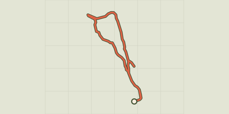
From the viewpoint, admire the flight of the vultures in the Gorges du Verdon, their favourite stomping ground. To discover the charm of a village of Haute Provence, Trigance, a village overlooking the valley of Jabron is to discover its architectural treasures dominated by its castle, the Carajuan and Sautet bridges. From the car park at the entrance of Trigance, go up to the village by the Rue du Four. Go through the village taking the Rue de l'Horloge and reach to the Henry Giraud square. Go past the grocery store, the heritage museum and continue along the small road towards the Gorges du Verdon (Rue du St-Esprit). Leave the road accessing the castle to the left (cannot be visited). 1 - At the next turn (Combaou de Breis), go straight and take the path towards the Carajuan and Sautet bridges (purple markings). When coming out of the pines and spruces, leave the road coming from the right and continue for 500m until the crossing with the Granges de Breis route. 2, Turn right down the track towards the Carajuan bridge. 3, At 500m at the signpost les Merlatieres make a detour (700m there and back) taking the Sautet the bridge and resume by taking the path leading towards the Carajuan bridge at 2km. 4, At the Carajuan bridge, take the path just before, to the left and go up 1.1km to the Belvédère des Vautours (250m of elevation) 5, Turn around and return to the starting point by the same route.
Difficulty
Official rating: moderate, by Parcs naturels régionaux de Provence-Alpes-Côte d'Azur.
Before you go
- We recommend at least 2L of water per person, a hat, proper walking shoes and a pair of binoculars.
Getting there
Start: Parking à l'entrée de Trigance, Trigance (83).
Sources
- Track: Parcs naturels régionaux de Provence-Alpes-Côte d'Azur (Chemins des Parcs), Licence Ouverte 2.0, Licence Ouverte 2.0 (Etalab) (www.cheminsdesparcs.fr/trek/33778-TRIGANCE---Le-belvedere-des-vautours). Time estimated by GPX Path with the Mac app rule, breaks not included.
- Official elevation gain: 358 m, Parcs naturels régionaux de Provence-Alpes-Côte d'Azur
Nearby tracks

 © OpenStreetMap, SRTM · OpenTopoMap (CC-BY-SA)
Trigance - Sentier découverte préhistorique : Les Condamines
Verdon, Trigance (83) · LoopOfficial rating by Parcs naturels régionaux de Provence-Alpes-Côte d'Azur © OpenStreetMap, SRTM · OpenTopoMap (CC-BY-SA)
Comps-sur-Artuby - La boucle du Siounet
Verdon, Comps-sur-Artuby (83) · LoopOfficial rating by Parcs naturels régionaux de Provence-Alpes-Côte d'Azur © OpenStreetMap, SRTM · OpenTopoMap (CC-BY-SA)
Comps-sur-Artuby - Sentier des Prés de Laure
Verdon, Comps-sur-Artuby (83) · LoopOfficial rating by Parcs naturels régionaux de Provence-Alpes-Côte d'Azur © OpenStreetMap, SRTM · OpenTopoMap (CC-BY-SA)
Rougon - Rougon - Chasteuil + Autocar
Verdon, Rougon (04) · Point to pointOfficial rating by Parcs naturels régionaux de Provence-Alpes-Côte d'Azur © OpenStreetMap, SRTM · OpenTopoMap (CC-BY-SA)
Le Bourguet - Bagarry
Verdon, Le Bourguet (83) · LoopOfficial rating by Parcs naturels régionaux de Provence-Alpes-Côte d'Azur © OpenStreetMap, SRTM · OpenTopoMap (CC-BY-SA)
Le Fayet
Verdon, Comps-sur-Artuby (83) · LoopOfficial rating by Parcs naturels régionaux de Provence-Alpes-Côte d'Azur