
Biasses
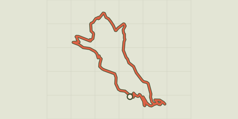
Key facts
- Distance
- 6.3 km
- Ascent
- +418 m
- Descent
- −299 m
- Estimated time
- 2 hr
- hiking
- Difficulty
- Moderate
- official rating
- Route
- Loop
- back to the start
Profile and gradient
- under 10%
- 10 to 20%
- over 20%
Gradient along the route: 3.8 km under 10%, 1.7 km at 10 to 20% and 0.8 km over 20%. Elevation from 438 m to 624 m over 6.3 km.
Description
The path goes through typical Cevenol hamlets and passes near the imposing magnanerie (silkworm farm) of La Roque. On its rocky outcrop, La Canourgue tower proudly stands guard over the Vallée Française. Departure from Biasses bridge. 1) Take on your right the concrete path, pass the “Barral” house, continue on the path that comes out near the hamlet of Bruguier-Bas, reach the D983, and cross it to take the path opposite that goes to the hamlet of Les Plantiers (under La Canourgue tower). 2) At the hamlet of Les Plantiers, first take the left then take the right the path that climbs to La Canourgue tower. 3) From the tower, retrace your steps to take the path on the right. 4) Pass below the house of Le Bruguier-Haut and join up with the road that you follow to Mazel Escassier. Just after the house, take the path on the right that leads to the D983. Turn right onto the road for 100 m. Take the road on the left for 540 m. 5) Take the path on the right towards the Magnanerie de La Roque. 6) Below the magnanerie, take the path on the left that descends to the hamlet of Le Castelet. Continue in the chestnut orchard to the valley floor. Join up with the road and turn right onto it to Biasses.
Difficulty
Official rating: moderate, by Parc national des Cévennes.
Before you go
- Make sure your equipment is appropriate for the day’s weather conditions. Remember that the weather changes quickly in the mountains. Take enough water, wear sturdy shoes and put on a hat. Please close all gates and barriers behind you.
Getting there
Start: Au pont de Biasses, Molezon (48).
Sources
- Track: Parc national des Cévennes, Licence Ouverte 1.0, Licence Ouverte 1.0 (Etalab) (destination.cevennes-parcnational.fr/trek/43201-Biasses). Time estimated by GPX Path with the Mac app rule, breaks not included.
- Official elevation gain: 418 m, Parc national des Cévennes
Nearby tracks

 © OpenStreetMap, SRTM · OpenTopoMap (CC-BY-SA)
Bézuc
Cévennes, Le Pompidou (48) · LoopOfficial rating by Parc national des Cévennes © OpenStreetMap, SRTM · OpenTopoMap (CC-BY-SA)
Saint-Flour valley
Cévennes, Le Pompidou (48) · LoopOfficial rating by Parc national des Cévennes © OpenStreetMap, SRTM · OpenTopoMap (CC-BY-SA)
Barre-des-Cévennes
Cévennes, Barre-des-Cévennes (48) · LoopOfficial rating by Parc national des Cévennes © OpenStreetMap, SRTM · OpenTopoMap (CC-BY-SA)
Pont Marès
Cévennes, Saint-André-de-Valborgne (30) · LoopOfficial rating by Parc national des Cévennes © OpenStreetMap, SRTM · OpenTopoMap (CC-BY-SA)
The corniches de l’Hospitalet
Cévennes, Vebron (48) · LoopOfficial rating by Parc national des Cévennes © OpenStreetMap, SRTM · OpenTopoMap (CC-BY-SA)
Le Col Salidès par Saint-André de Valborgne
Cévennes, Saint-André-de-Valborgne (30) · LoopOfficial rating by Parc national des Cévennes