
Le Pas de l'Ane

Key facts
- Distance
- 11.8 km
- Ascent
- +529 m
- Descent
- −450 m
- Estimated time
- 3 hr 35
- hiking
- Difficulty
- Difficult
- official rating
- Route
- Loop
- back to the start
Profile and gradient
- under 10%
- 10 to 20%
- over 20%
Gradient along the route: 8.9 km under 10%, 2.7 km at 10 to 20% and 0.3 km over 20%. Elevation from 557 m to 895 m over 11.8 km.
Description
This is a fabulous cliff-edge path above the Trévezel gorge. The torrent has exploited a geological fault line to carve its deep gorge into the Causse plateau. This gigantic balcony offers views onto wooded cliffs with large bare limestone formations, almost like fangs. At the very bottom lies the hamlet of Le Villaret, through which you will pass in two or three hours, depending on your speed. Be careful not to imitate the donkey that gave the rocky cliff edge opposite you its name! A long time ago, that donkey took a wrong step (“pas de l’âne” means “donkey step”) and fell off the cliff with its unlucky owner… Signposts will guide you all along this route, as well as yellow painted waymarks. In the description below, the signposted place names and/or directions are given in bold italics between quotation marks: Start in Trèves, on the car park in front of the mairie. Take the path uphill to the cross. - There are several hairpin bends to reach the signpost “Roc du regard”: go to the viewpoint. - At “Roc du regard”, turn left; make sure to close the barrier. - Continue on the path. At the lane “Le puech”, go right towards "Mare d'Espinassous" and the hamlet. - Walk through the hamlet of L'Espinassous and continue straight ahead. - At the signpost "Mare d'Espinassous" turn right and go downhill to “Randavel”, then to the D157. - Turn right onto the road for about 800 m. - Turn left and cross the bridge over the Trévezel river. Continue on the road towards Comeiras. - In the 4th hairpin bend, leave the road and go straight, close the barrier. - Continue on the path to a level area. - Difficult downhill section among the rocks: slippery path. - At "La Sourdette" go back up towards “Hameau du Villaret” and from there downhill to “Trèves” via "La vierge". Cross the village uphill to the mairie.
Difficulty
Official rating: difficult, by Parc national des Cévennes.
Before you go
- Caution: in the gorge, the path is slippery at ambient humidity and passes among the rocks (impassable for mountain-bikes). Before committing yourself to a circuit, ensure that it is suitable for your activity level and ability. Remember that the weather changes quickly in the mountains. Take enough water. Very difficult sections on the return leg. Children under 16 years of age and groups are advised to abstain from this hike.
Getting there
Start: Trèves - Mairie, Trèves (30).
Sources
- Track: Parc national des Cévennes, Licence Ouverte 1.0, Licence Ouverte 1.0 (Etalab) (destination.cevennes-parcnational.fr/trek/45098-Le-Pas-de-l-Ane). Time estimated by GPX Path with the Mac app rule, breaks not included.
- Official elevation gain: 529 m, Parc national des Cévennes
Nearby tracks

 © OpenStreetMap, SRTM · OpenTopoMap (CC-BY-SA)
Canayère
Cévennes, Trèves (30) · LoopOfficial rating by Parc national des Cévennes © OpenStreetMap, SRTM · OpenTopoMap (CC-BY-SA)
One foot in the Dourbie valley, the other in the Trévezel
Cévennes, Trèves (30) · Point to pointOfficial rating by Parc national des Cévennes © OpenStreetMap, SRTM · OpenTopoMap (CC-BY-SA)
The Causse de Canayère plateau
Cévennes, Trèves (30) · LoopOfficial rating by Parc national des Cévennes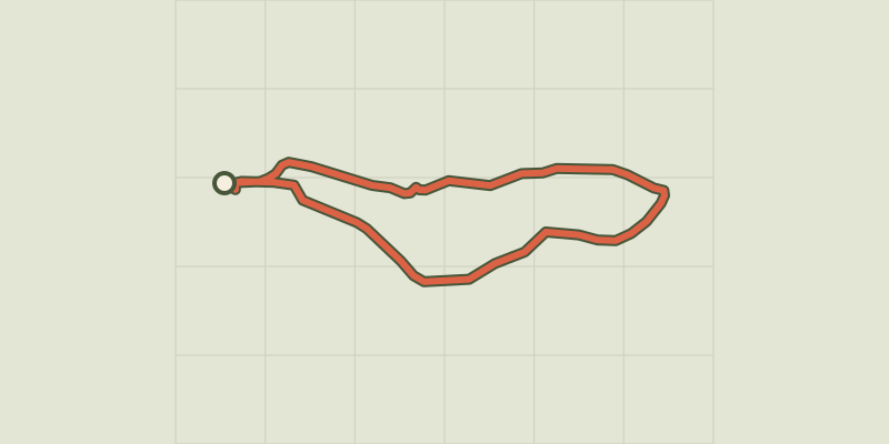 © OpenStreetMap, SRTM · OpenTopoMap (CC-BY-SA)
Sentier de découverte - Canayère - indices de la vie rurale
Cévennes, Trèves (30) · LoopOfficial rating by Parc national des Cévennes © OpenStreetMap, SRTM · OpenTopoMap (CC-BY-SA)
Le Suquet ridge
Cévennes, Dourbies (30) · LoopOfficial rating by Parc national des Cévennes © OpenStreetMap, SRTM · OpenTopoMap (CC-BY-SA)
Sentier de La Bourelle
Cévennes, Dourbies (30) · LoopOfficial rating by Parc national des Cévennes