
The Causse de Canayère plateau

Key facts
- Distance
- 3.3 km
- Ascent
- +148 m
- Descent
- −105 m
- Estimated time
- 1 hr
- hiking
- Difficulty
- Very easy
- official rating
- Route
- Loop
- back to the start
Profile and gradient
- under 10%
- 10 to 20%
- over 20%
Gradient along the route: 2.4 km under 10%, 0.7 km at 10 to 20% and 0.2 km over 20%. Elevation from 807 m to 911 m over 3.3 km.
Description
The small plateau known as the Causse de Canayère offers you a fabulous journey through time: both through geological time and, much closer to us, from the time of the first humans to today. This path between limestone and schist bedrock helps you to imagine the folds, collapses and faults that have affected this region in geological time. You walk past fault lines, along which the land has sunk by several hundred metres, and overlook a river that has been carving out its gorge for almost three million years. The path’s various stopping places also showcase humanity’s influence on the environment and landscape since prehistoric times. Accessible on foot directly from the village of Trèves via Le Villaret hamlet (there and back 4km, elevation gain 330m).
Difficulty
Official rating: very easy, by Parc national des Cévennes.
Before you go
- This path has rocky and vertiginous sections. For your own safety, you must stay on the waymarked path.
Getting there
Start: Maison forestière de Canayère, Trèves (30).
Sources
- Track: Parc national des Cévennes, Licence Ouverte 1.0, Licence Ouverte 1.0 (Etalab) (destination.cevennes-parcnational.fr/trek/73297-Sentier-de-decouverte---Canayere---geologie-et-paysage). Time estimated by GPX Path with the Mac app rule, breaks not included.
- Official elevation gain: 148 m, Parc national des Cévennes
Nearby tracks
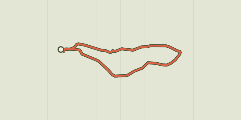
 © OpenStreetMap, SRTM · OpenTopoMap (CC-BY-SA)
Sentier de découverte - Canayère - indices de la vie rurale
Cévennes, Trèves (30) · LoopOfficial rating by Parc national des Cévennes © OpenStreetMap, SRTM · OpenTopoMap (CC-BY-SA)
Le Pas de l'Ane
Cévennes, Trèves (30) · LoopOfficial rating by Parc national des Cévennes © OpenStreetMap, SRTM · OpenTopoMap (CC-BY-SA)
Canayère
Cévennes, Trèves (30) · LoopOfficial rating by Parc national des Cévennes © OpenStreetMap, SRTM · OpenTopoMap (CC-BY-SA)
One foot in the Dourbie valley, the other in the Trévezel
Cévennes, Trèves (30) · Point to pointOfficial rating by Parc national des Cévennes © OpenStreetMap, SRTM · OpenTopoMap (CC-BY-SA)
Le Suquet ridge
Cévennes, Dourbies (30) · LoopOfficial rating by Parc national des Cévennes © OpenStreetMap, SRTM · OpenTopoMap (CC-BY-SA)
Sentier de La Bourelle
Cévennes, Dourbies (30) · LoopOfficial rating by Parc national des Cévennes