
Monoblet: the botanical path
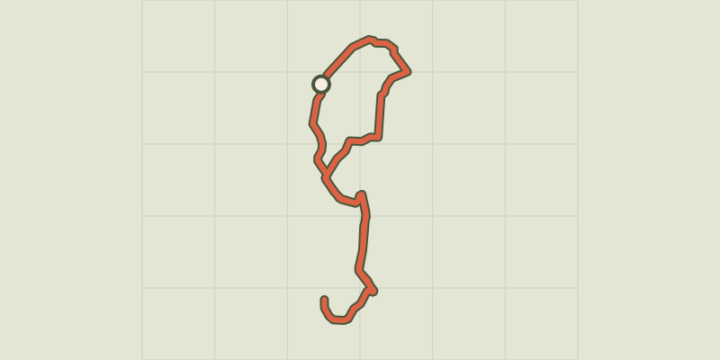
Key facts
- Distance
- 4.3 km
- Ascent
- +148 m
- Descent
- −122 m
- Estimated time
- 1 hr 15
- hiking
- Difficulty
- Easy
- official rating
- Route
- Loop
- back to the start
Profile and gradient
- under 10%
- 10 to 20%
- over 20%
Gradient along the route: 3.4 km under 10% and 1.0 km at 10 to 20%. Elevation from 243 m to 318 m over 4.3 km.
Description
The municipality of Monoblet has contrasting types of scenery: the reliefs are covered in oak and chestnut trees, the valley floors are lively with farming. This is an original path through Cévenol flora. As elsewhere in the Cévennes, silk farming developed at Monoblet in the early 18th century. It declined here from the mid-19th century onwards, leaving behind many vestiges both built and scenic. This botanical path has 17 stopping places for observation: mulberry tree, Judas tree, chestnut tree, grapevine, prostrate Canary clover, downy oak, blue grass lily, Arabian pea trefoil, olive tree, laurustinus, thyme, holm oak, strawberry tree, mahaleb cherry, wild aspargus, service or serb tree, Kokuzo mulberry tree. By the cemetery, a there-and-back variant of this walk takes you past Kokuso mulberry trees to the Gréfeuilhe spinnng mill, which is home to the workshops of Les Soieries des Cévennes and Séricyne (not open to the public).
Difficulty
Official rating: easy, by Parc national des Cévennes.
Before you go
- This walk has rocky sections and overhangs the river. For your own safety, you must stay on the waymarked path.
Getting there
Start: Temple octogonal, Monoblet (30).
Sources
- Track: Parc national des Cévennes, Licence Ouverte 1.0, Licence Ouverte 1.0 (Etalab) (destination.cevennes-parcnational.fr/trek/73295-Monoblet%2C-le-sentier-botanique). Time estimated by GPX Path with the Mac app rule, breaks not included.
- Official elevation gain: 148 m, Parc national des Cévennes
Nearby tracks

 © OpenStreetMap, SRTM · OpenTopoMap (CC-BY-SA)
Les jumelles
Cévennes, Monoblet (30) · LoopOfficial rating by Parc national des Cévennes © OpenStreetMap, SRTM · OpenTopoMap (CC-BY-SA)
The Château de Fressac
Cévennes, Monoblet (30) · LoopOfficial rating by Parc national des Cévennes © OpenStreetMap, SRTM · OpenTopoMap (CC-BY-SA)
Le valat de Valestalière
Cévennes, Monoblet (30) · LoopOfficial rating by Parc national des Cévennes © OpenStreetMap, SRTM · OpenTopoMap (CC-BY-SA)
Cros: the silk trail
Cévennes, Cros (30) · LoopOfficial rating by Parc national des Cévennes © OpenStreetMap, SRTM · OpenTopoMap (CC-BY-SA)
Le chemin des Fileuses
Cévennes, Colognac (30) · LoopOfficial rating by Parc national des Cévennes © OpenStreetMap, SRTM · OpenTopoMap (CC-BY-SA)
Sentier des Fileuses - Carré de soie
Cévennes, Colognac (30) · Out and backOfficial rating by Parc national des Cévennes