
Sheep bridge
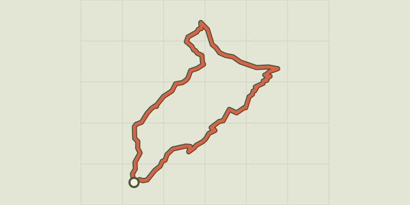
Key facts
- Distance
- 11.2 km
- Ascent
- +669 m
- Descent
- −560 m
- Estimated time
- 3 hr 40
- hiking
- Difficulty
- Difficult
- official rating
- Route
- Loop
- back to the start
Profile and gradient
- under 10%
- 10 to 20%
- over 20%
Gradient along the route: 7.3 km under 10%, 3.1 km at 10 to 20% and 0.8 km over 20%. Elevation from 463 m to 1,000 m over 11.2 km.
Description
After a beautiful uphill section through a chestnut orchard, you get extraordinary views. The ridge path that you are on is a former route for transhumant sheep (sheep going to and from summer pastures). As you explore the sheep bridge and walk back downhill, alongside you is a former forest now planted with downy oaks. Signposts will guide you all along this route, as well as yellow painted waymarks. In the description below, the signposted place names and/or directions are given in bold italics between quotation marks: From your starting-point at "Puech Sigal", take the track on the left. Follow signs for - "Favières", - "Jasse de Rieusset", - At “Col de l’Homme Mort”, Turn right toward - "Le Clos", - "Col de l'Asclier". Go downhill on the road for 100m - At "Source de l'Asclier", take the path on the right and go downhill to “Mas Corbières”. - At "Mas Corbières", head for "Puech Sigal" via - "Valnières".
Difficulty
Official rating: difficult, by Parc national des Cévennes.
Before you go
- Before committing yourself to a circuit, ensure that it is suitable for your activity level and ability. Remember that the weather changes quickly in the mountains. Take enough water. Please close all gates and barriers behind you. Caution: The downhill section to Mas Corbières is difficult.
Getting there
Start: Puech Sigal, Val-d'Aigoual (30).
Sources
- Track: Parc national des Cévennes, Licence Ouverte 1.0, Licence Ouverte 1.0 (Etalab) (destination.cevennes-parcnational.fr/trek/45100-Pont-Moutonnier). Time estimated by GPX Path with the Mac app rule, breaks not included.
- Official elevation gain: 669 m, Parc national des Cévennes
Nearby tracks

 © OpenStreetMap, SRTM · OpenTopoMap (CC-BY-SA)
Col de Bès
Cévennes, Val-d'Aigoual (30) · LoopOfficial rating by Parc national des Cévennes © OpenStreetMap, SRTM · OpenTopoMap (CC-BY-SA)
L'oignon doux - sentier de découverte
Cévennes, Val-d'Aigoual (30) · LoopOfficial rating by Parc national des Cévennes © OpenStreetMap, SRTM · OpenTopoMap (CC-BY-SA)
Taleyrac
Cévennes, Val-d'Aigoual (30) · LoopOfficial rating by Parc national des Cévennes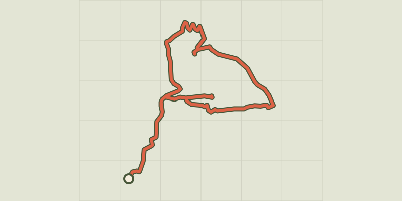 © OpenStreetMap, SRTM · OpenTopoMap (CC-BY-SA)
La Croix de Bassel
Cévennes, Saint-Martial (30) · LoopOfficial rating by Parc national des Cévennes © OpenStreetMap, SRTM · OpenTopoMap (CC-BY-SA)
Col de Bès
Cévennes, Saint-Martial (30) · LoopOfficial rating by Parc national des Cévennes © OpenStreetMap, SRTM · OpenTopoMap (CC-BY-SA)
Col de la Tribale et du Devinayre
Cévennes, Saint-Martial (30) · LoopOfficial rating by Parc national des Cévennes