
The Puechs
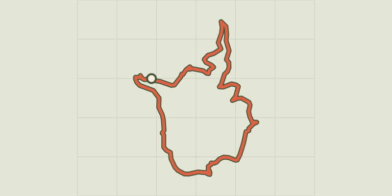
Key facts
- Distance
- 11.6 km
- Ascent
- +391 m
- Descent
- −323 m
- Estimated time
- 3 hr 15
- hiking
- Difficulty
- Moderate
- official rating
- Route
- Loop
- back to the start
Profile and gradient
- under 10%
- 10 to 20%
- over 20%
Gradient along the route: 9.3 km under 10% and 2.3 km at 10 to 20%. Elevation from 152 m to 430 m over 11.6 km.
Description
Immerse yourself in a history as you walk from the banks of the river Gardon to Mas Soubeyran, a museum of French Protestantism. You will be able to enjoy far-reaching views onto the Puechs, Mont Aigoual, Mont Liron and, on clear days, even the Alps. Signposts will guide you all along this route. In the description below, the signposted place names and/or directions are given in bold italics between quotation marks: From the car park "Mialet", turn right onto the D 50, cross the Pont des Camisards bridge. - At "Pont des Camisards" turn left towards - "Le Travès". Then head for Mas Soubeyran via: - " La Rouquette". - At "Mialet-Mas Soubeyran", take the path on the right to reach La Baumelle gully, which leads to the mas (farm) of the same name. Walk past the mas on its right. - At "La Baumelle" continue on the track to join up with the road. Turn right onto the road and after 250 m turn left on a path towards La Rouvière. - At "La Rouvière", turn left onto a fire road (DFCI) and take a path on the left that goes downhill into Roquefeuille gully. Cross the bridge, take the road on the left and then a small path on the right that will lead you back to Mialet.
Difficulty
Official rating: moderate, by Parc national des Cévennes.
Before you go
- Make sure your equipment is appropriate for the day's weather conditions. Remember that the weather changes quickly in the mountains. Take enough water, wear solid shoes and put on a hat. Please close all gates and barriers after yourself.
Getting there
Start: Mialet, Mialet (30).
Sources
- Track: Parc national des Cévennes, Licence Ouverte 1.0, Licence Ouverte 1.0 (Etalab) (destination.cevennes-parcnational.fr/trek/39895-Les-Puechs). Time estimated by GPX Path with the Mac app rule, breaks not included.
- Official elevation gain: 391 m, Parc national des Cévennes
Nearby tracks

 © OpenStreetMap, SRTM · OpenTopoMap (CC-BY-SA)
Les berges du Gardon
Cévennes, Mialet (30) · LoopOfficial rating by Parc national des Cévennes © OpenStreetMap, SRTM · OpenTopoMap (CC-BY-SA)
Around Les Aigladines
Cévennes, Mialet (30) · LoopOfficial rating by Parc national des Cévennes © OpenStreetMap, SRTM · OpenTopoMap (CC-BY-SA)
Panorama de Valaurie
Cévennes, Thoiras-Corbès (30) · LoopOfficial rating by Parc national des Cévennes © OpenStreetMap, SRTM · OpenTopoMap (CC-BY-SA)
Les Escorces
Cévennes, Saint-Jean-du-Gard (30) · LoopOfficial rating by Parc national des Cévennes © OpenStreetMap, SRTM · OpenTopoMap (CC-BY-SA)
Saint-Jean, Pont vieux
Cévennes, Saint-Jean-du-Gard (30) · LoopOfficial rating by Parc national des Cévennes © OpenStreetMap, SRTM · OpenTopoMap (CC-BY-SA)
From one Gardon to the next
Cévennes, Saint-Jean-du-Gard (30) · LoopOfficial rating by Parc national des Cévennes