
Villefort
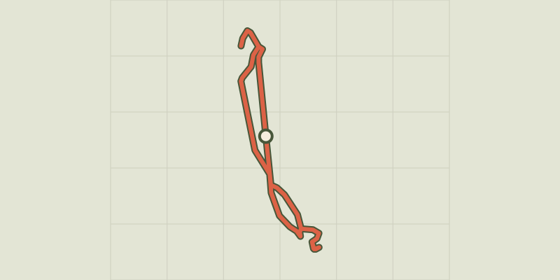
Key facts
- Distance
- 1.5 km
- Ascent
- +36 m
- Descent
- −20 m
- Estimated time
- 25 min
- hiking
- Difficulty
- Very easy
- official rating
- Route
- Loop
- back to the start
Profile and gradient
- under 10%
- 10 to 20%
- over 20%
Gradient along the route: 1.5 km under 10%. Elevation from 576 m to 600 m over 1.5 km.
Description
Built at the foot of Mont Lozère on the Regordane Way, Villefort has developed its own forms of architecture, which make use of both schist and granite. Villefort, a one-road village at the foot of Mont Lozère, was built along a north-south geological fault between granite bedrock and schist. Its location on the Regordane Way, which was an economic and cultural artery during the Middle Ages, stimulated its growth. Villefort experienced another boom around 1860, becoming a true commercial hub of the Cévennes, when its train station, one of the main stations of the railway through the Cévennes, was built. A few clarifications: • To reach Panels 5 (How the village is arranged) and 6 (Paris-Marseille train line), go up Rue du Chazalet and take the first lane on the right. Take a small path (GR 44) that climbs about 50 m to the viewpoint. • To get to Panel 13 (River network), continue along Impasse du Lavoir and take the first road on the left, which heads downhill to the river.
Difficulty
Official rating: very easy, by Parc national des Cévennes.
Before you go
- This path has 14 numbered information panels.
Getting there
Start: Pharmacie du centre, Villefort (48).
Sources
- Track: Parc national des Cévennes, Licence Ouverte 1.0, Licence Ouverte 1.0 (Etalab) (destination.cevennes-parcnational.fr/trek/38122-Sentier-de-Villefort). Time estimated by GPX Path with the Mac app rule, breaks not included.
- Official elevation gain: 36 m, Parc national des Cévennes
Nearby tracks

 © OpenStreetMap, SRTM · OpenTopoMap (CC-BY-SA)
Chapelas Roc
Cévennes, Villefort (48) · LoopOfficial rating by Parc national des Cévennes © OpenStreetMap, SRTM · OpenTopoMap (CC-BY-SA)
Croix de Gratassac
Cévennes, Villefort (48) · LoopOfficial rating by Parc national des Cévennes © OpenStreetMap, SRTM · OpenTopoMap (CC-BY-SA)
The cliffs of Pourcharesses
Cévennes, Villefort (48) · LoopOfficial rating by Parc national des Cévennes © OpenStreetMap, SRTM · OpenTopoMap (CC-BY-SA)
Villefort Lake
Cévennes, Villefort (48) · LoopOfficial rating by Parc national des Cévennes © OpenStreetMap, SRTM · OpenTopoMap (CC-BY-SA)
Valat du Collet
Cévennes, Saint-André-Capcèze (48) · LoopOfficial rating by Parc national des Cévennes © OpenStreetMap, SRTM · OpenTopoMap (CC-BY-SA)
Sentier du Mas de l'Ayre
Cévennes, Malons-et-Elze (30) · LoopOfficial rating by Parc national des Cévennes