
Around the mines (trail route no. 22)

Key facts
- Distance
- 11.5 km
- Ascent
- +426 m
- Descent
- −369 m
- Estimated time
- 1 hr 30
- trail running
- Difficulty
- Easy
- official rating
- Route
- Loop
- back to the start
Profile and gradient
- under 10%
- 10 to 20%
- over 20%
Gradient along the route: 8.7 km under 10% and 2.9 km at 10 to 20%. Elevation from 957 m to 1,295 m over 11.5 km.
Description
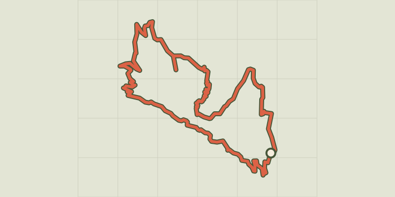
Alternating between meadow and forest, this circuit takes you into the Fournel valley, a place steeped in history, marked by the presence of silver mines Running through the municipality of L'Argentière-la-Bessée, this trail takes you up to the north-facing slopes ("Ubac") and on to the Bois de Champ Pelbaud through a pine forest before dropping back down into the eponymous valley, a popular ice climbing centre in the winter. You will overlook the gorges of the Fournel where silver mining was at its peak in the nineteenth century, before passing through the fields and buildings of the municipality. The circuit starts at the Les Écrins campsite in L'Argentière-la-Bessée, follows the railway line for 500 metres, before crossing it to take the local road towards Le Plan Léothaud - At the centre of the hairpin bend, go right onto a path leading to Peyre de Lière - Go to the extreme right towards the "Ubac" (north-facing slope) and Leyrette and then climb up to the Bois de Champ Pelbaud, going through a pine forest until you come to Le Sapey - Cross the Fournel via the bridge at Le Sapey and then head to the right towards the silver mines ("Mines d'Argent") - Before the silver mines, head left to reach the Les Blachières road which takes you on a more open descent through fields and houses to the church and then past the industrial zone of L'Argentière-la-Bessée - At the roundabout, turn right, then left and then right again to join the green route ("Voie Verte") to L'Argentière-la-Bessée along the banks of the Durance. Then, go back across the Fournel to the white water stadium and the starting point
Difficulty
Official rating: easy, by Parc national des Écrins.
Before you go
- Before setting off, it is very important to check the opening periods for this route on the website: https://stationdetrail.com/fr/stations/le-pays-des-ecrins/parcours
- Share your photographs on social networks with #stationdetrailecrins
- Check weather conditions before setting off.
- Rescue services contact details: Secours Montagne (Mountain Rescue): +33 (0)4 92 22 22 22 or 112
- Show consideration for the work of farmers, livestock keepers and owners
- Close all gates behind you
- Take your litter home
- Do not take shortcuts across pastureland
- The trail routes are also suitable for walking
Getting there
Start: Camping Les Écrins, L’Argentière-la-Bessée, L'Argentière-la-Bessée (05).
Sources
- Track: Parc national des Écrins, Licence Ouverte 2.0, Licence Ouverte 2.0 (Etalab) (destination.ecrins-parcnational.fr/trek/970964-Trail-N22---Autour-des-mines). Time estimated by GPX Path with the Mac app rule, breaks not included.
- Official elevation gain: 426 m, Parc national des Écrins
Nearby tracks
 © OpenStreetMap, SRTM · OpenTopoMap (CC-BY-SA)
Les Têtes via La Pignée (trail route no. 23)
Écrins, L'Argentière-la-Bessée (05) · LoopOfficial rating by Parc national des Écrins © OpenStreetMap, SRTM · OpenTopoMap (CC-BY-SA)
Kilomètre Vertical - L'Argentière-la-Bessée
Écrins, L'Argentière-la-Bessée (05) · Out and backOfficial rating by Parc national des Écrins © OpenStreetMap, SRTM · OpenTopoMap (CC-BY-SA)
Trail N°09 - Bois de France
Écrins, L'Argentière-la-Bessée (05) · LoopOfficial rating by Parc national des Écrins © OpenStreetMap, SRTM · OpenTopoMap (CC-BY-SA)
Entrainement - Boucle Longue - Freissinières
Écrins, Freissinières (05) · LoopOfficial rating by Parc national des Écrins © OpenStreetMap, SRTM · OpenTopoMap (CC-BY-SA)
Kilomètre Vertical - Freissinières
Écrins, Freissinières (05) · Out and backOfficial rating by Parc national des Écrins © OpenStreetMap, SRTM · OpenTopoMap (CC-BY-SA)
Our ancestors, those trail runners (trail route no. 6)
Écrins, Freissinières (05) · LoopOfficial rating by Parc national des Écrins