
The Valsenestre valley

Key facts
- Distance
- 5.9 km
- Ascent
- +760 m
- Descent
- −748 m
- Estimated time
- 3 hr 50
- hiking
- Difficulty
- Moderate
- official rating
- Route
- Out and back
- same way back
Profile and gradient
- under 10%
- 10 to 20%
- over 20%
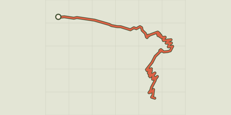
Gradient along the route: 0.9 km under 10%, 1.5 km at 10 to 20% and 3.6 km over 20%. Elevation from 1,296 m to 1,963 m over 5.9 km.
Description
Between mountain cliffs and grassy plateaux, the Valsenestre valley is a favourite spot for rock-climbers. This trail winds its way through a large valley, inhabited by large number of chamois in the Alpine zone and by Alpine ibex in the mountain cliffs. The valley ends with a pleasant sloping ledge featuring a recently restored and authentic shepherd’s cabin. Vincent Nobili; Valbonnais Park Keeper From the village of Valsenestre, after the stopover gîte, follow the path to the left. It heads due north through a few bends over fairly low-lying vegetation. From here, you can see the Béranger valley, before you arrive at a large plateau (Le Clos), where you cross the torrent over a small footbridge. From here on, in summer, you can see sheep grazing in the mountain pastures. Follow the valley along a winding path around a large rocky bar to arrive at the Valsenestre valley. Here there is a shepherd’s cabin where you can watch the chamois and Alpine ibex that are attracted by the salt lick put out for the sheep. Behind the cabin, you can see a waterfall that is the source for the stream. The peaks surrounding this valley reach the high point of 3126 m at the Pic du Clapier du Peyron. To its left are the Brèche de Valsenestre 2,598 m, the Brèche du Lauvitel 2,855 m and lastly the Pas de l'Aiguille 2,354 m. To its right, the Col and the Tête de Ramu (2,760 m). Take the same route on the way back.
Difficulty
Official rating: moderate, by Parc national des Écrins.
Before you go
- In winter, the access road to the car park is closed.
- When you arrive at the cabin, you will see the flocks guarded by Pyrenean Mountain dogs, whose role is to defend the sheep. Don’t go too near them - although the dogs seem friendly, they might see you as a threat and become aggressive.
Getting there
Start: Valsenestre, Valjouffrey (38).
Sources
- Track: Parc national des Écrins, Licence Ouverte 2.0, Licence Ouverte 2.0 (Etalab) (destination.ecrins-parcnational.fr/trek/938060-Le-vallon-de-Valsenestre). Time estimated by GPX Path with the Mac app rule, breaks not included.
- Official elevation gain: 760 m, Parc national des Écrins
Nearby tracks
 © OpenStreetMap, SRTM · OpenTopoMap (CC-BY-SA)
Col de Côte Belle from Valsenestre
Écrins, Valjouffrey (38) · Out and backOfficial rating by Parc national des Écrins © OpenStreetMap, SRTM · OpenTopoMap (CC-BY-SA)
Combe Oursière
Écrins, Valjouffrey (38) · Out and backOfficial rating by Parc national des Écrins © OpenStreetMap, SRTM · OpenTopoMap (CC-BY-SA)
La Muzelle pass
Écrins, Valjouffrey (38) · Out and backOfficial rating by Parc national des Écrins © OpenStreetMap, SRTM · OpenTopoMap (CC-BY-SA)
Labarre Lake
Écrins, Valjouffrey (38) · Out and backOfficial rating by Parc national des Écrins © OpenStreetMap, SRTM · OpenTopoMap (CC-BY-SA)
Tour of Pic de Valsenestre
Écrins, Valjouffrey (38) · Point to pointOfficial rating by Parc national des Écrins © OpenStreetMap, SRTM · OpenTopoMap (CC-BY-SA)
La Chalp valley
Écrins, Valjouffrey (38) · Out and backOfficial rating by Parc national des Écrins