
Tour of the Pays des Ecrins in 6 days
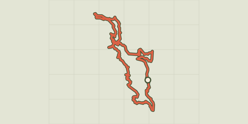
Key facts
- Distance
- 76.0 km
- Ascent
- +3,861 m
- Descent
- −3,565 m
- Estimated time
- 24 hr 30
- hiking
- Difficulty
- Moderate
- official rating
- Route
- Point to point
- ends elsewhere
Profile and gradient
- under 10%
- 10 to 20%
- over 20%
Gradient along the route: 44.5 km under 10%, 27.5 km at 10 to 20% and 4.0 km over 20%. Elevation from 957 m to 1,836 m over 76.0 km.
Description
From hamlets to villages, mountain passes to valleys, alpine pastures to mountain streams, this tour of the Pays des Écrins takes you not only to the iconic places and peaks of Les Écrins but also along more secret and less trodden pathways. To embark on the tour of the Pays des Écrins is to discover a land of water, water that shapes the landscape and sustains plant life, "white coal" as it is known, white gold! A land of history and mountain culture, a land offering refuge and a warm welcome! As they roam the many valleys amidst imposing and unspoilt nature, hikers absorb the epic tale of this territory. L'Argentière, the starting point of this tour, is a dynamic town which has successfully combined industrial development and the touristic promotion of its rich cultural and natural heritage. You can take advantage of its shops for your final preparations.The first stage leads to the alpine pasture hamlet of Bouchier. After following the Gyronde mountain stream and passing through the village of Les Vigneaux, the path climbs uphill offering superb views over the Queyras valley and the Briançon area. This slope faces south and it can be very hot here.The next day's stage leads to Vallouise, along the Montbrison massif. After Les Vigneaux, the view opens out over the glacial valleys of Ailefroide and the Glacier Blanc. Make the most of your stopover to visit the Park Centre ("Maison du Parc").On the route to Ailefroide from Vallouise, hikers will encounter an environment of rock and ice overlooked by legendary peaks, including the omnipresent Pelvoux.On the fourth day of your trip, you will discover hamlets which have developed tourist activity in keeping with their unique geographical situation, each in its own distinctive way.The following day, crossing over the Col de la Pousterle takes you back in a wild valley, the Fournel Valley. Then, crossing over the Col de la Lauze takes you to Freissinières with its characteristic and unspoilt landscapes.On the more technical stage 6, the path climbs up between the cliffs to the Crêtes de La Rortie and weaves between the needles of rock before starting the descent to L'Argentière.The variant will constitute a more cultural stage - its length making it challenging nevertheless - to discover the unique history of these villages perched dizzily over the Durance, and the abandoned village of Rame.
Difficulty
Official rating: moderate, by Parc national des Écrins.
Before you go
- Difficulty level: easy to medium, essentially due to the length of some stages. Difficult sections on stage 6. It is possible to avoid these. Enquire at the tourist offices about snow conditions on the Ailefroide stage and the mountain pass crossings before setting out. There are some ford crossings which could present problems in heavy rain storms.
Getting there
Start: L'Argentière-La Bessée, L'Argentière-la-Bessée (05).
Sources
- Track: Parc national des Écrins, Licence Ouverte 2.0, Licence Ouverte 2.0 (Etalab) (destination.ecrins-parcnational.fr/trek/975971-Tour-du-Pays-des-Ecrins-en-6-jours). Time estimated by GPX Path with the Mac app rule, breaks not included.
- Official elevation gain: 3,861 m, Parc national des Écrins
Nearby tracks

 © OpenStreetMap, SRTM · OpenTopoMap (CC-BY-SA)
The Sentier des Mineurs - The Miners' path
Écrins, L'Argentière-la-Bessée (05) · LoopOfficial rating by Parc national des Écrins © OpenStreetMap, SRTM · OpenTopoMap (CC-BY-SA)
Tour du Pays des Ecrins en 7 jours
Écrins, L'Argentière-la-Bessée (05) · Point to pointOfficial rating by Parc national des Écrins © OpenStreetMap, SRTM · OpenTopoMap (CC-BY-SA)
Du train au glacier Blanc en 3 jours (sans voiture)
Écrins, L'Argentière-la-Bessée (05) · Point to pointOfficial rating by Parc national des Écrins © OpenStreetMap, SRTM · OpenTopoMap (CC-BY-SA)
Tour of the Pays des Ecrins in 3 days
Écrins, L'Argentière-la-Bessée (05) · Point to pointOfficial rating by Parc national des Écrins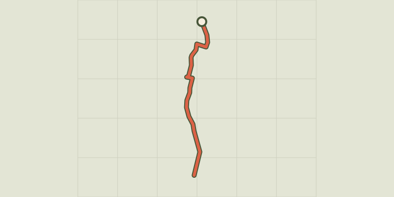 © OpenStreetMap, SRTM · OpenTopoMap (CC-BY-SA)
The L’Argentière-la-Bessée green route ("Voie Verte")
Écrins, L'Argentière-la-Bessée (05) · Out and backOfficial rating by Parc national des Écrins © OpenStreetMap, SRTM · OpenTopoMap (CC-BY-SA)
THEMED PATH: Industrial circuit walk
Écrins, L'Argentière-la-Bessée (05) · LoopOfficial rating by Parc national des Écrins