
Col des Aires
Key facts
- Distance
- 13.5 km
- Ascent
- +531 m
- Descent
- −418 m
- Estimated time
- 3 hr 55
- hiking
- Difficulty
- Difficult
- official rating
- Route
- Loop
- back to the start
Profile and gradient
- under 10%
- 10 to 20%
- over 20%
Gradient along the route: 11.5 km under 10% and 2.0 km at 10 to 20%. Elevation from 286 m to 609 m over 13.5 km.
Description
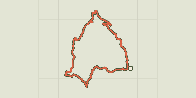
An athletic hike to explore the magnificent panoramas of the southern Cévennes, from ridges to valleys. Signposts will guide you all along this route. In the description below, the signposted place names and/or directions are given in bold italics between quotation marks : Starting from “SAINT BRESSON”, walk to “CAMPIS” via : - “Le Roc de Gourgue”, - “Le Bois”, - “Ancienne Ecole de Campis”. - From “CAMPIS”, continue to : - “Serre de campis”, - “Loves” , - “Serre de Loves” to : - “POMMIERS”. Continue to : - “Pierre Plantée”. From here, optional there-and-back of 400m to the menhir (standing stone). Return to “SAINT BRESSON” via : - “Roquevieille” and “Le Roc de Gourgue”. This walk is taken from the guidebook Les Vallées Cévenoles - En Pays Viganais, published by the Communauté de communes Pays Viganais-Cévennes as part of the collection Espaces Naturels Gardois and the label Gard Pleine Nature.
Difficulty
Official rating: difficult, by Parc national des Cévennes.
Before you go
- Make sure your equipment is appropriate for the day’s weather conditions. Take enough water, wear sturdy shoes and put on a hat. Please close any gates and barriers behind you.
Getting there
Start: Saint-Bresson, Saint-Bresson (30).
Sources
- Track: Parc national des Cévennes, Licence Ouverte 1.0, Licence Ouverte 1.0 (Etalab) (destination.cevennes-parcnational.fr/trek/96952-Col-des-Aires). Time estimated by GPX Path with the Mac app rule, breaks not included.
- Official elevation gain: 531 m, Parc national des Cévennes
Nearby tracks

 © OpenStreetMap, SRTM · OpenTopoMap (CC-BY-SA)
La Clastre chapel
Cévennes, Roquedur (30) · LoopOfficial rating by Parc national des Cévennes © OpenStreetMap, SRTM · OpenTopoMap (CC-BY-SA)
Pont de Mousse
Cévennes, Avèze (30) · LoopOfficial rating by Parc national des Cévennes © OpenStreetMap, SRTM · OpenTopoMap (CC-BY-SA)
Towards the Col des Mourèzes pass
Cévennes, Le Vigan (30) · LoopOfficial rating by Parc national des Cévennes © OpenStreetMap, SRTM · OpenTopoMap (CC-BY-SA)
By the River Arre
Cévennes, Le Vigan (30) · LoopOfficial rating by Parc national des Cévennes © OpenStreetMap, SRTM · OpenTopoMap (CC-BY-SA)
Sur les pas d'André Chamson - 2 jours
Cévennes, Le Vigan (30) · Point to pointOfficial rating by Parc national des Cévennes © OpenStreetMap, SRTM · OpenTopoMap (CC-BY-SA)
From Le Vigan to Mont Aigoual, 5 days
Cévennes, Le Vigan (30) · Point to pointOfficial rating by Parc national des Cévennes