
Alpilles Roquemartine: The Mouriès loop
Key facts
- Distance
- 31.7 km
- Ascent
- +406 m
- Descent
- −353 m
- Estimated time
- 1 hr 50
- road cycling
- Difficulty
- Moderate
- official rating
- Route
- Loop
- back to the start
Profile and gradient
- under 10%
- 10 to 20%
- over 20%
Gradient along the route: 31.7 km under 10%. Elevation from 12 m to 246 m over 31.7 km.
Description
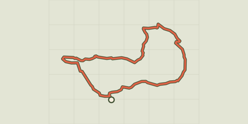
Between plains and mountainous areas, get away to the heart of the beautiful agricultural landscapes of the Alpilles! The beautiful and varied setting of this loop will allow you to roam quiet roads along many vineyards and olive groves. Before strolling through the Alpilles Massif with its impressive rock walls, you will pass through the small town of Aureille, where the tranquility and authenticity are matched only by the beauty of its church. From the Tourist Office, take the D24 "Avenue Paul Revoil" towards Eygalières until the roundabout. 1 - Cross the roundabout and continue on the D24 until the intersection with the D24a, heading towards Aureille. 2 - Take a right. Continue on the D24a which goes through olive groves over 5km until Aureille and its junction with the D25a. 3 - Take a left towards Eygalières. Go through the village of Aureille and cross the mountain pass named "Pas de la Figuière" to reach the intersection with the D25. 4 - Switch to the left towards Eygalières. Continue to the vineyards of "Vallongue" and the junction with the D24. 5 - Take a left towards Mouriès. After 8km you will reach the place called the "Destet" and the intersection with the D78. 6 - Take a right. Take the D78 until the junction with the D5, before arriving in Maussane-les-Alpilles. 7 - Turn left towards Mouriès. Continue on the D5 until the intersection with the D17. 8 - Do not take the D17. Just before, turn left on the "Chemin d'Alphonse Daudet" and reach the roundabout from the start.
Difficulty
Official rating: moderate, by Parcs naturels régionaux de Provence-Alpes-Côte d'Azur.
Before you go
- For your safety and for the preservation of forests, access to natural areas is regulated from June to September. For more information during the summer, call 08 11 20 13 13 (cost of a local call) or go to www.bouches-du-rhone.pref.gouv.fr or download the free application MYPROVENCE ENVIE DE BALADE (available on Appstore and Android Market)
Getting there
Start: Bureau d'Information Touristique, Mouriès, Mouriès (13).
Sources
- Track: Parcs naturels régionaux de Provence-Alpes-Côte d'Azur (Chemins des Parcs), Licence Ouverte 2.0, Licence Ouverte 2.0 (Etalab) (www.cheminsdesparcs.fr/trek/57118-MOURIES---Alpilles-Roquemartine-a-velo-%3A-la-variante-de-Mouries). Time estimated by GPX Path with the Mac app rule, breaks not included.
- Official elevation gain: 406 m, Parcs naturels régionaux de Provence-Alpes-Côte d'Azur
Nearby tracks

 © OpenStreetMap, SRTM · OpenTopoMap (CC-BY-SA)
The Alpilles Roquemartine by Bike: The Integral
Provence-Alpes-Côte d'Azur, Mouriès (13) · LoopOfficial rating by Parcs naturels régionaux de Provence-Alpes-Côte d'Azur © OpenStreetMap, SRTM · OpenTopoMap (CC-BY-SA)
Maussane-les-Alpilles - Tour des Baux-de-Provence à vélo
Provence-Alpes-Côte d'Azur, Maussane-les-Alpilles (13) · LoopOfficial rating by Parcs naturels régionaux de Provence-Alpes-Côte d'Azur © OpenStreetMap, SRTM · OpenTopoMap (CC-BY-SA)
Le Paradou - Le tour du Marais des Baux à vélo
Provence-Alpes-Côte d'Azur, Paradou (13) · LoopOfficial rating by Parcs naturels régionaux de Provence-Alpes-Côte d'Azur © OpenStreetMap, SRTM · OpenTopoMap (CC-BY-SA)
Saint Remy de Provence - Cycling from the Alpilles to Val d'Enfer
Provence-Alpes-Côte d'Azur, Saint-Rémy-de-Provence (13) · LoopOfficial rating by Parcs naturels régionaux de Provence-Alpes-Côte d'Azur © OpenStreetMap, SRTM · OpenTopoMap (CC-BY-SA)
Saint-Rémy-de-Provence - Les jardins de Mistral à vélo
Provence-Alpes-Côte d'Azur, Saint-Rémy-de-Provence (13) · LoopOfficial rating by Parcs naturels régionaux de Provence-Alpes-Côte d'Azur © OpenStreetMap, SRTM · OpenTopoMap (CC-BY-SA)
Fontvielle - Des Alpilles à la Camargue à vélo
Provence-Alpes-Côte d'Azur, Fontvieille (13) · LoopOfficial rating by Parcs naturels régionaux de Provence-Alpes-Côte d'Azur