
St. Michel Rock

Key facts
- Distance
- 8.9 km
- Ascent
- +550 m
- Descent
- −532 m
- Estimated time
- 3 hr 15
- hiking
- Difficulty
- Moderate
- official rating
- Route
- Loop
- back to the start
Profile and gradient
- under 10%
- 10 to 20%
- over 20%
Gradient along the route: 4.2 km under 10%, 3.3 km at 10 to 20% and 1.3 km over 20%. Elevation from 681 m to 1,187 m over 8.9 km.
Description
Between rocky trail balconies, undergrowth passages and panoramic views from peaks, a comprehensive approach to the Cean Valley. With a quiet start on a track with a beautiful view of the village and its cliffs, this hike becomes more immersive when crossing the trail overlooking the Bagnols' ravine. Rising up the forest to the Saint-Michel Rock is rewarded with a panoramic view of the valleys of Cean and Buëch. The descent rather physical, takes place exclusively on small paths between peak and undergrowth in a wild atmosphere. From the fountain in the village square, take the D30 towards Laragne then the small road on the right leading to the Princes d'Orange campsite, and after the bridge, go up the main road that passes the campsite. Continue on the track until you reach a fork. 1 - Go right along the trail, overlooking the opposite winding path. At the Paturle (former farm), turn left, avoid a first trail to continue uphill for a few moments until reaching a second fork. 2 - After the old wooden signpost, continue along the trail to the right which goes up in the underbrush, past the ruins of Paturle and, after a long crossing on the trail overhanging the gorges of Bagnols, you will arrive at an intersection. 3 - Go left, climb the two bends of the trail and join a path. Follow it to the left up to the neck of the Bouzon. Cross the ONF barrier and continue towards the Saint Michel summit. Possibility to reach the summit by a steep (1216m; panorama and orientation table) and then back to the intersection. 4 - At the signpost, go down the path following the ridge (a few steep passages on rocks and undergrowth) to a junction. Turn right to a new junction with a signpost. 5 - Go down to the right and then turn left and find the trail; descend for a few moments to arrive at the starting junction. Using the climbing route, return to the village.
Difficulty
Official rating: moderate, by Parcs naturels régionaux de Provence-Alpes-Côte d'Azur.
Getting there
Start: Place du village, Orpierre, Orpierre (05).
Sources
- Track: Parcs naturels régionaux de Provence-Alpes-Côte d'Azur (Chemins des Parcs), Licence Ouverte 2.0, Licence Ouverte 2.0 (Etalab) (www.cheminsdesparcs.fr/trek/56083-ORPIERRE---Le-Rocher-Saint-Michel). Time estimated by GPX Path with the Mac app rule, breaks not included.
- Official elevation gain: 550 m, Parcs naturels régionaux de Provence-Alpes-Côte d'Azur
Nearby tracks

 © OpenStreetMap, SRTM · OpenTopoMap (CC-BY-SA)
Orpierre - Balcons du protestantisme en 2 jours
Provence-Alpes-Côte d'Azur, Orpierre (05) · Point to pointOfficial rating by Parcs naturels régionaux de Provence-Alpes-Côte d'Azur © OpenStreetMap, SRTM · OpenTopoMap (CC-BY-SA)
Saint-Cyrice - L'ancienne Saint-Cyrice
Provence-Alpes-Côte d'Azur, Étoile-Saint-Cyrice (05) · LoopOfficial rating by Parcs naturels régionaux de Provence-Alpes-Côte d'Azur © OpenStreetMap, SRTM · OpenTopoMap (CC-BY-SA)
Barret-sur-Méouge - Crête de Chabre depuis le col de la Crousette
Provence-Alpes-Côte d'Azur, Barret-sur-Méouge (05) · LoopOfficial rating by Parcs naturels régionaux de Provence-Alpes-Côte d'Azur © OpenStreetMap, SRTM · OpenTopoMap (CC-BY-SA)
Valbuëch-Méouge - Banc du Bouc
Provence-Alpes-Côte d'Azur, Val Buëch-Méouge (05) · LoopOfficial rating by Parcs naturels régionaux de Provence-Alpes-Côte d'Azur © OpenStreetMap, SRTM · OpenTopoMap (CC-BY-SA)
Garde-Colombe - Riou et Revuaire
Provence-Alpes-Côte d'Azur, Garde-Colombe (05) · LoopOfficial rating by Parcs naturels régionaux de Provence-Alpes-Côte d'Azur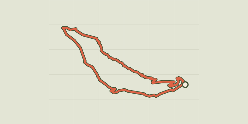 © OpenStreetMap, SRTM · OpenTopoMap (CC-BY-SA)
Monks' Trail
Provence-Alpes-Côte d'Azur, Serres (05) · LoopOfficial rating by Parcs naturels régionaux de Provence-Alpes-Côte d'Azur