
The Serre de l'Aigle

Key facts
- Distance
- 6.9 km
- Ascent
- +372 m
- Descent
- −347 m
- Estimated time
- 2 hr 15
- hiking
- Difficulty
- Easy
- official rating
- Route
- Loop
- back to the start
Profile and gradient
- under 10%
- 10 to 20%
- over 20%
Gradient along the route: 4.5 km under 10%, 1.9 km at 10 to 20% and 0.5 km over 20%. Elevation from 689 m to 1,008 m over 6.9 km.
Description
A varied hike in state forest and then crest. Very beautiful view on the valley of Rosans and the characteristic summit of Risou. This hike on the outskirts of the medieval village of Rosans is a good way to discover how landscapes and place names have evolved over time. The height gained in the first part of the route makes it possible to better appreciate the position and the history of the village in this open valley. From the village square, climb the small road on the right of the church towards the Lastic. At the hangars of the hamlet, leave the road and climb to the left the drivable trail. Continue this trail for 2km up to Estang. 1- Leave the trail that leads to the place and continue climbing. Enter a pine plantation 500m further. Shortly after the beginning of the wood, do not miss an old path that goes right. 2- Turn right and go down the path, on the side of the valley of Estang. Cross the creek (flooded area!) and go up to a trail. Take the ascending false-flat, on the right. After the ridge, locate in the next pin the path that goes to the right. 3- Turn right onto the ridge trail of the Serre de l'Aigle. Further down, cross the straddle and continue down the east side of the hillock. Follow the fence on the right to reach the other side of the hillock where you must cross. Arrive at a thematic terminal "Toponymy trail of Rosanais". Turn right and follow a fence for 700m. Descend the trail and cross a rocky slab (be careful not to slip!). 4- Find a trail and take a right. At the trail crossroad, turn right, pass 2 curves and join the road (D25). Continue straight ahead past the playground and reach the center of Rosans.
Difficulty
Official rating: easy, by Parcs naturels régionaux de Provence-Alpes-Côte d'Azur.
Before you go
- After point 2: a ford.
- Under point 3: respect the fences erected along the trail and pay attention to the slab.
- Upstream of point 4: caution on the slab especially in wet weather or after a storm.
Getting there
Start: Place du village, Rosans, Rosans (05).
Sources
- Track: Parcs naturels régionaux de Provence-Alpes-Côte d'Azur (Chemins des Parcs), Licence Ouverte 2.0, Licence Ouverte 2.0 (Etalab) (www.cheminsdesparcs.fr/trek/55703-ROSANS---Le-Serre-de-l-Aigle). Time estimated by GPX Path with the Mac app rule, breaks not included.
- Official elevation gain: 372 m, Parcs naturels régionaux de Provence-Alpes-Côte d'Azur
Nearby tracks

 © OpenStreetMap, SRTM · OpenTopoMap (CC-BY-SA)
Rosans - De Rosans à la vallée de l'Oule, entre artisanat et paysages (4 jours)
Provence-Alpes-Côte d'Azur, Rosans (05) · Point to pointOfficial rating by Parcs naturels régionaux de Provence-Alpes-Côte d'Azur © OpenStreetMap, SRTM · OpenTopoMap (CC-BY-SA)
Rosans - Le plateau de Pié-Léger
Provence-Alpes-Côte d'Azur, Rosans (05) · LoopOfficial rating by Parcs naturels régionaux de Provence-Alpes-Côte d'Azur © OpenStreetMap, SRTM · OpenTopoMap (CC-BY-SA)
Pommerol - Les crêtes de Raton
Provence-Alpes-Côte d'Azur, Rosans (05) · LoopOfficial rating by Parcs naturels régionaux de Provence-Alpes-Côte d'Azur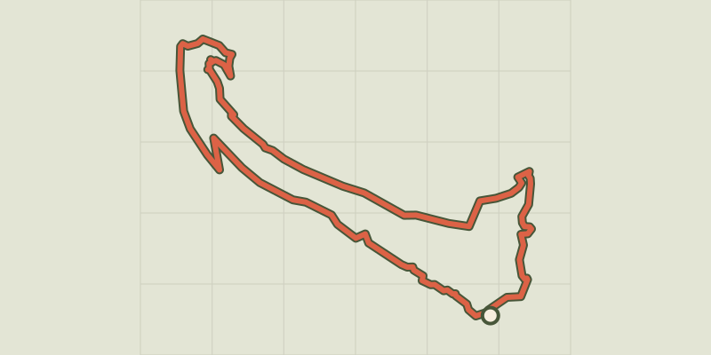 © OpenStreetMap, SRTM · OpenTopoMap (CC-BY-SA)
L'Epine - Le Duffre
Provence-Alpes-Côte d'Azur, L'Épine (05) · LoopOfficial rating by Parcs naturels régionaux de Provence-Alpes-Côte d'Azur © OpenStreetMap, SRTM · OpenTopoMap (CC-BY-SA)
Saint-Cyrice - L'ancienne Saint-Cyrice
Provence-Alpes-Côte d'Azur, Étoile-Saint-Cyrice (05) · LoopOfficial rating by Parcs naturels régionaux de Provence-Alpes-Côte d'Azur © OpenStreetMap, SRTM · OpenTopoMap (CC-BY-SA)
Orpierre - Balcons du protestantisme en 2 jours
Provence-Alpes-Côte d'Azur, Orpierre (05) · Point to pointOfficial rating by Parcs naturels régionaux de Provence-Alpes-Côte d'Azur