
Col Girardin

Key facts
- Distance
- 9.5 km
- Ascent
- +743 m
- Descent
- −726 m
- Estimated time
- 4 hr 10
- hiking
- Difficulty
- Moderate
- official rating
- Route
- Loop
- back to the start
Profile and gradient
- under 10%
- 10 to 20%
- over 20%
Gradient along the route: 2.9 km under 10%, 3.3 km at 10 to 20% and 3.3 km over 20%. Elevation from 1,967 m to 2,685 m over 9.5 km.
Description
A pilgrimage site, the path of Lake Sainte Anne has many alternative routes to the Ubaye or the Lac Miroir. Guarded by the peak of Mount Fonte Sancte, the highest point of Queyras, Lake Sainte Anne, very accessible, offers a high mountain atmosphere. Steep walls and rock glaciers adorn this remarkable atmosphere. From the car park, go down and turn left, cross a bridge and turn left again. Get on the wide path on the left bank of the stream of the Col du Tronchet. As the trail refines, cross the stream by a bridge and take on a rise in curves. 1 - At point Costes du Col Tronchet (2 164m), turn right on a path that remains levelled, cross the stream again by a wooden bridge and follow the descending false flat. Go around a large mound, and continue to the left. 2 - Exit the forest on a plateau, go around it by the left and follow the last climb to the lake Sainte Anne. 3 - Reach to the lake and turn left on the GR. Take a short climb and continue on the ascending false flat. At the foot of the last climb, go up to the right in the shale until Col Girardin. The same route is used for the return.
Difficulty
Official rating: moderate, by Parcs naturels régionaux de Provence-Alpes-Côte d'Azur.
Getting there
Start: Fond de Chaurionde, Ceillac, Ceillac (05).
Sources
- Track: Parcs naturels régionaux de Provence-Alpes-Côte d'Azur (Chemins des Parcs), Licence Ouverte 2.0, Licence Ouverte 2.0 (Etalab) (www.cheminsdesparcs.fr/trek/27774-CEILLAC---Lac-Sainte-Anne-et-Col-Girardin). Time estimated by GPX Path with the Mac app rule, breaks not included.
- Official elevation gain: 743 m, Parcs naturels régionaux de Provence-Alpes-Côte d'Azur
Nearby tracks
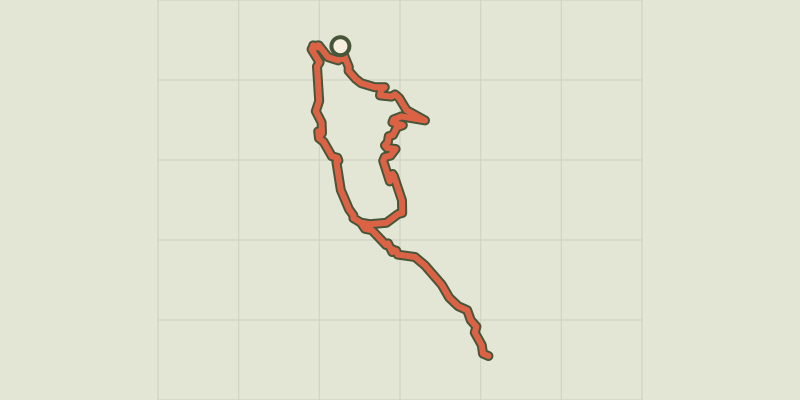
 © OpenStreetMap, SRTM · OpenTopoMap (CC-BY-SA)
Ceillac - Les lacs Miroir et Saint-Anne
Queyras, Ceillac (05) · LoopOfficial rating by Parcs naturels régionaux de Provence-Alpes-Côte d'Azur © OpenStreetMap, SRTM · OpenTopoMap (CC-BY-SA)
Val d'Escreins - Col de la Coulette
Queyras, Vars (05) · LoopOfficial rating by Parcs naturels régionaux de Provence-Alpes-Côte d'Azur © OpenStreetMap, SRTM · OpenTopoMap (CC-BY-SA)
Source de la Font-Sancte - Vars
Queyras, Vars (05) · Out and backOfficial rating by Parcs naturels régionaux de Provence-Alpes-Côte d'Azur © OpenStreetMap, SRTM · OpenTopoMap (CC-BY-SA)
Cugulet depuis le Val d'Escreins - Vars
Queyras, Vars (05) · LoopOfficial rating by Parcs naturels régionaux de Provence-Alpes-Côte d'Azur © OpenStreetMap, SRTM · OpenTopoMap (CC-BY-SA)
Pic d'Escreins - Vars
Queyras, Vars (05) · Out and backOfficial rating by Parcs naturels régionaux de Provence-Alpes-Côte d'Azur © OpenStreetMap, SRTM · OpenTopoMap (CC-BY-SA)
Crête de Curlet
Queyras, Saint-Véran (05) · LoopOfficial rating by Parcs naturels régionaux de Provence-Alpes-Côte d'Azur