
A round-trip to Peyroules

Key facts
- Distance
- 4.8 km
- Ascent
- +216 m
- Descent
- −213 m
- Estimated time
- 1 hr 30
- hiking
- Difficulty
- Moderate
- official rating
- Route
- Loop
- back to the start
Profile and gradient
- under 10%
- 10 to 20%
- over 20%
Gradient along the route: 2.8 km under 10% and 2.0 km at 10 to 20%. Elevation from 1,032 m to 1,245 m over 4.8 km.
Description
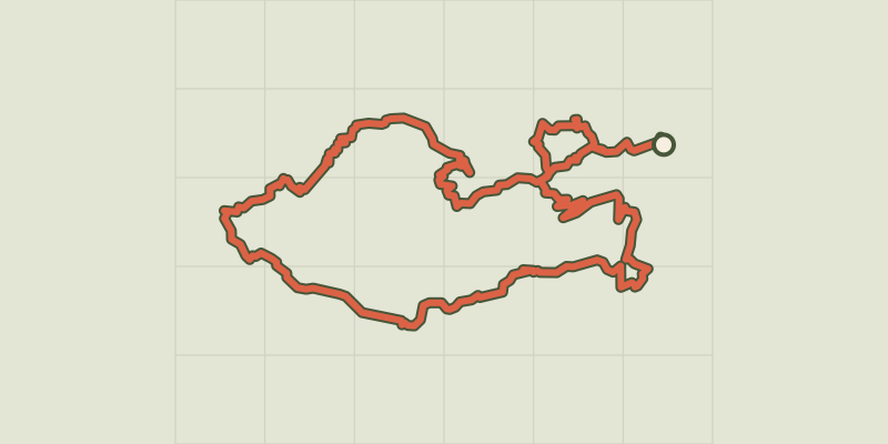
Walk to the abandoned hamlet of Ville overlooking the Jabron valley and the village of Peyroules Great walk in the footsteps of the past, in the middle of old cultivated areas. The abandoned hamlet of Ville overlooks the Jabron valley and the village of Peyroules Nice to do in the spring! From the car park, follow the D452 towards la Foux on 300m. 1- At the village's exit (junction with D452 road of Mousteiret), go up the paved road to the left (rue du Collet). Pass a shed and take the path going left. Bypassing the valley, go up the hill passing through the pines and oaks. Further down, cross the small stream of Ste-Anne, and reach a wider path 100m further. Take this path for 500m and reach the junction with the itinerary of the Col des Portes. 2- Follow to the left the path to the Peyroules round-trip until the farmof the Pré Neuf. Follow the trail that bypasses the home. Quickly reach old cultivated areas. Follow the main road and go down towards the imposing Romanesque chapel and the abandoned hamlet of Ville. 3- After the chapel, at 200m, it's possible to follow the trail to the hilltop hamlet of Ville and to see the panorama of the valley. Otherwise, go down the path towards the southeast. Pass a small mountain pass. Go along the trail along the valley, cross the ravine of Ville and go down the hillside to the reach the road. Return to the starting point by the B-road; for about 800 m.
Difficulty
Official rating: moderate, by Parcs naturels régionaux de Provence-Alpes-Côte d'Azur.
Before you go
- Avoid high summer temperatures, leave early. We recommend: 2L of water per person, a hat and proper hiking shoes. Preferred seasons: spring
Getting there
Start: Parking de la mairie, Peyroules, Peyroules (04).
Sources
- Track: Parcs naturels régionaux de Provence-Alpes-Côte d'Azur (Chemins des Parcs), Licence Ouverte 2.0, Licence Ouverte 2.0 (Etalab) (www.cheminsdesparcs.fr/trek/54049-PEYROULES---La-Circulaire). Time estimated by GPX Path with the Mac app rule, breaks not included.
- Official elevation gain: 216 m, Parcs naturels régionaux de Provence-Alpes-Côte d'Azur
Nearby tracks
 © OpenStreetMap, SRTM · OpenTopoMap (CC-BY-SA)
Tour de l'Artuby - 5 par Le Logis du Pin
Verdon, La Martre (83) · Point to pointOfficial rating by Parcs naturels régionaux de Provence-Alpes-Côte d'Azur © OpenStreetMap, SRTM · OpenTopoMap (CC-BY-SA)
Le chemin de Napoléon
Verdon, La Martre (83) · Out and backOfficial rating by Parcs naturels régionaux de Provence-Alpes-Côte d'Azur © OpenStreetMap, SRTM · OpenTopoMap (CC-BY-SA)
The Tour of Défens des Colettes
Verdon, Soleilhas (04) · LoopOfficial rating by Parcs naturels régionaux de Provence-Alpes-Côte d'Azur © OpenStreetMap, SRTM · OpenTopoMap (CC-BY-SA)
La Martre - L'Avelanier
Verdon, La Martre (83) · LoopOfficial rating by Parcs naturels régionaux de Provence-Alpes-Côte d'Azur © OpenStreetMap, SRTM · OpenTopoMap (CC-BY-SA)
Chateauvieux - La boucle Chateauvieux - La Martre
Verdon, Châteauvieux (83) · LoopOfficial rating by Parcs naturels régionaux de Provence-Alpes-Côte d'Azur © OpenStreetMap, SRTM · OpenTopoMap (CC-BY-SA)
The summit of Teillon
Verdon, La Garde (04) · Out and backOfficial rating by Parcs naturels régionaux de Provence-Alpes-Côte d'Azur