
Buffe Arnaud Walk

Key facts
- Distance
- 11.6 km
- Ascent
- +426 m
- Descent
- −403 m
- Estimated time
- 3 hr 25
- hiking
- Difficulty
- Moderate
- official rating
- Route
- Loop
- back to the start
Profile and gradient
- under 10%
- 10 to 20%
- over 20%
Gradient along the route: 9.0 km under 10% and 2.6 km at 10 to 20%. Elevation from 304 m to 514 m over 11.6 km.
Description
After strolling through the narrow streets of this typical village of Haute Provence, discover the landscapes and views of the dam and the Verdon valley. From the hills with many views you can admire the Verdon, the dam of Greoux with the lake of Esparron-de-Verdon, the Colostre. From the village square follow the GR®4 (red and white markings) up the alleys to the clock tower. Exit the village to the west and pass a small bridge. 1- Leave the road in a left turn to continue straight ahead past the campsite and follow the stone road which climbs quickly in the pines towards the plateau. 2- Leave the road on the left and continue straight on the GR®4 and follow the direction Gréoux-les-Bains. 3- Turn left the GR® and cross old fields of lavender then continue in the forest. At the first crossroad, turn left. At the second, with a very large pine tree, turn right. Finally on the third, go left (south-west) towards Gréoux-les-Bains and the Verdon. 4- At the edge of the road, turn left, due south and left again until the D952. Cross it and go down to Verdon. 5- Follow the Verdon on the left for 650m, then at the post arrow follow the path on the left until the D952. Cross it then turn right and continue for 350m until the next post pole. 6- Get to the left and climb towards Buffe Arnaud. 7- At the post pole "Buffe Arnaud", continue straight on towards St-Martin-de-Brômes and follow the ridge to point 2. Then take a right and return by the same way to the starting point.
Difficulty
Official rating: moderate, by Parcs naturels régionaux de Provence-Alpes-Côte d'Azur.
Before you go
- We would advise 2 L of water per person, a hat and proper walking shoes.
Getting there
Start: Place du Village, Saint-Martin-de-Brômes, Saint-Martin-de-Brômes (04).
Sources
- Track: Parcs naturels régionaux de Provence-Alpes-Côte d'Azur (Chemins des Parcs), Licence Ouverte 2.0, Licence Ouverte 2.0 (Etalab) (www.cheminsdesparcs.fr/trek/56277-SAINT-MARTIN-DE-BROMES---La-promenade-de-Buffe-Arnaud). Time estimated by GPX Path with the Mac app rule, breaks not included.
- Official elevation gain: 426 m, Parcs naturels régionaux de Provence-Alpes-Côte d'Azur
Nearby tracks

 © OpenStreetMap, SRTM · OpenTopoMap (CC-BY-SA)
From Séouve to Sainte-Magdeleine
Verdon, Esparron-de-Verdon (04) · LoopOfficial rating by Parcs naturels régionaux de Provence-Alpes-Côte d'Azur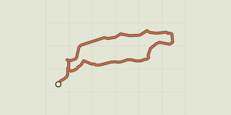 © OpenStreetMap, SRTM · OpenTopoMap (CC-BY-SA)
Esparron-de-Verdon - Autour de la Colle
Verdon, Esparron-de-Verdon (04) · LoopOfficial rating by Parcs naturels régionaux de Provence-Alpes-Côte d'Azur © OpenStreetMap, SRTM · OpenTopoMap (CC-BY-SA)
The Botanical Trail
Verdon, Esparron-de-Verdon (04) · LoopOfficial rating by Parcs naturels régionaux de Provence-Alpes-Côte d'Azur © OpenStreetMap, SRTM · OpenTopoMap (CC-BY-SA)
La balade du Quartier
Verdon, Saint-Julien (83) · Out and backOfficial rating by Parcs naturels régionaux de Provence-Alpes-Côte d'Azur © OpenStreetMap, SRTM · OpenTopoMap (CC-BY-SA)
The tour of the Esparron lake
Verdon, Gréoux-les-Bains (04) · Point to pointOfficial rating by Parcs naturels régionaux de Provence-Alpes-Côte d'Azur © OpenStreetMap, SRTM · OpenTopoMap (CC-BY-SA)
Gréoux-les-Bains - Le Tour des balcons du Verdon et plateau de Valensole
Verdon, Gréoux-les-Bains (04) · Point to pointOfficial rating by Parcs naturels régionaux de Provence-Alpes-Côte d'Azur