
Mountain Biking Plateau Cabins
Key facts
- Distance
- 13.9 km
- Ascent
- +304 m
- Descent
- −267 m
- Estimated time
- 1 hr 30
- mtb
- Difficulty
- Easy
- official rating
- Route
- Loop
- back to the start
Profile and gradient
- under 10%
- 10 to 20%
- over 20%
Gradient along the route: 13.2 km under 10% and 0.7 km at 10 to 20%. Elevation from 580 m to 684 m over 13.9 km.
Description
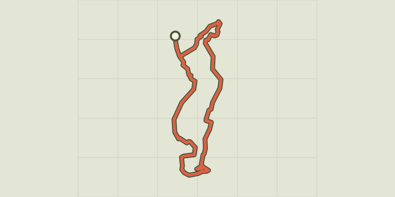
On this walk you will the discover cabins in the middle, fields of lavender, wheat, canola, and sunflower. With a harmonious succession of stony roads, rolling trails, and quiet roads, discover the rich heritage of the Plateau de Valensole. Nestled amidst fields of wheat and lavender, cabins, and pigeon lofts dotting your way and offering you some shaded breaks. Sheltered from the traffic, decorated with superb panoramas, these routes invite you to talk calm walks, nose in the air and a bounce in your step. The beginning of the path is the same as for loop 1, only the way back differs. From the junction, take direction Puimoisson indicated by a hiking sign. Circulating on a rolling trail allowing you to admire a clear landscape, in front of the crest of Montdenier. When you reach a fork, turn left to find the Notre-Dame chapel, in the heart of an oak forest. Go down again to the foot of Puimoisson using a cobble path (be careful!), Where a last effort is necessary to reach the village. Upstream of the fork which leads to the Chapel, a variant is possible (right) to reach the road.
Difficulty
Official rating: easy, by Parcs naturels régionaux de Provence-Alpes-Côte d'Azur.
Before you go
- On the roads, follow the rules and be careful at intersections. - Do not attempt to enter the huts, they are private property! Be careful as you approach, some cabins can be dangerous (falling stones, snakes, & hellip; ) - Be careful in the hot summer temperatures: take water in quantity and follow picnic tips: use of an ATV is recommended. Make sure you have all the necessary accessories/equipment for a good hike: helmets, repair tools, air pump, anti-theft, maps, sunscreen.
Getting there
Start: Puimoisson, Puimoisson (04).
Sources
- Track: Parcs naturels régionaux de Provence-Alpes-Côte d'Azur (Chemins des Parcs), Licence Ouverte 2.0, Licence Ouverte 2.0 (Etalab) (www.cheminsdesparcs.fr/trek/20167-PUIMOISSON---Les-Cabanons-du-plateau-a-VTT). Time estimated by GPX Path with the Mac app rule, breaks not included.
- Official elevation gain: 304 m, Parcs naturels régionaux de Provence-Alpes-Côte d'Azur
Nearby tracks

 © OpenStreetMap, SRTM · OpenTopoMap (CC-BY-SA)
Pigeon huts and ATV cabins
Verdon, Riez (04) · LoopOfficial rating by Parcs naturels régionaux de Provence-Alpes-Côte d'Azur © OpenStreetMap, SRTM · OpenTopoMap (CC-BY-SA)
Moustiers-Sainte-Marie - Jusqu’aux plages du lac de Sainte-Croix à VTT
Verdon, Moustiers-Sainte-Marie (04) · Out and backOfficial rating by Parcs naturels régionaux de Provence-Alpes-Côte d'Azur © OpenStreetMap, SRTM · OpenTopoMap (CC-BY-SA)
Saint-André-les-Alpes - Le Chalvet à VTT
Verdon, Saint-André-les-Alpes (04) · LoopOfficial rating by Parcs naturels régionaux de Provence-Alpes-Côte d'Azur
 © OpenStreetMap, SRTM · OpenTopoMap (CC-BY-SA)
Puimoisson - La chapelle Notre-Dame de Bellevue
Verdon, Puimoisson (04) · LoopOfficial rating by Parcs naturels régionaux de Provence-Alpes-Côte d'Azur © OpenStreetMap, SRTM · OpenTopoMap (CC-BY-SA)
The Millarettes plateau
Verdon, Riez (04) · LoopOfficial rating by Parcs naturels régionaux de Provence-Alpes-Côte d'Azur © OpenStreetMap, SRTM · OpenTopoMap (CC-BY-SA)
La Chapelle Saint-Maxime
Verdon, Riez (04) · LoopOfficial rating by Parcs naturels régionaux de Provence-Alpes-Côte d'Azur