
The Coteau Chiron (Chiron hill)

Key facts
- Distance
- 7.2 km
- Ascent
- +150 m
- Descent
- −124 m
- Estimated time
- 1 hr 50
- hiking
- Difficulty
- Very easy
- official rating
- Route
- Loop
- back to the start
Profile and gradient
- under 10%
- 10 to 20%
- over 20%
Gradient along the route: 6.8 km under 10% and 0.4 km at 10 to 20%. Elevation from 402 m to 475 m over 7.2 km.
Description
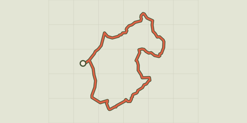
Exploring the Coteau Chiron along the Saint Laurent lake and a part of the lower gorges. By going around the hill of Coteau Chiron, you will reach to the Saint-Laurent lake, an idyllic spot, which calls for resting and strolling. Then along the lower gorge, you can admire the lengthy task of the Verdon which has dug into the limestone rock for millennia and at a winding path, you will discover lake Montpezat and its hilltop village. From the car park, exit the village through the road Montagnac-Montpezat on the right. When you reach the oratory of Saint-Laurent, at a crossroads between the Riez road and the Montpezatof road, continue straight on the small road C1 of Montpezat. 400m further, just before the bridge, leave the road and follow the path on the right. Go downwards at the edge of the field until the ruins of Angles. 1 - Take the trail on the right and 200m further, go down the road on the left. Coming out a passageway through the woods, reach to a vast mountain pass at the edge of the field (420m). Turn left. Go down the path along the meadows until lake Saint-Laurent. 2 - Upstream the lake, take the left path. Further down, go into the woods. Continue on the main route. The trail rises quickly on the left, upstream the gorges of Verdon, on the hillside of Coteau Chiron (look out for the marking!). When the view opens onto lake Montpezat, follow the trail that descends to the Verdon. Reach to the fencing of the camp (intersection of routes between Saint-Laurent and Montpezat). 3 - Follow the road on the left towards Saint-Laurent. Reach the edges of the forest, and after a short ascent, go to the ruins of Angles. 1 - Turn right and return to the village following the route taken to go.
Difficulty
Official rating: very easy, by Parcs naturels régionaux de Provence-Alpes-Côte d'Azur.
Before you go
- Avoid high summer temperatures, leave early. We recommend: 2 L of water per person, a hat and proper walking shoes.
Getting there
Start: Parking des Aires, Saint-Laurent du Verdon, Saint-Laurent-du-Verdon (04).
Sources
- Track: Parcs naturels régionaux de Provence-Alpes-Côte d'Azur (Chemins des Parcs), Licence Ouverte 2.0, Licence Ouverte 2.0 (Etalab) (www.cheminsdesparcs.fr/trek/3548-SAINT-LAURENT-DU-VERDON---Le-Coteau-Chiron). Time estimated by GPX Path with the Mac app rule, breaks not included.
- Official elevation gain: 150 m, Parcs naturels régionaux de Provence-Alpes-Côte d'Azur
Nearby tracks
 © OpenStreetMap, SRTM · OpenTopoMap (CC-BY-SA)
Saint-Laurent-du-Verdon - Le Lac d'Artignosc
Verdon, Saint-Laurent-du-Verdon (04) · LoopOfficial rating by Parcs naturels régionaux de Provence-Alpes-Côte d'Azur © OpenStreetMap, SRTM · OpenTopoMap (CC-BY-SA)
Saint-Laurent-du-Verdon - Notre-Dame du Verdon
Verdon, Saint-Laurent-du-Verdon (04) · LoopOfficial rating by Parcs naturels régionaux de Provence-Alpes-Côte d'Azur © OpenStreetMap, SRTM · OpenTopoMap (CC-BY-SA)
La baume bonne
Verdon, Quinson (04) · Out and backOfficial rating by Parcs naturels régionaux de Provence-Alpes-Côte d'Azur © OpenStreetMap, SRTM · OpenTopoMap (CC-BY-SA)
The old Quinson
Verdon, Quinson (04) · LoopOfficial rating by Parcs naturels régionaux de Provence-Alpes-Côte d'Azur © OpenStreetMap, SRTM · OpenTopoMap (CC-BY-SA)
The Poiraque source
Verdon, Quinson (04) · Out and backOfficial rating by Parcs naturels régionaux de Provence-Alpes-Côte d'Azur © OpenStreetMap, SRTM · OpenTopoMap (CC-BY-SA)
The prehistoric village
Verdon, Quinson (04) · LoopOfficial rating by Parcs naturels régionaux de Provence-Alpes-Côte d'Azur