
The old Quinson
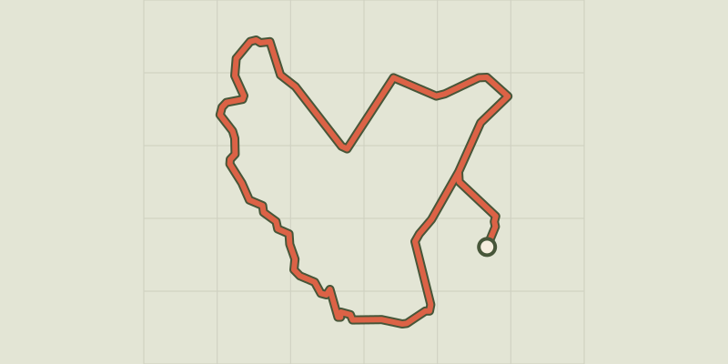
Key facts
- Distance
- 3.4 km
- Ascent
- +169 m
- Descent
- −161 m
- Estimated time
- 1 hr 05
- hiking
- Difficulty
- Easy
- official rating
- Route
- Loop
- back to the start
Profile and gradient
- under 10%
- 10 to 20%
- over 20%
Gradient along the route: 2.4 km under 10%, 0.4 km at 10 to 20% and 0.6 km over 20%. Elevation from 363 m to 529 m over 3.4 km.
Description
Climb on this barred spur overlooking the Verdon and the lowland where the local populations of the second iron age had settled. The walk of old Quinson takes place, after a small steep, on the heights, around the hill of Saint Michel, on which are the vestiges of the old village. If vegetation has now regained its rights, it is through the development of dry stone walls that we find traces of this occupation. A walk where you have to open your eyes . From the car park take the direction of the museum and go up the path to it. 1- Go then on the left, pass in front of the hotel Notre-Dame and take just after the Notre Dame road on the right. After 50 m turn left to arrive at the chapel. 2- Leave the main track and continue on the path on the right. Go along a quarry, enter the undergrowth. Continue uphill, sometimes steep, in the middle of some rocky outcrops. Go between the cliff and a rocky tooth and get on the top, on the ridge, the ruins of the Old Quinson. 3- Follow the main path on the right. After crossing the plateau to the north, join an open area that expands. After 300 m, get a new flat level. 4- Leave the main path and follow the path on the right towards the village of Quinson (yellow markings). Quickly the path crosses the hutch down crossing across the hillside. Get below the intersection with the Lier path. 5- Continue down the path for about 400 m On the bottom, leave the path and turn left. Under the oak trees, follow a low wall and join the cemetery. Enter the small road on the right to the village.
Difficulty
Official rating: easy, by Parcs naturels régionaux de Provence-Alpes-Côte d'Azur.
Getting there
Start: Parking de la préhistoire, Quinson (04).
Sources
- Track: Parcs naturels régionaux de Provence-Alpes-Côte d'Azur (Chemins des Parcs), Licence Ouverte 2.0, Licence Ouverte 2.0 (Etalab) (www.cheminsdesparcs.fr/trek/65483-QUINSON---Le-vieux-Quinson). Time estimated by GPX Path with the Mac app rule, breaks not included.
- Official elevation gain: 169 m, Parcs naturels régionaux de Provence-Alpes-Côte d'Azur
Nearby tracks

 © OpenStreetMap, SRTM · OpenTopoMap (CC-BY-SA)
The Poiraque source
Verdon, Quinson (04) · Out and backOfficial rating by Parcs naturels régionaux de Provence-Alpes-Côte d'Azur © OpenStreetMap, SRTM · OpenTopoMap (CC-BY-SA)
The prehistoric village
Verdon, Quinson (04) · LoopOfficial rating by Parcs naturels régionaux de Provence-Alpes-Côte d'Azur © OpenStreetMap, SRTM · OpenTopoMap (CC-BY-SA)
La baume bonne
Verdon, Quinson (04) · Out and backOfficial rating by Parcs naturels régionaux de Provence-Alpes-Côte d'Azur © OpenStreetMap, SRTM · OpenTopoMap (CC-BY-SA)
The Garde-Canal trail
Verdon, Quinson (04) · LoopOfficial rating by Parcs naturels régionaux de Provence-Alpes-Côte d'Azur © OpenStreetMap, SRTM · OpenTopoMap (CC-BY-SA)
Saint-Laurent-du-Verdon - Le Lac d'Artignosc
Verdon, Saint-Laurent-du-Verdon (04) · LoopOfficial rating by Parcs naturels régionaux de Provence-Alpes-Côte d'Azur © OpenStreetMap, SRTM · OpenTopoMap (CC-BY-SA)
The Coteau Chiron (Chiron hill)
Verdon, Saint-Laurent-du-Verdon (04) · LoopOfficial rating by Parcs naturels régionaux de Provence-Alpes-Côte d'Azur