
cirque de Saint-Chély-du-Tarn

Key facts
- Distance
- 15.7 km
- Ascent
- +808 m
- Descent
- −640 m
- Estimated time
- 4 hr 50
- hiking
- Difficulty
- Difficult
- official rating
- Route
- Loop
- back to the start
Profile and gradient
- under 10%
- 10 to 20%
- over 20%
Gradient along the route: 12.1 km under 10%, 2.7 km at 10 to 20% and 0.8 km over 20%. Elevation from 459 m to 906 m over 15.7 km.
Description
This hike in one of the most beautiful natural cirques in the Tarn Gorge takes you from the river to the Causse Méjean plateau, passing through typical hamlets such as Hauterives. From the car park in Saint Chély-du-Tarn, take the tarred lane that goes uphill towards the back of the village and joins up with a track. 1) Turn left onto the track and climb for 4 km to the Col de Coperlac pass. 2) At the pass, cross the D 986 towards Mas-Saint-Chély, then turn right to take a path bordered by boxwood to the heights of the hamlet of Caussignac. The path comes out onto the tarred road in the village; continue straight ahead on the road. 3) 200 m after the village, turn right, join up with the road, cross it and take the path opposite to the hamlet of Anhillac. 4) As you enter the hamlet, take the road that veers slightly to the left and follow it to the metal cross. Turn right and walk to the edge of the Causse plateau. 5) Take on your right the path that plunges into the Gorge. Walk alongside the ruins of Hauterives castle and join up with the Tarn Valley path. 6) Turn left to explore the hamlet of Hauterives. Then retrace your steps and follow the Tarn Gorge path to Saint-Chély-du-Tarn.
Difficulty
Official rating: difficult, by Parc national des Cévennes.
Before you go
- Make sure your equipment is appropriate for the day’s weather conditions. Remember that the weather changes quickly in the mountains. Take enough water, wear sturdy shoes and put on a hat. Please close all gates and barriers behind you.
Getting there
Start: Saint-Chély du Tarn, Gorges du Tarn Causses (48).
Sources
- Track: Parc national des Cévennes, Licence Ouverte 1.0, Licence Ouverte 1.0 (Etalab) (destination.cevennes-parcnational.fr/trek/43958-Le-cirque-de-Saint-Chely-du-Tarn). Time estimated by GPX Path with the Mac app rule, breaks not included.
- Official elevation gain: 808 m, Parc national des Cévennes
Nearby tracks

 © OpenStreetMap, SRTM · OpenTopoMap (CC-BY-SA)
Puech d'Alluech
Cévennes, Mas-Saint-Chély (48) · LoopOfficial rating by Parc national des Cévennes © OpenStreetMap, SRTM · OpenTopoMap (CC-BY-SA)
The riverbanks
Cévennes, Gorges du Tarn Causses (48) · LoopOfficial rating by Parc national des Cévennes © OpenStreetMap, SRTM · OpenTopoMap (CC-BY-SA)
Domaine des Boissets
Cévennes, Gorges du Tarn Causses (48) · LoopOfficial rating by Parc national des Cévennes © OpenStreetMap, SRTM · OpenTopoMap (CC-BY-SA)
Patrimoine naturel et culturel de Boissets
Cévennes, Gorges du Tarn Causses (48) · LoopOfficial rating by Parc national des Cévennes © OpenStreetMap, SRTM · OpenTopoMap (CC-BY-SA)
Roc des Hourtous
Cévennes, La Malène (48) · LoopOfficial rating by Parc national des Cévennes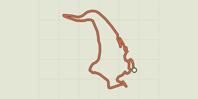 © OpenStreetMap, SRTM · OpenTopoMap (CC-BY-SA)
Castelbouc
Cévennes, Gorges du Tarn Causses (48) · LoopOfficial rating by Parc national des Cévennes