
Puech d'Alluech

Key facts
- Distance
- 12.7 km
- Ascent
- +383 m
- Descent
- −322 m
- Estimated time
- 3 hr 30
- hiking
- Difficulty
- Moderate
- official rating
- Route
- Loop
- back to the start
Profile and gradient
- under 10%
- 10 to 20%
- over 20%
Gradient along the route: 12.1 km under 10% and 0.6 km at 10 to 20%. Elevation from 973 m to 1,144 m over 12.7 km.
Description
A Causse atmosphere between dolines and sheep pasture, alternating with wooded areas. The highpoint of this walk is to climb Le Puech d’Alluech, a volcanic peak with 360° views. From the car park, take the track and, at the intersection, turn right. Your hike starts on the Causse Méjean circuit (yellow and red waymarks). Follow this path through the rolling countryside part to the foot of Puech d’Alluech. - Just before you get to the road, take the track on the left that goes uphill to the top of Puech d’Alluech (there-and-back 2.6 km). On your return, take the road on the left for 150 m, then take the track on the left that cuts across and joins the road, to the hamlet of Chamblon. - In Chamblon, pass below the sheepfold, go uphill towards the house, continue straight ahead to cut across the road and take the path opposite that joins the road to Prunets. - In Prunets, leave the GR®60 trail that veers off to the right, and instead take the track on the left that passes below the houses. The track climbs; at the top, leave it on the right to go back down towards the trees. You are walking around the Puech. - At the crossroads, continue straight ahead and, as you arrive in the hamlet of Cabrières, walk around it on the left instead, alongside a large basin. - After the hamlet of Cabrières, take the road that goes uphill on the left for 700 m. - At the crossroads, take the track that runs alongside the telephone cable to return to your starting-point.
Difficulty
Official rating: moderate, by Parc national des Cévennes.
Before you go
- You are advised not to bring dogs (flocks with guard dogs) A walk that is accessible for everyone but with little shade. You cross several fences (gates or stiles): close them well. . Make sure your equipment is appropriate for the day’s weather conditions. Remember that the weather changes quickly in the mountains. Take enough water, wear sturdy shoes and put on a hat. Please close all gates and barriers behind you.
Getting there
Start: À 1 km de Mas St-Chély, Mas-Saint-Chély (48).
Sources
- Track: Parc national des Cévennes, Licence Ouverte 1.0, Licence Ouverte 1.0 (Etalab) (destination.cevennes-parcnational.fr/trek/73354-Puech-d-Alluech). Time estimated by GPX Path with the Mac app rule, breaks not included.
- Official elevation gain: 383 m, Parc national des Cévennes
Nearby tracks

 © OpenStreetMap, SRTM · OpenTopoMap (CC-BY-SA)
cirque de Saint-Chély-du-Tarn
Cévennes, Gorges du Tarn Causses (48) · LoopOfficial rating by Parc national des Cévennes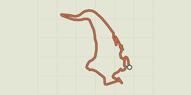 © OpenStreetMap, SRTM · OpenTopoMap (CC-BY-SA)
Castelbouc
Cévennes, Gorges du Tarn Causses (48) · LoopOfficial rating by Parc national des Cévennes © OpenStreetMap, SRTM · OpenTopoMap (CC-BY-SA)
The riverbanks
Cévennes, Gorges du Tarn Causses (48) · LoopOfficial rating by Parc national des Cévennes © OpenStreetMap, SRTM · OpenTopoMap (CC-BY-SA)
Domaine des Boissets
Cévennes, Gorges du Tarn Causses (48) · LoopOfficial rating by Parc national des Cévennes © OpenStreetMap, SRTM · OpenTopoMap (CC-BY-SA)
La Chadenède, The Monks
Cévennes, Gorges du Tarn Causses (48) · LoopOfficial rating by Parc national des Cévennes © OpenStreetMap, SRTM · OpenTopoMap (CC-BY-SA)
Roc des Hourtous
Cévennes, La Malène (48) · LoopOfficial rating by Parc national des Cévennes