
Goats’ Bridge
Key facts
- Distance
- 7.9 km
- Ascent
- +390 m
- Descent
- −350 m
- Estimated time
- 2 hr 30
- hiking
- Difficulty
- Easy
- official rating
- Route
- Loop
- back to the start
Profile and gradient
- under 10%
- 10 to 20%
- over 20%
Gradient along the route: 5.1 km under 10%, 2.2 km at 10 to 20% and 0.6 km over 20%. Elevation from 302 m to 494 m over 7.9 km.
Description
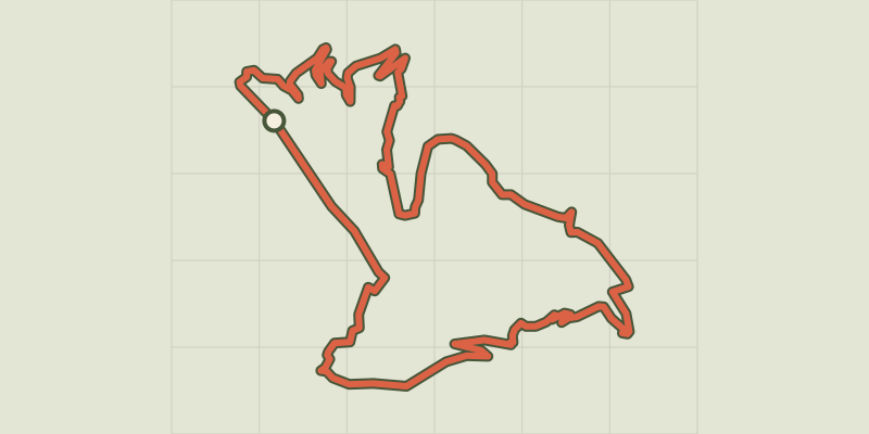
A walk centred on the Gardon river and its history of floods between Saumane and L'Estréchure. Deep in the Borgne valley, enjoy a short circuit around the Gardon river. Despite its tranquil appearance, its riverbed has seen much water flow past, some of it furiously memorable. As you pass from the adret (sunny side) to the ubac (shaded side), you will also be able to gauge the extent to which humans have shaped the Cévenol landscape whilst adapting to it. Signposts will guide you all along this route. In the description below, the signposted place names and/or directions are given in bold italics between quotation marks: From “Saumane” village square, walk towards “CHÂTEAU DE L’HOM” via “Pont de Saumane”. - At “Pont de Saumane”, cross the river towards “Cabrijoule”. - At the signpost “Cabrijoule”, go right towards “CHÂTEAU DE L’HOM”. - Before the entrance to the campsite, at the signpost “CHÂTEAU DE L’HOM”, turn right towards “La Bécédelle”. - At the entrance to “La Bécédelle”, turn right towards “Saumane” and join the D907 road. - At the road, turn left to return to the village and the car park.
Difficulty
Official rating: easy, by Parc national des Cévennes.
Before you go
- NB: The return leg is on the D907 road.
- Make sure your equipment is appropriate for the day’s weather conditions. Remember that the weather changes quickly in the mountains. Take enough water, wear sturdy shoes and put on a hat.
Getting there
Start: Saumane, Saumane (30).
Sources
- Track: Parc national des Cévennes, Licence Ouverte 1.0, Licence Ouverte 1.0 (Etalab) (destination.cevennes-parcnational.fr/trek/45050-Le-pont-des-chevres). Time estimated by GPX Path with the Mac app rule, breaks not included.
- Official elevation gain: 390 m, Parc national des Cévennes
Nearby tracks

 © OpenStreetMap, SRTM · OpenTopoMap (CC-BY-SA)
L'Exil
Cévennes, Saumane (30) · LoopOfficial rating by Parc national des Cévennes © OpenStreetMap, SRTM · OpenTopoMap (CC-BY-SA)
Chemin des fileuses
Cévennes, L'Estréchure (30) · LoopOfficial rating by Parc national des Cévennes © OpenStreetMap, SRTM · OpenTopoMap (CC-BY-SA)
Le Soult
Cévennes, L'Estréchure (30) · LoopOfficial rating by Parc national des Cévennes © OpenStreetMap, SRTM · OpenTopoMap (CC-BY-SA)
St Marcel de Fontfouillouse
Cévennes, Les Plantiers (30) · LoopOfficial rating by Parc national des Cévennes © OpenStreetMap, SRTM · OpenTopoMap (CC-BY-SA)
Saint-Roman
Cévennes, Moissac-Vallée-Française (48) · LoopOfficial rating by Parc national des Cévennes © OpenStreetMap, SRTM · OpenTopoMap (CC-BY-SA)
The Rocher de l'Aigle (Eagle's Rock)
Cévennes, Les Plantiers (30) · LoopOfficial rating by Parc national des Cévennes