
Les Balcons de l’Aigoual: a land art circuit
Key facts
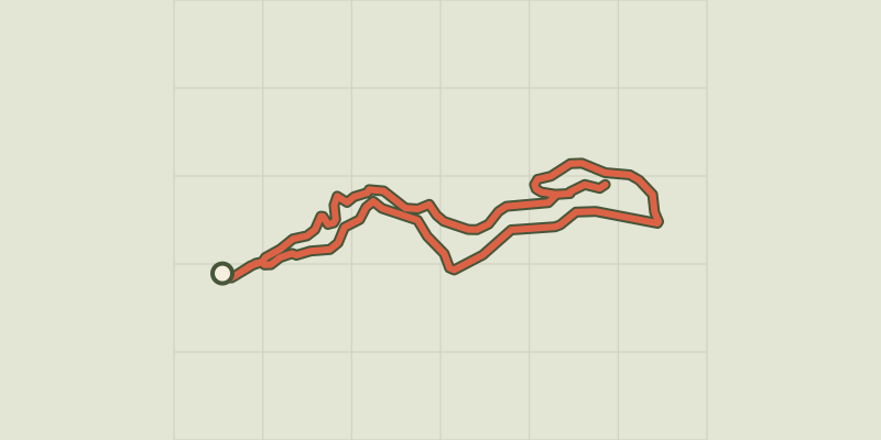
- Distance
- 7.9 km
- Ascent
- +188 m
- Descent
- −146 m
- Estimated time
- 2 hr 05
- hiking
- Difficulty
- Moderate
- official rating
- Route
- Loop
- back to the start
Profile and gradient
- under 10%
- 10 to 20%
- over 20%
Gradient along the route: 7.7 km under 10% and 0.2 km at 10 to 20%. Elevation from 1,409 m to 1,559 m over 7.9 km.
Description
A unique land art circuit in the National Park’s central zone proposing 14 regularly renewed installations, which are inspired by the natural environment and scenery of Mont Aigoual. Here artists present the relationship between humans and nature and their encounter with the climatic phenomena of Mont Aigoual. Their works are therefore constantly evolving. Art inserted into the environment connects with a fundamental source of creativity for artists: observing and being inspired by nature. This circuit takes you through different atmospheres and sites, and proposes a sensitive and intimate approach to nature. The circuit gradually leaves the activity centre and enters the foliage, then goes through a wooden arch. After 500 m, it reaches the decommissioned D249 that takes you all the way to the summit. This path is for pedestrians and accessible to pushchairs and wheelchairs. The downhill return is on the GR 6 long-distance hiking trail, which is accessible only to hikers. The blue pictogram waymarks the entire circuit.
Difficulty
Official rating: moderate, by Parc national des Cévennes.
Before you go
- At the summit of Mont Aigoual, weather conditions can change rapidly. Before setting out, seek advice from the tourist office. This circuit is prohibited in strong winds or snowy conditions.
Getting there
Start: Station de Prat Peyrot, Val-d'Aigoual (30).
Sources
- Track: Parc national des Cévennes, Licence Ouverte 1.0, Licence Ouverte 1.0 (Etalab) (destination.cevennes-parcnational.fr/trek/74746-Les-Balcons-de-l-Aigoual---Parcours-Landart). Time estimated by GPX Path with the Mac app rule, breaks not included.
- Official elevation gain: 188 m, Parc national des Cévennes
Nearby tracks

 © OpenStreetMap, SRTM · OpenTopoMap (CC-BY-SA)
The Hérault waterfalls - long
Cévennes, Meyrueis (48) · LoopOfficial rating by Parc national des Cévennes © OpenStreetMap, SRTM · OpenTopoMap (CC-BY-SA)
La Dauphine
Cévennes, Val-d'Aigoual (30) · LoopOfficial rating by Parc national des Cévennes © OpenStreetMap, SRTM · OpenTopoMap (CC-BY-SA)
Col de la Caumette
Cévennes, Val-d'Aigoual (30) · LoopOfficial rating by Parc national des Cévennes © OpenStreetMap, SRTM · OpenTopoMap (CC-BY-SA)
The Hérault waterfalls - short
Cévennes, Val-d'Aigoual (30) · Out and backOfficial rating by Parc national des Cévennes © OpenStreetMap, SRTM · OpenTopoMap (CC-BY-SA)
Trévezel: the botanists' and foresters' path
Cévennes, Val-d'Aigoual (30) · LoopOfficial rating by Parc national des Cévennes © OpenStreetMap, SRTM · OpenTopoMap (CC-BY-SA)
L'Hort de Dieu arboretum, short
Cévennes, Val-d'Aigoual (30) · LoopOfficial rating by Parc national des Cévennes