
Valescure path
Key facts
- Distance
- 2.6 km
- Ascent
- +135 m
- Descent
- −113 m
- Estimated time
- 50 min
- hiking
- Difficulty
- Moderate
- official rating
- Route
- Loop
- back to the start
Profile and gradient
- under 10%
- 10 to 20%
- over 20%
Gradient along the route: 1.4 km under 10%, 1.0 km at 10 to 20% and 0.2 km over 20%. Elevation from 386 m to 488 m over 2.6 km.
Description
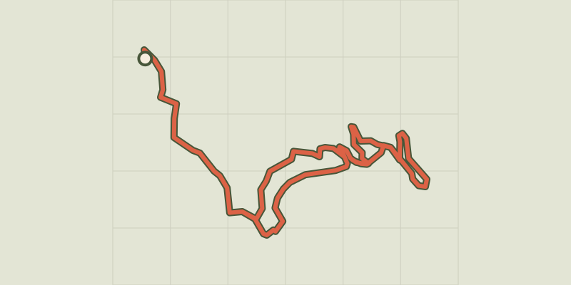
A path by water and through history, exploring béals, gourgues and other tancats in the cool undergrowth of the Vallée Borgne. The Valescure path winds its way through the Vallée Borgne state forest near the village of Peyroles, alongside streams with historic hydraulic structures that have partly been restored. The path offers you the opportunity to discover the huge efforts made by locals to work the land under difficult circumstances, and to retain river water. Signposts will guide you all along this route, as well as yellow painted waymarks. In the description below, the signposted place names and/or directions are given in bold italics between quotation marks: Starting from “Château de Vallée Obscure”, head downhill towards: - “La Jasse”, then turn left towards - “Le Gué”, then right towards - “La Cascade”, continue on to - “Les Tancats”, then turn right towards - “Les Blocs Granitiques”, then turn right towards - “La Bastide”, completing a loop back to the “La Bastide” signpost. From there, return to “Les Blocs Granitiques” (5), turn right and continue to “Les Tancats” (4), then “La Cascade” (3). Turn left towards “La Jasse” (1) and return to “Château de Vallée Obscure” / car park.
Difficulty
Official rating: moderate, by Parc national des Cévennes.
Before you go
- This path has five numbered information panels. There is also a signpost for “tancats ou rascaçs” that is visible before the path starting-point, 800 m after you have crossed the bridge over the river Gardon. Park by the side of the road.[on garde, même si le POI est supprimé, voir ci-dessous ?] Difficult uphill sections. Do not take this path when it is raining (possibility of flooding, and path is slippery). Do not park in front of the gates at the entrance to the path//track.
Getting there
Start: Parking, Peyrolles-en-Cévennes (30).
Sources
- Track: Parc national des Cévennes, Licence Ouverte 1.0, Licence Ouverte 1.0 (Etalab) (destination.cevennes-parcnational.fr/trek/38013-Valescure---Sentier-de-decouverte). Time estimated by GPX Path with the Mac app rule, breaks not included.
- Official elevation gain: 135 m, Parc national des Cévennes
Nearby tracks

 © OpenStreetMap, SRTM · OpenTopoMap (CC-BY-SA)
Valescure
Cévennes, Peyrolles-en-Cévennes (30) · LoopOfficial rating by Parc national des Cévennes © OpenStreetMap, SRTM · OpenTopoMap (CC-BY-SA)
The stagecoach
Cévennes, Peyrolles-en-Cévennes (30) · LoopOfficial rating by Parc national des Cévennes © OpenStreetMap, SRTM · OpenTopoMap (CC-BY-SA)
Le Mauripe
Cévennes, Soudorgues (30) · LoopOfficial rating by Parc national des Cévennes © OpenStreetMap, SRTM · OpenTopoMap (CC-BY-SA)
La salindrenque
Cévennes, Soudorgues (30) · LoopOfficial rating by Parc national des Cévennes © OpenStreetMap, SRTM · OpenTopoMap (CC-BY-SA)
Le Briontet
Cévennes, Soudorgues (30) · LoopOfficial rating by Parc national des Cévennes © OpenStreetMap, SRTM · OpenTopoMap (CC-BY-SA)
Le Soult
Cévennes, L'Estréchure (30) · LoopOfficial rating by Parc national des Cévennes