
La plaine sous le Roc mountain bike loop

Key facts
- Distance
- 10.0 km
- Ascent
- +123 m
- Descent
- −98 m
- Estimated time
- 55 min
- mtb
- Difficulty
- Very easy
- official rating
- Route
- Loop
- back to the start
Profile and gradient
- under 10%
- 10 to 20%
- over 20%
Gradient along the route: 10.0 km under 10%. Elevation from 781 m to 839 m over 10.0 km.
Description
A very easy route under the rocky overhang of Embrun, magnified by a view from below. The imposing shadow of the Roc d'Embrun, dominated by the Notre Dame du Réal cathedral, looms over the plain where a number of private gardens irrigated by the waters of the Durance flourish. In spring and early summer, when its flow is at its highest, the sound of its tumultuous waters are a pleasant accompaniment. - Join the path laid out on the banks of the Durance from the beach car park, passing in front of the chalet. Head up the Durance and under the road bridge. Head past the wooden footbridge, then turn left 50m after the footbridge into a housing estate, then right 100m after a small hill. At the next junction, turn right onto a track and turn left almost immediately. Continue along the path until you reach a small road. - Then turn left along the Durance then left again 100m later towards Roc d'Embrun. Turn right at the junction, remaining on a small tarmac road. After around 200m, take a wide, passable path to the right and follow it for around 300m until you come to the road that runs alongside the Durance. Turn left and head up the Durance. The narrow road comes to an intersection with Departmental Road 994D. Turn right onto the main road and cross the wooden bridge over the Durance. - Turn right after the bridge and take the road. Leave this road after 200m and turn right onto a small path that winds through the woods. Pass under the N94 bridge on the left of the pylon, then follow a track for 1km until you reach a small road. After the Travellers' area, turn left, then follow the road round to the right. At Pastourelle, an abandoned farm, turn left and return to the Grillon camp-site, continuing straight on until you reach the road. Turn right towards Embrun. At the roundabout, take the first exit and continue straight through the cattle drive. At Super U, take the second exit to the footbridge over the Durance. Now you just have to descend along the Durance, as on the outward journey, to return to the car park.
Difficulty
Official rating: very easy, by Parc national des Écrins.
Getting there
Start: Plan d'eau, Embrun, Embrun (05).
Sources
- Track: Parc national des Écrins, Licence Ouverte 2.0, Licence Ouverte 2.0 (Etalab) (destination.ecrins-parcnational.fr/trek/987363-N2---La-plaine-sous-le-Roc). Time estimated by GPX Path with the Mac app rule, breaks not included.
- Official elevation gain: 123 m, Parc national des Écrins
Nearby tracks

 © OpenStreetMap, SRTM · OpenTopoMap (CC-BY-SA)
The Saint Sauveur loop
Écrins, Embrun (05) · LoopOfficial rating by Parc national des Écrins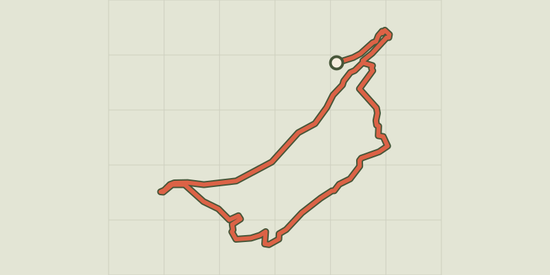 © OpenStreetMap, SRTM · OpenTopoMap (CC-BY-SA)
Crots Beach
Écrins, Embrun (05) · LoopOfficial rating by Parc national des Écrins © OpenStreetMap, SRTM · OpenTopoMap (CC-BY-SA)
Combe des Champannes loop
Écrins, Embrun (05) · LoopOfficial rating by Parc national des Écrins © OpenStreetMap, SRTM · OpenTopoMap (CC-BY-SA)
Lac de Serre-Ponçon 5-day Mountain Bike Tour
Écrins, Embrun (05) · Point to pointOfficial rating by Parc national des Écrins © OpenStreetMap, SRTM · OpenTopoMap (CC-BY-SA)
Grand Tour des Ecrins VTTAE - Grande Traversée VTT-FFC
Écrins, Embrun (05) · Point to pointOfficial rating by Parc national des Écrins © OpenStreetMap, SRTM · OpenTopoMap (CC-BY-SA)
Enduro de frozane
Écrins, Embrun (05) · Point to pointOfficial rating by Parc national des Écrins