
Les Eyssarts

Key facts
- Distance
- 11.4 km
- Ascent
- +360 m
- Descent
- −329 m
- Estimated time
- 3 hr 15
- hiking
- Difficulty
- Easy
- official rating
- Route
- Loop
- back to the start
Profile and gradient
- under 10%
- 10 to 20%
- over 20%
Gradient along the route: 9.2 km under 10% and 2.3 km at 10 to 20%. Elevation from 1,085 m to 1,383 m over 11.4 km.
Description
A walk through forest for the most part, its high point being a panoramic view over the Vallouise valley. This itinerary introduces you to three villages in the territory - Les Vigneaux, Puy Saint-Vincent and Vallouise-Pelvoux - all in tranquil surroundings and which time seems to have passed by. On top of this, the circuit offers a panoramic view from the chapel of Saint-Romain, a fine example of the historical, iconic architecture of the municipality of Puy Saint-Vincent. The route starts at Le Pont du Rif, from the car park on the right-hand bank of the Gyronde. Take the paved road heading towards the campsite «Le Courounba» - Before you reach the campsite, go left onto a path which runs just above it - At the intersection, continue straight ahead towards Les Eyssarts (Snowshoe track ("Piste de raquettes") no. 10) - At the end of the path, turn left and after 150 metres head right onto the heritage path ("Sentier du patrimoine") towards the chapel of Saint-Romain - Turn right and after another 150 metres turn left which takes you up a short incline. At the end of the path, where you reach the D4, head right and after 15 metres turn right again onto a track leading to the chapel of Saint-Romain - At the chapel of Saint-Romain, retrace your steps until you are back on the road, then turn left again and start the descent, following signs for Vallouise, via the "Sentier du facteur" (postman's path) - At the end of the track, head left to continue downhill on a new track which brings you to the D4 again. Carry on downhill and at the intersection turn right towards the Park Centre ("Maison du Parc") - Leave the road going right to follow the Gyronde towards Champ Clément, Les Parchers and La Chambon. After 350 metres, turn left and continue in the same direction - Turn right again, following the first part of the trail in reverse, to skirt around the campsite and back to your starting point
Difficulty
Official rating: easy, by Parc national des Écrins.
Before you go
- Check weather conditions before setting off.
- Rescue services contact details: Secours Montagne (Mountain Rescue): +33 (0)4 92 22 22 22 or 112
- Show consideration for the work of farmers, livestock keepers and owners
- Close all gates behind you
- Take your litter home
- Do not take shortcuts across pastureland
Getting there
Start: Pont du Rif (côté rive droite de la Gyronde), Les Vigneaux, Les Vigneaux (05).
Sources
- Track: Parc national des Écrins, Licence Ouverte 2.0, Licence Ouverte 2.0 (Etalab) (destination.ecrins-parcnational.fr/trek/973847-Les-Eyssarts). Time estimated by GPX Path with the Mac app rule, breaks not included.
- Official elevation gain: 360 m, Parc national des Écrins
Nearby tracks

 © OpenStreetMap, SRTM · OpenTopoMap (CC-BY-SA)
THEMED PATH: The Le Cloutas path
Écrins, Les Vigneaux (05) · LoopOfficial rating by Parc national des Écrins © OpenStreetMap, SRTM · OpenTopoMap (CC-BY-SA)
RANDOLAND: Les Vigneaux
Écrins, Les Vigneaux (05) · LoopOfficial rating by Parc national des Écrins © OpenStreetMap, SRTM · OpenTopoMap (CC-BY-SA)
Bouchier et le Clot de la Siva
Écrins, Les Vigneaux (05) · LoopOfficial rating by Parc national des Écrins © OpenStreetMap, SRTM · OpenTopoMap (CC-BY-SA)
Le belvédère des Têtes
Écrins, Les Vigneaux (05) · Out and backOfficial rating by Parc national des Écrins © OpenStreetMap, SRTM · OpenTopoMap (CC-BY-SA)
La tête d'Oréac
Écrins, Les Vigneaux (05) · LoopOfficial rating by Parc national des Écrins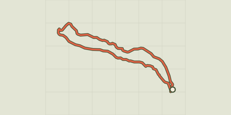 © OpenStreetMap, SRTM · OpenTopoMap (CC-BY-SA)
Around Les Vigneaux and Grand Parcher
Écrins, Les Vigneaux (05) · LoopOfficial rating by Parc national des Écrins