
The Tuckett refuge

Key facts
- Distance
- 7.5 km
- Ascent
- +602 m
- Descent
- −554 m
- Estimated time
- 3 hr 15
- hiking
- Difficulty
- Easy
- official rating
- Route
- Out and back
- same way back
Profile and gradient
- under 10%
- 10 to 20%
- over 20%
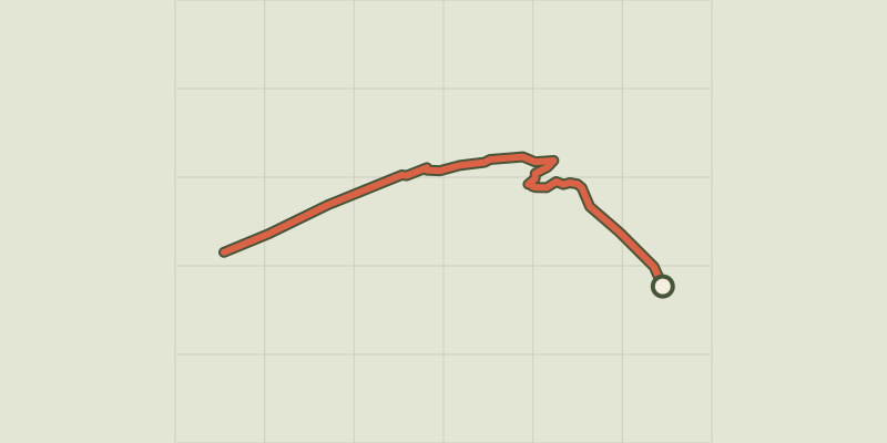
Gradient along the route: 2.6 km under 10%, 3.4 km at 10 to 20% and 1.5 km over 20%. Elevation from 1,876 m to 2,420 m over 7.5 km.
Description
A journey in a stone atmosphere at the heart of the valley, giving visitors a better understanding of the glacier landscapes of the Ecrins. The former Tucket refuge was built in 1886 to replace a shelter below a rock that was used by early mountain-climbers and bears witness to the pioneering age of Alpine mountain-climbing in Vallouise in the second half of the 19th century. From the chalet-hotel, head north-east across the footbridges over the Momie torrent and the Noir glacier. The path then rises towards a group of smooth, polished and mottled rocks. The path passes the fork towards the Glacier Noir trail (to the left). - Then take the winding path upwards. Cross the footbridge over the Glacier Blanc torrent and follow the path running along the left bank of the torrent and rising to the old Tuckett refuge. - Take the same way back down to the Pré de Madame Carle car park.
Difficulty
Official rating: easy, by Parc national des Écrins.
Before you go
- Summer route: make sure the access road to Pré de Madame Carle is open and that the footbridges over the torrents have been put back.
- There has been a charge for parking in the Pré de Madame Carle town car park since 2013.
Getting there
Start: Pré de Madame Carle, Pelvoux, Vallouise-Pelvoux (05).
Sources
- Track: Parc national des Écrins, Licence Ouverte 2.0, Licence Ouverte 2.0 (Etalab) (destination.ecrins-parcnational.fr/trek/903976-Le-refuge-Tuckett). Time estimated by GPX Path with the Mac app rule, breaks not included.
- Official elevation gain: 602 m, Parc national des Écrins
Nearby tracks
 © OpenStreetMap, SRTM · OpenTopoMap (CC-BY-SA)
Le glacier Noir
Écrins, Vallouise-Pelvoux (05) · Out and backOfficial rating by Parc national des Écrins © OpenStreetMap, SRTM · OpenTopoMap (CC-BY-SA)
The White Glacier
Écrins, Vallouise-Pelvoux (05) · Out and backOfficial rating by Parc national des Écrins © OpenStreetMap, SRTM · OpenTopoMap (CC-BY-SA)
Tour des refuges en Vallouise en 5 jours
Écrins, Vallouise-Pelvoux (05) · Point to pointOfficial rating by Parc national des Écrins © OpenStreetMap, SRTM · OpenTopoMap (CC-BY-SA)
Sélé Refuge
Écrins, Vallouise-Pelvoux (05) · Out and backOfficial rating by Parc national des Écrins © OpenStreetMap, SRTM · OpenTopoMap (CC-BY-SA)
Tour des refuges en Vallouise en 4 jours
Écrins, Vallouise-Pelvoux (05) · Point to pointOfficial rating by Parc national des Écrins © OpenStreetMap, SRTM · OpenTopoMap (CC-BY-SA)
La Bosse de Clapouse
Écrins, Vallouise-Pelvoux (05) · Out and backOfficial rating by Parc national des Écrins