
Woodland discovery trail
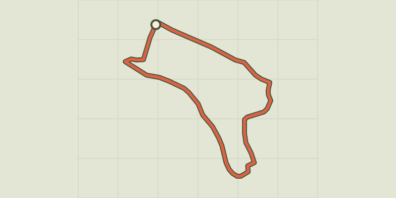
Key facts
- Distance
- 2.7 km
- Ascent
- +40 m
- Descent
- −35 m
- Estimated time
- 40 min
- hiking
- Difficulty
- Very easy
- official rating
- Route
- Loop
- back to the start
Profile and gradient
- under 10%
- 10 to 20%
- over 20%
Gradient along the route: 2.7 km under 10%. Elevation from 1,017 m to 1,055 m over 2.7 km.
Description
The loop makes its way between the hedges of the Champsaur woodland. Along the way, there are information panels about farming, animals and plants. On a hot summer’s day, walking under the cover of the ash trees to the lapping sound of a little canal, in harmony with the birdsong, is a real experience of peace. As you go round a bend in the path you might spot a deer or a fox. This is an introduction to another aspect of the Massif des Ecrins, far from the high mountains, but one that is not at all lacking in charm. From the small car park near a large sheepfold and panels describing the route (near the bus stop), follow the blackbird symbols marking the circuit. The route is very easy, with a path lined with hedges leading to the old Les Costes road, which is now a track. Turn right and continue for about 200m. The "blackbird" tells you to turn right again and go down towards the St Eusèbe road. You have to cross a ford in a small stream (not difficult). Once on the tarmac road, you again turn right towards the village of Beaurepaire, which fully deserves its name (“beautiful spot”). Cross the village, then go up to the right again as you leave the village. A little road takes you up to the car park where the trail began.
Difficulty
Official rating: very easy, by Parc national des Écrins.
Before you go
- A very easy hike, ideal for families.
Getting there
Start: Beaurepaire, Aubessagne (05).
Sources
- Track: Parc national des Écrins, Licence Ouverte 2.0, Licence Ouverte 2.0 (Etalab) (destination.ecrins-parcnational.fr/trek/938710-Sentier-de-decouverte-du-bocage). Time estimated by GPX Path with the Mac app rule, breaks not included.
- Official elevation gain: 40 m, Parc national des Écrins
Nearby tracks

 © OpenStreetMap, SRTM · OpenTopoMap (CC-BY-SA)
Tour du Vieux Chaillol par le Tourond en 6 jours
Écrins, Saint-Jacques-en-Valgodemard (05) · Point to pointOfficial rating by Parc national des Écrins © OpenStreetMap, SRTM · OpenTopoMap (CC-BY-SA)
Tour du Vieux Chaillol in 5 days
Écrins, Saint-Jacques-en-Valgodemard (05) · Point to pointOfficial rating by Parc national des Écrins © OpenStreetMap, SRTM · OpenTopoMap (CC-BY-SA)
Le sentier du Roy
Écrins, La Motte-en-Champsaur (05) · LoopOfficial rating by Parc national des Écrins © OpenStreetMap, SRTM · OpenTopoMap (CC-BY-SA)
Font Froide Mountain Pass
Écrins, La Motte-en-Champsaur (05) · Out and backOfficial rating by Parc national des Écrins © OpenStreetMap, SRTM · OpenTopoMap (CC-BY-SA)
The 6 mountain huts
Écrins, Saint-Maurice-en-Valgodemard (05) · Out and backOfficial rating by Parc national des Écrins © OpenStreetMap, SRTM · OpenTopoMap (CC-BY-SA)
Le balcon du Champsaur
Écrins, Saint-Michel-de-Chaillol (05) · LoopOfficial rating by Parc national des Écrins