
Véroncle in its entirety

Key facts
- Distance
- 14.8 km
- Ascent
- +539 m
- Descent
- −429 m
- Estimated time
- 4 hr 10
- hiking
- Difficulty
- Difficult
- official rating
- Route
- Loop
- back to the start
Profile and gradient
- under 10%
- 10 to 20%
- over 20%
Gradient along the route: 12.6 km under 10% and 2.2 km at 10 to 20%. Elevation from 203 m to 513 m over 14.8 km.
Description
An exceptional natural site, landscapes of great aesthetic quality and a succession of ingenious hydraulic remains... « After the lessons on the Bories, on the Gordes, here is another lessonon rural engineering.! At the time the castle of Gordes was being built, qualified with the lovely word as Renaissance, men brought stones down to build wells to trap the precious fluid and to make the windmills turn in the meandering of the Gorges of Véroncle. It was indeed the start of a new world.». According to J.P. Locci and D. Lacaille Association for the promotion and the preservation of industrial heritage in Vaucluse. From the car park, go left on the D15 for 300m. Take the path to the right. 1 - Go straight and down the long flat area of Vézaule. Further down, leave the left path behind and reach into the Gorges and the windmill of Grailles (private property, cannot be visited). 2 - Retrace your steps and 60m further, take a right at the bottom of the ravine. Reach the Cabrier windmill. Weave along the wall to the left, cross a narrow balcony passage, then pass through the water carrying canal. Climb a first ladder, pass a ledge and continue alternating between the two banks. Higher up, cross a rocky ledge (handrail), then move left to rise. Pass a flat area and go down to the right. Go left to the bottom of the Gorges. Pass the Jean de Marre windmills (I and II) and then reach the crossroads upstream. 3 - Go up some 30 metres upstream until a rocky slab. Do not climb the steep path to the right but continue on the one that runs along the river bed. 200m further after a little ledge, cross a ford, take the path on the opposite bank in the downstream direction. Climb two stony steep paths, reach the old track and continue climbing the milder slope. Reach the plateau and continue the path until the track. 4 - At the crossroads ''Lauzière'', follow the left path. Pass two turns and continue on the small road. At the crossroads, continue left. Reach the D4 (calvary), turn left and reach Murs. 5 - At the crossroads between the D4 and the D15, exit to the left on the small road. Lower down, go onto the opposite track. 700m further, do not miss the start of the trail to the right. Go down two rocky hairpin bends, go past the Moulin des Etangs (private property, cannot be visited). Continue onto the valley floor. Pass the Devissé windmill and continue going. 6 - In front of the Charlesse windmill and its penstock, continue at the bottom of the Gorges to the left. Make a detour to the right to reach the foot of the ledge of the mill of the Cata well. Continue at the bottom of the Gorges and reach the path taken to go. 3 - Turn right and climb the hairpin bends. Continue on the balcony path. At the crossroads "Vezaule", continue left. 2 - Turn right and return to the starting point following the route taken to go.
Difficulty
Official rating: difficult, by Parcs naturels régionaux de Provence-Alpes-Côte d'Azur.
Before you go
- Do not engage in the downstream part of the route after a storm or rainy weather; some ravine bottom passages can be very difficult, in fact dangerous!
- Also in the downstream part, be very careful when crossing more or less airy ledges (ladder, handrail).
- Caution with your ankles on rocky and slippery passages at the bottom.
Getting there
Start: Aire de repos en bordure de la route de Murs (D15), 2 km au nord de Gordes., Gordes (84).
Sources
- Track: Parcs naturels régionaux de Provence-Alpes-Côte d'Azur (Chemins des Parcs), Licence Ouverte 2.0, Licence Ouverte 2.0 (Etalab) (www.cheminsdesparcs.fr/trek/34251-GORDES---MURS---L-integrale-de-Veroncle). Time estimated by GPX Path with the Mac app rule, breaks not included.
- Official elevation gain: 539 m, Parcs naturels régionaux de Provence-Alpes-Côte d'Azur
Nearby tracks

 © OpenStreetMap, SRTM · OpenTopoMap (CC-BY-SA)
Gordes - Le moulin Jean-de-Marre
Luberon, Gordes (84) · Out and backOfficial rating by Parcs naturels régionaux de Provence-Alpes-Côte d'Azur © OpenStreetMap, SRTM · OpenTopoMap (CC-BY-SA)
Trails of the Maquis de Gordes through La Sénancole
Luberon, Gordes (84) · LoopOfficial rating by Parcs naturels régionaux de Provence-Alpes-Côte d'Azur © OpenStreetMap, SRTM · OpenTopoMap (CC-BY-SA)
Gordes - Le col de Gordes
Luberon, Gordes (84) · LoopOfficial rating by Parcs naturels régionaux de Provence-Alpes-Côte d'Azur © OpenStreetMap, SRTM · OpenTopoMap (CC-BY-SA)
Veroncle, through its depths!
Luberon, Gordes (84) · Point to pointOfficial rating by Parcs naturels régionaux de Provence-Alpes-Côte d'Azur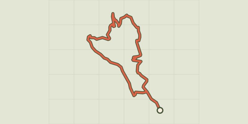 © OpenStreetMap, SRTM · OpenTopoMap (CC-BY-SA)
Gordes - Sentier du Maquis de Gordes par Véroncle
Luberon, Gordes (84) · LoopOfficial rating by Parcs naturels régionaux de Provence-Alpes-Côte d'Azur © OpenStreetMap, SRTM · OpenTopoMap (CC-BY-SA)
The upstream sections of the gorges of Véroncle
Luberon, Murs (84) · LoopOfficial rating by Parcs naturels régionaux de Provence-Alpes-Côte d'Azur