
“Astouin” cycling circuit
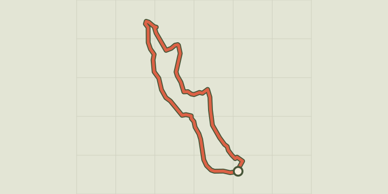
Key facts
- Distance
- 31.2 km
- Ascent
- +8 m
- Descent
- −5 m
- Estimated time
- 1 hr 20
- road cycling
- Difficulty
- Easy
- official rating
- Route
- Loop
- back to the start
Profile and gradient
- under 10%
- 10 to 20%
- over 20%
Gradient along the route: 31.2 km under 10%. Elevation from 0 m to 8 m over 31.2 km.
Description
Walk along the banks of the Petit-Rhône to observe the exceptional environment of this stream! A route in the heart of Camargue landscapes between land and water! On the water side, observe the meeting of the Rhone with the sea and cross the Petit-Rhône with the Sauvage’s ferry. While the Grand Rhone was channelled for navigation, the Petit-Rhône remained wilder. Rich in fish, especially catfish, it is also home to a population of nutria. Land side, enjoy this circuit that runs along the rice fields and find you closer to the Camargue horses! Back to the Tourist Office, head left on Van Gogh Avenue, towards Aigues-Mortes. Continue straight for 6 km and follow the Grau d'Orgon and the Petit-Rhône, on the D38. 1 - Turn left on the D85 and take the Sauvage ferry (information about ferry times at the Tourist Office). Continue on the D85 towards Aigues-Mortes and cross the small bridge that spans the Peccais Canal at Sylvéréal. 2 - At the intersection of the D58, turn right and continue for 350 m towards Arles. Take the bridge over the Petit-Rhône. 3- Then turn right towards S33. Walk 2 km and reach the Astouin hamlet. Leave on the left the Astouin Castle estate. 4 - At the intersection with the D38, go to the right and continue the D38 for more than 3,5 km. 5 - Take the D38A, turn left and continue straight until you reach the D570. 6- At the intersection with the D570, turn right and continue for about 4.5 km. 7 - After the Le Boumian hotel, take the small dirt road on the left, parallel to the D570. Continue straight for about 1.5 km. 8 - Turn left before the roubine (stream). Continue the path that runs along the roubine. Pass the small bridge and continue to the right. Continue straight and turn right on the road to Cacharel and cross the village to regain the starting point of the circuit, the Tourist Office of Saintes-Maries-de-la-Mer.
Difficulty
Official rating: easy, by Parcs naturels régionaux de Provence-Alpes-Côte d'Azur.
Before you go
- Caution on the D38! D58 up to Sylvéréal, dangerous road! Stay alert on the D570, busy road. Respect the rules of the road on roads open to public traffic.
Getting there
Start: Port Gardian, Saintes-Maries-de-la-Mer, Saintes-Maries-de-la-Mer (13).
Sources
- Track: Parcs naturels régionaux de Provence-Alpes-Côte d'Azur (Chemins des Parcs), Licence Ouverte 2.0, Licence Ouverte 2.0 (Etalab) (www.cheminsdesparcs.fr/trek/61625-SAINTES-MARIES-DE-LA-MER---Circuit-Astouin-a-velo). Time estimated by GPX Path with the Mac app rule, breaks not included.
- Official elevation gain: 69 m, Parcs naturels régionaux de Provence-Alpes-Côte d'Azur
Nearby tracks

 © OpenStreetMap, SRTM · OpenTopoMap (CC-BY-SA)
"Dromar' cycling path
Provence-Alpes-Côte d'Azur, Saintes-Maries-de-la-Mer (13) · LoopOfficial rating by Parcs naturels régionaux de Provence-Alpes-Côte d'Azur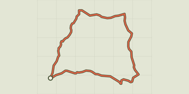 © OpenStreetMap, SRTM · OpenTopoMap (CC-BY-SA)
Go qround Vaccarès in 2 days by bike
Provence-Alpes-Côte d'Azur, Saintes-Maries-de-la-Mer (13) · Point to pointOfficial rating by Parcs naturels régionaux de Provence-Alpes-Côte d'Azur © OpenStreetMap, SRTM · OpenTopoMap (CC-BY-SA)
Cycling around Saintes-Maries-de-la-Mer
Provence-Alpes-Côte d'Azur, Saintes-Maries-de-la-Mer (13) · LoopOfficial rating by Parcs naturels régionaux de Provence-Alpes-Côte d'Azur © OpenStreetMap, SRTM · OpenTopoMap (CC-BY-SA)
The draille de Méjanes by mountain bike
Provence-Alpes-Côte d'Azur, Saintes-Maries-de-la-Mer (13) · Out and backOfficial rating by Parcs naturels régionaux de Provence-Alpes-Côte d'Azur © OpenStreetMap, SRTM · OpenTopoMap (CC-BY-SA)
From Sauvage ferry to Cacharel by bike
Provence-Alpes-Côte d'Azur, Saintes-Maries-de-la-Mer (13) · LoopOfficial rating by Parcs naturels régionaux de Provence-Alpes-Côte d'Azur © OpenStreetMap, SRTM · OpenTopoMap (CC-BY-SA)
The Albaron marsh in Saliers by bike
Provence-Alpes-Côte d'Azur, Arles (13) · LoopOfficial rating by Parcs naturels régionaux de Provence-Alpes-Côte d'Azur