
Bike ride in the Provencal countryside

Key facts
- Distance
- 39.4 km
- Ascent
- +83 m
- Descent
- −45 m
- Estimated time
- 1 hr 40
- road cycling
- Difficulty
- Easy
- official rating
- Route
- Loop
- back to the start
Profile and gradient
- under 10%
- 10 to 20%
- over 20%
Gradient along the route: 39.4 km under 10%. Elevation from 5 m to 55 m over 39.4 km.
Description
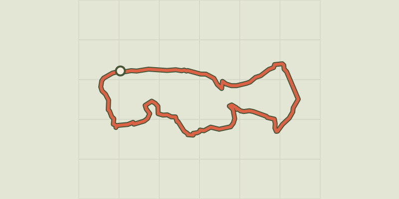
A loop that will make you travel across fields and cross many channels! After crossing the city of Tarascon with its exceptional heritage, the Grands Champs lowland that connects the Alpilles to the Montagnette is waiting for you. Its small verdant roads, to the peaceful tranquillity, you will go from village to village, each offering their batch of surprises to discover. From the parking, go past the castle on the left. At the roundabout take the first exit, Itam Boulevard At the Porte Condamine roundabout, follow the 1st exit, boulevard Gambetta. Continue 100 m then turn left on the D80 towards Maillane. Continue on this road until you cross the D570n. 1- Cross the D570n and follow the D80a towards Maillane for 3 km. After the main entrance of the Breuil estate, turn left on the paved road of Mas de Terras. Continue for 1 km and turn left on the tarmac road of Mas de la Musique. Continue until the D80 then switch to the right. 2- At the roundabout marking the entrance to Graveson, take the 1st exit, Chateaurenard road. Turn immediately left on Lavandin Street towards the center. Continue to the Sundial hotel and turn left on Chemin du Moulin. 200 m further, past the Tourist Office and the Auguste Chabaud Museum. 3- Pass the National Course, take the Jeanne d'Arc street after the Virgin statue and turn right on the Provence street. Then turn right on the General de Gaulle avenue then left on Lieutenant Atger Avenue. At the roundabout continue on the D5 until the entrance to Maillane. 4- Cross Maillane via the Jousse d'Arbaud alley, General de Gaulle avenue and Poet's Avenue. Continue on the D27, for 4 km, to the business area of ??Massane. At the crossroads with the D99 (Caution, traffic!), Turn left then continue for 400 m and turn right on the D27 towards Les Baux-de-Provence. 5- Drive 1.5 km and turn right on the old road to Arles after crossing the crossing with the Mas-Blanc road. Continue to Saint-Etienne du Grès, cross the village and continue on the D32. At the crossroads with the D33, take the left to join the Saint-Gabriel chapel 100 m further. 6- At the Saint-Gabriel chapel, retrace your steps to the last crossroads and continue towards Tarascon. (Caution, traffic!) At the roundabout take the 3rd exit, D570N, then turn right on the Lansac road. At the intersection with the D35, turn right and drive to Tarascon and continue for 3.5 km. 7- Turn left on the D970, then at the next crossroad, turn left going under the level crossing. At the roundabout, take the 2nd exit, D99 towards Beaucaire. At the next roundabout, take the first exit and turn immediately left on the République Avenue to reach your starting point.
Difficulty
Official rating: easy, by Parcs naturels régionaux de Provence-Alpes-Côte d'Azur.
Before you go
- For your safety, and for the preservation of forest areas, access to natural areas is regulated from June to September. Inquire during the summer period on 08 11 20 13 13 (price of a local call) or on www.bouches-du-rhone.pref.gouv.fr Download the application for free MYPROVENCE ENVIE DE BALADE (available on Appstore and Android Market).
Getting there
Start: Parking avenue de la République, Tarascon, Tarascon (13).
Sources
- Track: Parcs naturels régionaux de Provence-Alpes-Côte d'Azur (Chemins des Parcs), Licence Ouverte 2.0, Licence Ouverte 2.0 (Etalab) (www.cheminsdesparcs.fr/trek/58299-TARASCON---La-campagne-provencale-a-velo). Time estimated by GPX Path with the Mac app rule, breaks not included.
- Official elevation gain: 83 m, Parcs naturels régionaux de Provence-Alpes-Côte d'Azur
Nearby tracks
 © OpenStreetMap, SRTM · OpenTopoMap (CC-BY-SA)
Saint Etienne du Gres - Cycling tour in Alpilles, in 3 days
Provence-Alpes-Côte d'Azur, Saint-Étienne-du-Grès (13) · Point to pointOfficial rating by Parcs naturels régionaux de Provence-Alpes-Côte d'Azur © OpenStreetMap, SRTM · OpenTopoMap (CC-BY-SA)
Fontvielle - Des Alpilles à la Camargue à vélo
Provence-Alpes-Côte d'Azur, Fontvieille (13) · LoopOfficial rating by Parcs naturels régionaux de Provence-Alpes-Côte d'Azur © OpenStreetMap, SRTM · OpenTopoMap (CC-BY-SA)
Saint Remy de Provence - Cycling from the Alpilles to Val d'Enfer
Provence-Alpes-Côte d'Azur, Saint-Rémy-de-Provence (13) · LoopOfficial rating by Parcs naturels régionaux de Provence-Alpes-Côte d'Azur © OpenStreetMap, SRTM · OpenTopoMap (CC-BY-SA)
Le Paradou - Le tour du Marais des Baux à vélo
Provence-Alpes-Côte d'Azur, Paradou (13) · LoopOfficial rating by Parcs naturels régionaux de Provence-Alpes-Côte d'Azur © OpenStreetMap, SRTM · OpenTopoMap (CC-BY-SA)
Saint-Rémy-de-Provence - Les jardins de Mistral à vélo
Provence-Alpes-Côte d'Azur, Saint-Rémy-de-Provence (13) · LoopOfficial rating by Parcs naturels régionaux de Provence-Alpes-Côte d'Azur © OpenStreetMap, SRTM · OpenTopoMap (CC-BY-SA)
Discovering Vaccarès by bike
Provence-Alpes-Côte d'Azur, Arles (13) · LoopOfficial rating by Parcs naturels régionaux de Provence-Alpes-Côte d'Azur