
Ongles - Plaine d’Ongles et colline de Piébroux
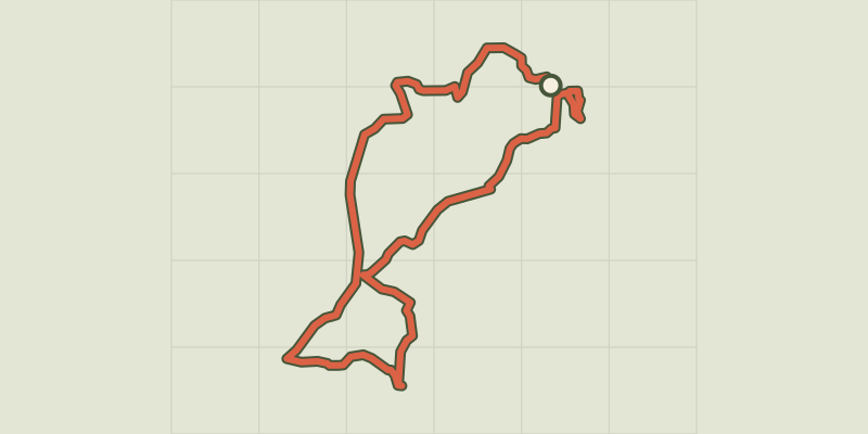
Key facts
- Distance
- 17.3 km
- Ascent
- +412 m
- Descent
- −335 m
- Estimated time
- 4 hr 35
- hiking
- Difficulty
- Moderate
- official rating
- Route
- Loop
- back to the start
Profile and gradient
- under 10%
- 10 to 20%
- over 20%
Gradient along the route: 16.0 km under 10% and 1.3 km at 10 to 20%. Elevation from 583 m to 761 m over 17.3 km.
Description
Difficulty
Official rating: moderate, by Parcs naturels régionaux de Provence-Alpes-Côte d'Azur.
Getting there
Start: Parking de l'école, Ongles., Ongles (04).
Sources
- Track: Parcs naturels régionaux de Provence-Alpes-Côte d'Azur (Chemins des Parcs), Licence Ouverte 2.0, Licence Ouverte 2.0 (Etalab) (www.cheminsdesparcs.fr/trek/134129-ONGLES---Plaine-d-Ongles-et-colline-de-Piebroux). Time estimated by GPX Path with the Mac app rule, breaks not included.
- Official elevation gain: 412 m, Parcs naturels régionaux de Provence-Alpes-Côte d'Azur
Nearby tracks

 © OpenStreetMap, SRTM · OpenTopoMap (CC-BY-SA)
Limans - Tour du Pâty
Luberon, Limans (04) · LoopOfficial rating by Parcs naturels régionaux de Provence-Alpes-Côte d'Azur © OpenStreetMap, SRTM · OpenTopoMap (CC-BY-SA)
The Rochers des Mourres
Luberon, Forcalquier (04) · LoopOfficial rating by Parcs naturels régionaux de Provence-Alpes-Côte d'Azur © OpenStreetMap, SRTM · OpenTopoMap (CC-BY-SA)
Forcalquier and its fortress
Luberon, Forcalquier (04) · LoopOfficial rating by Parcs naturels régionaux de Provence-Alpes-Côte d'Azur © OpenStreetMap, SRTM · OpenTopoMap (CC-BY-SA)
Saint-Étienne-les-Orgues - De Notre-Dame aux crêtes de Lure
Provence-Alpes-Côte d'Azur, Saint-Étienne-les-Orgues (04) · LoopOfficial rating by Parcs naturels régionaux de Provence-Alpes-Côte d'Azur © OpenStreetMap, SRTM · OpenTopoMap (CC-BY-SA)
Saint-Étienne-les-Orgues - Crêtes de Lure par le Pré de Fau
Provence-Alpes-Côte d'Azur, Saint-Étienne-les-Orgues (04) · LoopOfficial rating by Parcs naturels régionaux de Provence-Alpes-Côte d'Azur © OpenStreetMap, SRTM · OpenTopoMap (CC-BY-SA)
A stroll around the Observatory
Luberon, Saint-Michel-l'Observatoire (04) · LoopOfficial rating by Parcs naturels régionaux de Provence-Alpes-Côte d'Azur