
The bulls and the vine bath by bike

Key facts
- Distance
- 30.2 km
- Ascent
- +24 m
- Descent
- −5 m
- Estimated time
- 1 hr 15
- road cycling
- Difficulty
- Easy
- official rating
- Route
- Loop
- back to the start
Profile and gradient
- under 10%
- 10 to 20%
- over 20%
Gradient along the route: 30.2 km under 10%. Elevation from 0 m to 11 m over 30.2 km.
Description
On the path of the pilgrims to Santiago de Compostela, go in search of the many testimonies of agricultural life... On the way to Saint Jacques de Compostela, surrounded by landscapes shaped by the hand of winegrowers, Camargue bulls accompany you along the paths unveiling the vineyards of the Pays d'Arles. A stroll in the heart of the Camargue terroir and rural heritage! From the Tourist Office, turn left on Boulevard des Lices then turn right on Gambetta street towards Trinquetaille. Cross the Rhône and continue towards Saintes-Maries-de-la-Mer. 1- At the roundabout, take the C108 direction Gimeaux. 2- Turn left after the arena and follow the C113 "Palunlongue path". 3- At the crossroads of the D37, turn right for 500 m then turn right on the C118 road to the Saliers hamlet. 4- At the junction of the D572, turn right towards Arles for 500 m. Take on the left the road from Cazeneuve to Rigaudon. 5- At the old railway line, take the road opposite. 6- At the junction, cross the railway and take the VC105 "Chemin des Prêcheurs" on the right. At the stop turn right. 7- At the stop, turn left on the old road to Saint-Gilles, direction Trinquetaille.
Difficulty
Official rating: easy, by Parcs naturels régionaux de Provence-Alpes-Côte d'Azur.
Before you go
- At the intersection of the D572, dangerous road, caution!
- Respect the rules of the road on roads open to public traffic.
- On the old road of Saint-Gilles, attention, dangerous road!
Getting there
Start: Office de tourisme, Arles, Arles (13).
Sources
- Track: Parcs naturels régionaux de Provence-Alpes-Côte d'Azur (Chemins des Parcs), Licence Ouverte 2.0, Licence Ouverte 2.0 (Etalab) (www.cheminsdesparcs.fr/trek/18300-ARLES---Le-chemin-des-taureaux-a-velo). Time estimated by GPX Path with the Mac app rule, breaks not included.
- Official elevation gain: 24 m, Parcs naturels régionaux de Provence-Alpes-Côte d'Azur
Nearby tracks

 © OpenStreetMap, SRTM · OpenTopoMap (CC-BY-SA)
Discovering Vaccarès by bike
Provence-Alpes-Côte d'Azur, Arles (13) · LoopOfficial rating by Parcs naturels régionaux de Provence-Alpes-Côte d'Azur © OpenStreetMap, SRTM · OpenTopoMap (CC-BY-SA)
Cycling along the ViaRhôna
Provence-Alpes-Côte d'Azur, Arles (13) · Point to pointOfficial rating by Parcs naturels régionaux de Provence-Alpes-Côte d'Azur © OpenStreetMap, SRTM · OpenTopoMap (CC-BY-SA)
Fontvielle - Des Alpilles à la Camargue à vélo
Provence-Alpes-Côte d'Azur, Fontvieille (13) · LoopOfficial rating by Parcs naturels régionaux de Provence-Alpes-Côte d'Azur © OpenStreetMap, SRTM · OpenTopoMap (CC-BY-SA)
Le Paradou - Le tour du Marais des Baux à vélo
Provence-Alpes-Côte d'Azur, Paradou (13) · LoopOfficial rating by Parcs naturels régionaux de Provence-Alpes-Côte d'Azur © OpenStreetMap, SRTM · OpenTopoMap (CC-BY-SA)
The Albaron marsh in Saliers by bike
Provence-Alpes-Côte d'Azur, Arles (13) · LoopOfficial rating by Parcs naturels régionaux de Provence-Alpes-Côte d'Azur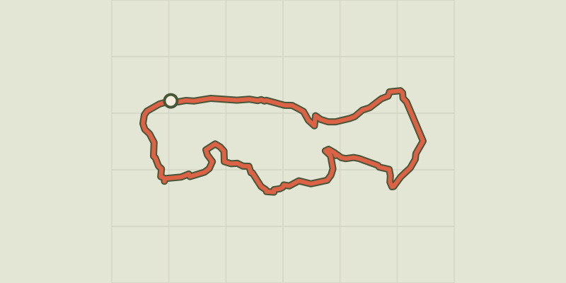 © OpenStreetMap, SRTM · OpenTopoMap (CC-BY-SA)
Saint Etienne du Gres - Cycling tour in Alpilles, in 3 days
Provence-Alpes-Côte d'Azur, Saint-Étienne-du-Grès (13) · Point to pointOfficial rating by Parcs naturels régionaux de Provence-Alpes-Côte d'Azur