
The trail of the Moulins de Daudet

Key facts
- Distance
- 2.2 km
- Ascent
- +46 m
- Descent
- −43 m
- Estimated time
- 35 min
- hiking
- Difficulty
- Very easy
- official rating
- Route
- Loop
- back to the start
Profile and gradient
- under 10%
- 10 to 20%
- over 20%
Gradient along the route: 2.1 km under 10% and 0.1 km at 10 to 20%. Elevation from 18 m to 56 m over 2.2 km.
Description
A walk between the mills to discover the place that inspired Lettres de mon moulin (Letters from my windmill) by Alphonse Daudet. "A pretty wood of pines sparkling with light tumbles in front of me to the bottom of the coast. On the horizon, the Alpilles cut their fine crests... No noise. Scarcely, at long intervals, a sound of a fife, a curlew in the lavender, a bell of mules on the road... All of this beautiful Provençal landscape lives only for the light." Alphonse Daudet, Lettres de mon moulin (Letters from my windmill). From the tourist office, take the path that runs alongside the playground, then cross the bridge. 1 - Turn right, cross the road and climb to the Sourdon windmill bypassing the water tower on the right. Then, return to the small bridge and turn right towards the Daudet windmill following the wooden panels. 2 - At the windmill, follow the path that gently slopes down to the Ramet and Tissot-Avon windmills. After the first, turn left and go down the road where you can still see the passage of the old carts. Continue to the entrance of the Castle of Montauban. 3 - Turn right and enter the castle courtyard. Possibility of visiting it. Go back through the entrance gate and continue straight up to Cours Hyacinthe Bellon. 4 - At the main one-way street, turn left and go up. Pass the church. 5 - Turn left in front of the bowling alley, then continue to return to the tourist office.
Difficulty
Official rating: very easy, by Parcs naturels régionaux de Provence-Alpes-Côte d'Azur.
Before you go
- Watch out for traffic when passing by roads.
- The visit of the castle of Montauban is free for children up to 6 years old. Beyond this, the price varies between 2.50 € and 3.50 € .
Getting there
Start: Bureau d'Information Touristique, Fontvieille, Fontvieille (13).
Sources
- Track: Parcs naturels régionaux de Provence-Alpes-Côte d'Azur (Chemins des Parcs), Licence Ouverte 2.0, Licence Ouverte 2.0 (Etalab) (www.cheminsdesparcs.fr/trek/40530-FONTVIEILLE---Le-sentier-des-Moulins-de-Daudet). Time estimated by GPX Path with the Mac app rule, breaks not included.
- Official elevation gain: 46 m, Parcs naturels régionaux de Provence-Alpes-Côte d'Azur
Nearby tracks

 © OpenStreetMap, SRTM · OpenTopoMap (CC-BY-SA)
Fontvieille - Aqueduc Nord
Provence-Alpes-Côte d'Azur, Fontvieille (13) · LoopOfficial rating by Parcs naturels régionaux de Provence-Alpes-Côte d'Azur © OpenStreetMap, SRTM · OpenTopoMap (CC-BY-SA)
Les Crottes d'Aubert
Provence-Alpes-Côte d'Azur, Fontvieille (13) · LoopOfficial rating by Parcs naturels régionaux de Provence-Alpes-Côte d'Azur © OpenStreetMap, SRTM · OpenTopoMap (CC-BY-SA)
Saint Etienne du Gres - La grande pinède des Alpilles
Provence-Alpes-Côte d'Azur, Saint-Étienne-du-Grès (13) · LoopOfficial rating by Parcs naturels régionaux de Provence-Alpes-Côte d'Azur © OpenStreetMap, SRTM · OpenTopoMap (CC-BY-SA)
Saint Etienne du Gres - De la cabane du Garde à Notre-Dame du Château
Provence-Alpes-Côte d'Azur, Saint-Étienne-du-Grès (13) · LoopOfficial rating by Parcs naturels régionaux de Provence-Alpes-Côte d'Azur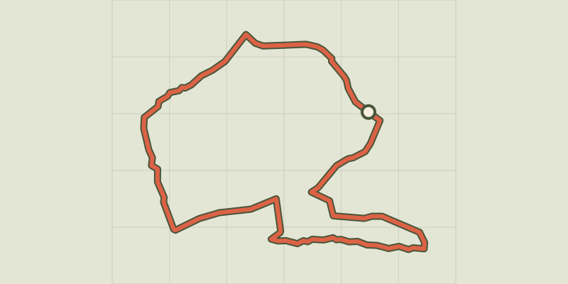 © OpenStreetMap, SRTM · OpenTopoMap (CC-BY-SA)
Le Paradou - Défends de Sousteyran
Provence-Alpes-Côte d'Azur, Paradou (13) · LoopOfficial rating by Parcs naturels régionaux de Provence-Alpes-Côte d'Azur © OpenStreetMap, SRTM · OpenTopoMap (CC-BY-SA)
Le Paradou - The Castillon Towers
Provence-Alpes-Côte d'Azur, Paradou (13) · LoopOfficial rating by Parcs naturels régionaux de Provence-Alpes-Côte d'Azur