
Le Paradou - The Castillon Towers
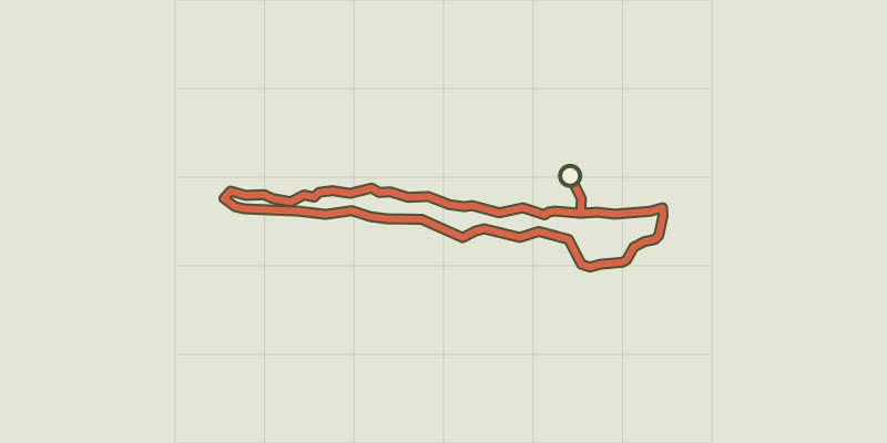
Key facts
- Distance
- 5.1 km
- Ascent
- +94 m
- Descent
- −52 m
- Estimated time
- 1 hr 15
- hiking
- Difficulty
- Very easy
- official rating
- Route
- Loop
- back to the start
Profile and gradient
- under 10%
- 10 to 20%
- over 20%
Gradient along the route: 5.0 km under 10% and 0.1 km at 10 to 20%. Elevation from 2 m to 45 m over 5.1 km.
Description
Come roam this playful path, where you will have the leisure to discover the Castillon towers and the surrounding landscapes. The Castillon Towers enables you to travel between eras. From the creation of the Alpilles massive 125 million years ago to its appropriation by man today, this walk is a real travel through time. In the small mountain range of Pène, men have found it to be a refuge since the Iron Age to the point to stay there over the centuries. Now owner of fauna and flora, it is possible to know from the top of this small hilly area, the evolution of this site and its surroundings. At the car park, take the rocky path marked in blue which goes up a gentle slope, going along an organic olive grove on the left. 1, Once the towers in sight, take the track which rises on the right, leaving the first turn on the left behind. When reaching the third tower, which was hidden until now, turn right then continue following the blue marked trail by going along the rocks of Pène. 2, At the road, turn immediately left and follow it along the path of Castillon towards different Mas (Provençal farmhouses). Possible presence of cars. Continue on the road until the junction at the Saint-Jean bridge. 3, Arriving at the "RIS" sign, turn left to take back the path that sinks again into the little massive. 1, Back to the Castillon towers, turn right and follow the first path taken to complete the tour of the towers.
Difficulty
Official rating: very easy, by Parcs naturels régionaux de Provence-Alpes-Côte d'Azur.
Before you go
- Do not go into the towers, risk of collapse.
- Caution with your ankles on the trails of the rocks of Pènes (between point 1 & 2 and between points 3 & 1).
- Respect the tranquillity of the place: The Mas (Provençal farmhouses) are private property.
- Watch out for cars on the roadside.
Getting there
Start: Parking des Tours de Castillon, Paradou, Paradou (13).
Sources
- Track: Parcs naturels régionaux de Provence-Alpes-Côte d'Azur (Chemins des Parcs), Licence Ouverte 2.0, Licence Ouverte 2.0 (Etalab) (www.cheminsdesparcs.fr/trek/39203-LE-PARADOU---Les-Tours-de-Castillon). Time estimated by GPX Path with the Mac app rule, breaks not included.
- Official elevation gain: 94 m, Parcs naturels régionaux de Provence-Alpes-Côte d'Azur
Nearby tracks
 © OpenStreetMap, SRTM · OpenTopoMap (CC-BY-SA)
Le Paradou - Défends de Sousteyran
Provence-Alpes-Côte d'Azur, Paradou (13) · LoopOfficial rating by Parcs naturels régionaux de Provence-Alpes-Côte d'Azur © OpenStreetMap, SRTM · OpenTopoMap (CC-BY-SA)
Maussane les Alpilles - Over the water
Provence-Alpes-Côte d'Azur, Maussane-les-Alpilles (13) · LoopOfficial rating by Parcs naturels régionaux de Provence-Alpes-Côte d'Azur © OpenStreetMap, SRTM · OpenTopoMap (CC-BY-SA)
Maussane les Alpilles - Towards Les-Baux-de-Provence
Provence-Alpes-Côte d'Azur, Maussane-les-Alpilles (13) · LoopOfficial rating by Parcs naturels régionaux de Provence-Alpes-Côte d'Azur © OpenStreetMap, SRTM · OpenTopoMap (CC-BY-SA)
Les Baux de Provence - Autour de la bauxite
Provence-Alpes-Côte d'Azur, Les Baux-de-Provence (13) · LoopOfficial rating by Parcs naturels régionaux de Provence-Alpes-Côte d'Azur © OpenStreetMap, SRTM · OpenTopoMap (CC-BY-SA)
Les Baux de Provence - Chemin des Trémaïé
Provence-Alpes-Côte d'Azur, Les Baux-de-Provence (13) · LoopOfficial rating by Parcs naturels régionaux de Provence-Alpes-Côte d'Azur © OpenStreetMap, SRTM · OpenTopoMap (CC-BY-SA)
Les Baux de Provence - Le Val d'Enfer
Provence-Alpes-Côte d'Azur, Les Baux-de-Provence (13) · LoopOfficial rating by Parcs naturels régionaux de Provence-Alpes-Côte d'Azur