
4-day Tour du Taillefer

Key facts
- Distance
- 48.4 km
- Ascent
- +3,038 m
- Descent
- −2,958 m
- Estimated time
- 18 hr 05
- hiking
- Difficulty
- Difficult
- official rating
- Route
- Point to point
- ends elsewhere
Profile and gradient
- under 10%
- 10 to 20%
- over 20%
Gradient along the route: 24.9 km under 10%, 16.0 km at 10 to 20% and 7.5 km over 20%. Elevation from 925 m to 2,104 m over 48.4 km.
Description
This Alpine trail is an invitation to experience the summits, to daydream in the streets of high-altitude villages, to ascend the high mountain passes and to walk across the Taillefer plateau, with its unique and untamed atmosphere. The trip last four days. A real change of scenery! You leave one civilisation for another: the civilisation of the mountain dwellers. Meet people, share daily lives that are very different from our own, and explore wild nooks and crannies with exceptional natural riches. It’s all there. We begin by going upwards and savouring the high mountains, via the Col de Corbières (1926 m), and the little mountain village of Villard-Reymond (the second highest village in France). The next day, you go down towards the Lignarre torrent, crossing it near the village of La Palud, before going up towards the hamlet of Ornon and tackling the ascent that will take you to the Taillefer refuge (2056 m). You now begin to explore the magnificent landscapes and the special atmosphere of the lake plateau, which you will fully experience the next day for your last stage, taking you back to the resort of Alpe du Grand Serre. And it’s not finished! From Alpe du Grand Serre, you still need to go up to Plancol, to admire the view over the Ecrins and Le Grand Armet. Then, during the descent, you pass through a few dizzying sections and return to the starting point: the Col d'Ornon.
Difficulty
Official rating: difficult, by Parc national des Écrins.
Before you go
- Ask about the opening dates for accommodation.
- Ask about snow conditions on the mountain passes early in the season.
- Be careful in the descent from Plancol to Col d’Ornon - some very high sections and sections with cables.
Getting there
Start: Col d'Ornon, Chantepérier (38).
Sources
- Track: Parc national des Écrins, Licence Ouverte 2.0, Licence Ouverte 2.0 (Etalab) (destination.ecrins-parcnational.fr/trek/955589-Tour-du-Taillefer-en-4-jours). Time estimated by GPX Path with the Mac app rule, breaks not included.
- Official elevation gain: 3,038 m, Parc national des Écrins
Nearby tracks

 © OpenStreetMap, SRTM · OpenTopoMap (CC-BY-SA)
Vallon Lake
Auvergne-Rhône-Alpes, Chantepérier (38) · Out and backOfficial rating by Parc national des Écrins © OpenStreetMap, SRTM · OpenTopoMap (CC-BY-SA)
Tête de Louis XVI via Col de Corbière
Écrins, Villard-Reymond (38) · Out and backOfficial rating by Parc national des Écrins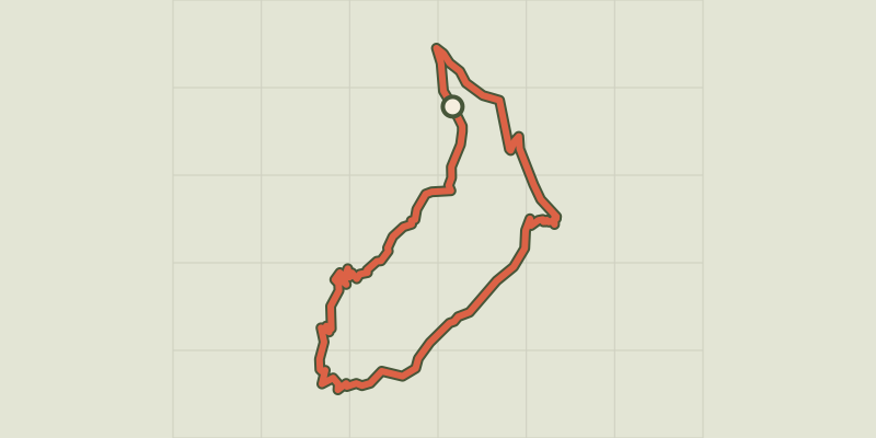 © OpenStreetMap, SRTM · OpenTopoMap (CC-BY-SA)
The Croix du Carrelet crests
Écrins, Villard-Reymond (38) · LoopOfficial rating by Parc national des Écrins © OpenStreetMap, SRTM · OpenTopoMap (CC-BY-SA)
The Prégentil headland
Écrins, Villard-Reymond (38) · Out and backOfficial rating by Parc national des Écrins © OpenStreetMap, SRTM · OpenTopoMap (CC-BY-SA)
Le plateau du Taillefer
Écrins, Ornon (38) · Out and backOfficial rating by Parc national des Écrins © OpenStreetMap, SRTM · OpenTopoMap (CC-BY-SA)
La cabane de Rif Meyol
Écrins, Chantepérier (38) · Out and backOfficial rating by Parc national des Écrins