
7-day Tour du Taillefer

Key facts
- Distance
- 76.7 km
- Ascent
- +3,854 m
- Descent
- −3,685 m
- Estimated time
- 24 hr 55
- hiking
- Difficulty
- Moderate
- official rating
- Route
- Point to point
- ends elsewhere
Profile and gradient
- under 10%
- 10 to 20%
- over 20%
Gradient along the route: 48.7 km under 10%, 18.5 km at 10 to 20% and 9.5 km over 20%. Elevation from 795 m to 2,104 m over 76.7 km.
Description
The Tour du Taillefer is a large-scale, accessible Alpine trail. A trip outside time, winding through rural valleys and mountain villages, from waterfalls to lakes, from cols to high plateaux. A very unusual summit in the Massif des Ecrins, the Taillefer provides whoever comes close to it with the memory of a very special atmosphere. To get there, you follow ancestral paths, moving between charming villages and exceptional panoramas. And we arrive at last: right in the middle of the lakes and peat bogs, the high Taillefer plateau is unveiled and stands out as the high point of the trip. The tour du Taillefer has 7 stages (with the option of just 6). It starts from Alpe du Grand Serre (a departure from the village of Valbonnais is also possible). You start off by following the Roizonne valley to the charming little Alpine village of Rif Bruyant. On the second day, you explore the Roizonne valley and its villages, but also cross the first col of the trip, the Col de Plan Collet (1,356 m), which opens up a view over the Dévoluy and Les Ecrins, and takes you to the Valbonnais valley. On the 3rd and 4th days, you walk along the Bonne and Malsanne valleys, through villages, hamlets, fields and woods, and rise slowly up to Col d'Ornon (1,360 m). From stage 5, you leave the bottom of the valley for the high mountains, via the Col de Corbières (1,926 m), and the small mountain village of Villard-Reymond (second highest village in France). The next day, you go down towards the Lignarre torrent, which you cross at the village of La Palud, before going up towards the hamlet of Ornon and tackling the ascent leading to the Taillefer refuge (2,056 m). You begin to explore these magnificent landscapes and the special atmosphere of the lake plateau, which you will fully experience the next day for your last stage, which takes you back to the resort of Alpe du Grand Serre.
Difficulty
Official rating: moderate, by Parc national des Écrins.
Before you go
- ATTENTION: Bivouacs between 7pm and 9am is allowed, but in dedicated areas on the Taillefer plateau. Camping, fires and water sports (including swimming) are prohibited on the Taillefer plateau. Dogs must be kept on a leash.
- Some sections of the route, especially on the Taillefer Plateau, may be snowed under early in the season - ask for information before setting off.
- Some parts of the route are on the road, so be careful.
- Consult the specific recommendations for each stage.
Getting there
Start: Alpe du Grand Serre, La Morte (38).
Sources
- Track: Parc national des Écrins, Licence Ouverte 2.0, Licence Ouverte 2.0 (Etalab) (destination.ecrins-parcnational.fr/trek/955415-Tour-du-Taillefer-en-6-jours). Time estimated by GPX Path with the Mac app rule, breaks not included.
- Official elevation gain: 3,854 m, Parc national des Écrins
Nearby tracks

 © OpenStreetMap, SRTM · OpenTopoMap (CC-BY-SA)
4-day Tour du Taillefer
Auvergne-Rhône-Alpes, Chantepérier (38) · Point to pointOfficial rating by Parc national des Écrins © OpenStreetMap, SRTM · OpenTopoMap (CC-BY-SA)
Le plateau du Taillefer
Écrins, Ornon (38) · Out and backOfficial rating by Parc national des Écrins © OpenStreetMap, SRTM · OpenTopoMap (CC-BY-SA)
Vallon Lake
Auvergne-Rhône-Alpes, Chantepérier (38) · Out and backOfficial rating by Parc national des Écrins © OpenStreetMap, SRTM · OpenTopoMap (CC-BY-SA)
The Prégentil headland
Écrins, Villard-Reymond (38) · Out and backOfficial rating by Parc national des Écrins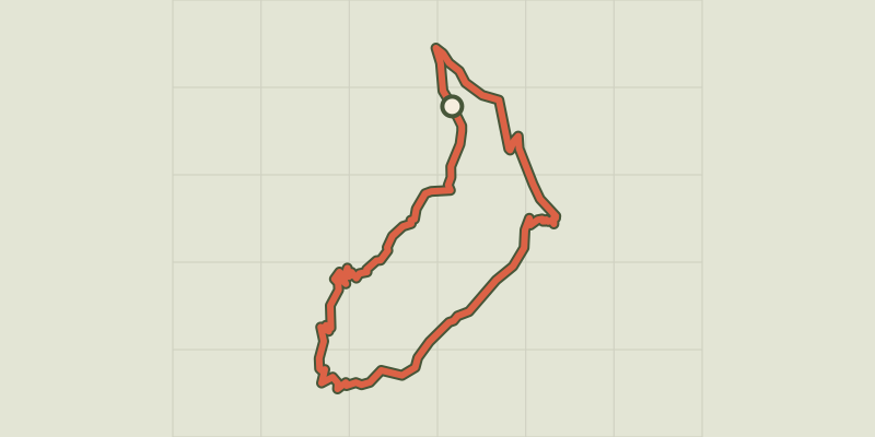 © OpenStreetMap, SRTM · OpenTopoMap (CC-BY-SA)
The Croix du Carrelet crests
Écrins, Villard-Reymond (38) · LoopOfficial rating by Parc national des Écrins © OpenStreetMap, SRTM · OpenTopoMap (CC-BY-SA)
Tête de Louis XVI via Col de Corbière
Écrins, Villard-Reymond (38) · Out and backOfficial rating by Parc national des Écrins